
Thunder Bay in Thunder Bay District, Ontario — Central Canada (North America)
Thunder Bay Public Library
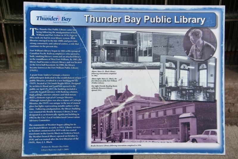
Fort William's library began in 1885 with a group of Canadian Pacific Railway employees who opened a bath, smoking/literary room and an attached library in the roundhouse of West Fort William. By 1905, the library had become a citizen's library and was located in the town hall basement. In 1908, the library became known as the Fort William Public Library (FWPL).
A grant from Andrew Carnegie, a known philanthropist dedicated to the establishment of free public libraries, resulted in a new building for the FWPL, located at 216 South Brodie Street. Designed by architects Hood and Scott and opened to the public on April 29, 1912, the building included a centrally located entrance with flanking columns, high ceilings, interior columns and tiled mosaic floors, elements typical of Carnegie libraries. Although stained glass was
this page online
The community of Westfort began calling for its own branch library as early as 1911. Library services in Westfort commenced in 1919 with two rented storefronts in the Garrity Block on Frederica Street. The Westfort branch library opened on October 4, 1938, and was named after the first librarian of the FWPL, Mary J. L. Black.
Captions (clockwise from top)
• Above: Mary J. L. Black Library following renovations completed in 1962.
• Above right: Mary J. L. Black, the first librarian of the Fort William (Public) Library.
• Far right: Fireside Reading Room of Brodie Resource Library, opened 1912.
• Brodie Resource Library following renovations completed in 1956.
Erected 2009 by City of Thunder Bay.
Topics and series.
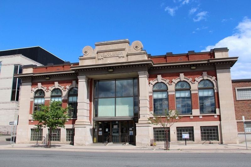
Location. 48° 22.893′ N, 89° 14.789′ W. Marker is in Thunder Bay, Ontario, in Thunder Bay District. It is on Brodie Street South north of Arthur Street East, on the right when traveling north. Touch for map. Marker is at or near this postal address: 216 Brodie St S, Thunder Bay ON P7E 1C1, Canada. Touch for directions.

Regionally, this marker is in Northern Ontario and specifically in Northwest Ontario. It is also in Central Canada. Globally, it is in North America, in the Great North Woods, on the Great Lakes, on Lake Superior’s North Shore, in the Western Hemisphere, in the Western World, and in the Anglosphere. Historically, it finds itself in what was once a British colony, the Viceroyalty of New France, the Haudenosaunee (Iroquois) Confederacy, and Rupert’s Land.
Other nearby markers. At least 8 other markers are within walking distance of this marker: 10-Mile Road Race (within shouting distance of this marker); City Hall (within shouting distance of this marker); William McGillivray (about 90 meters away, measured in a direct line); Fort Kaministiquia 1717 (about 90 meters away); 425 Donald Street East (about 180 meters away); The Western Route of the C.P.R. (approx. 0.3 kilometers away); The Capture of Fort William (approx. half a kilometer away); Fort William (approx. 1.1 kilometers away). Touch for a list and map of all markers in Thunder Bay.
Credits. This page was last revised on April 19, 2022. It was originally submitted on April 19, 2022, by Duane and Tracy Marsteller of Murfreesboro, Tennessee. This page has been viewed 471 times since then and 32 times this year. Photos: 1, 2. submitted on April 19, 2022, by Duane and Tracy Marsteller of Murfreesboro, Tennessee.
