Los Gatos in Santa Clara County, California — The American West (Pacific Coastal)
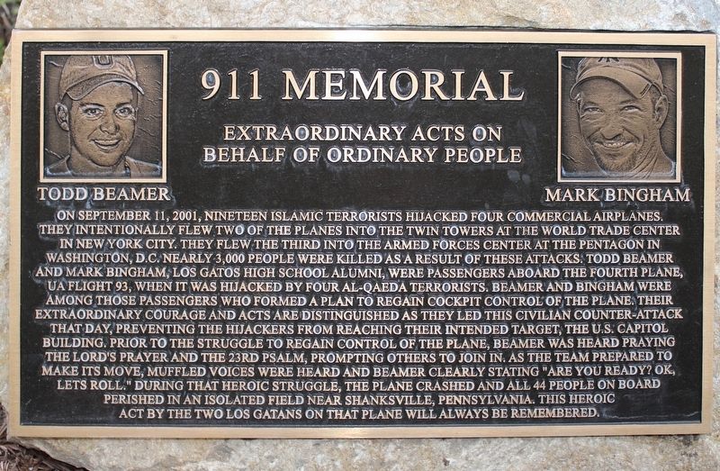
911 Memorial
Extraordinary Acts on Behalf of Ordinary People
Photographed by Joseph Alvarado, April 18, 2022
1. 911 Memorial
Inscription.
On September 11, 2001, nineteen Islamic terrorists hijacked four commercial airplanes. They intentionally flew two of the planes into the twin towers at the World Trade Center in New York City. They flew the third into the Armed Forces Center at the Pentagon in Washington, D.C. Nearly 3,000 people were killed as a result of these attacks. Todd Beamer and Mark Bingham, Los Gatos High School alumni, were passengers aboard the forth plane, UA FLight 93, when it was hijacked by four Al-Qaeda terrorists. Beamer and Bingham were amoung those passengers who formed a plan to regain cockpit control of the plane. Their extraordinary courage and acts and distinguished as they led this civilian counter-attack that day, preventing the hijackers from reaching their intended target, the U.S. Capitol building. Prior to the struggle to regain control of the plane, Beamer was heard praying the Lord's Prayer and the 23rd Psalm, prompting others to join in. As the team prepared to make its move, muffled voices were heard and Beamer clearly stating "Are you ready? OK, let's roll." During that heroic struggle, the plane crashed and all 44 people
Click or scan to see this page online
on board perished in an isolated field near Shanksville, Pennsylvania. This heroic act by the two Los Gatans on that plane will always be remembered.
Topics. This historical marker and memorial is listed in this topic list: 9/11 Attacks.
Location. 37° 13.257′ N, 121° 58.776′ W. Marker is in Los Gatos, California, in Santa Clara County. It is on Pageant Way, on the right when traveling north. Touch for map. Marker is at or near this postal address: 112 E Main Street, Los Gatos CA 95030, United States of America. Touch for directions.
Regionally, this marker and memorial is in the San Francisco Bay Area and on the Coast Ranges. It is also on the American Pacific Coast. Globally, it is in North America, on the Ring of Fire, on the Pacific Rim, in the Western Hemisphere, in the Western World, and in the Anglosphere. Historically, it finds itself in what was once New Spain and also Mexico’s Alta California.
Other nearby markers. At least 8 other markers are within 2 miles of this marker, measured as the crow flies: The Flame of Liberty Memorial (a few steps from this marker);
More about this marker. The plaque is mounted to a boulder at the base of a Redwood tree.
Credits. This page was last revised on April 22, 2022. It was originally submitted on April 19, 2022, by Joseph Alvarado of Livermore, California. This page has been viewed 615 times since then and 143 times this year. Photos:1, 2. submitted on April 19, 2022, by Joseph Alvarado of Livermore, California. • Andrew Ruppenstein was the editor who published this page.