Big Cedar in Le Flore County, Oklahoma — The American South (West South Central)
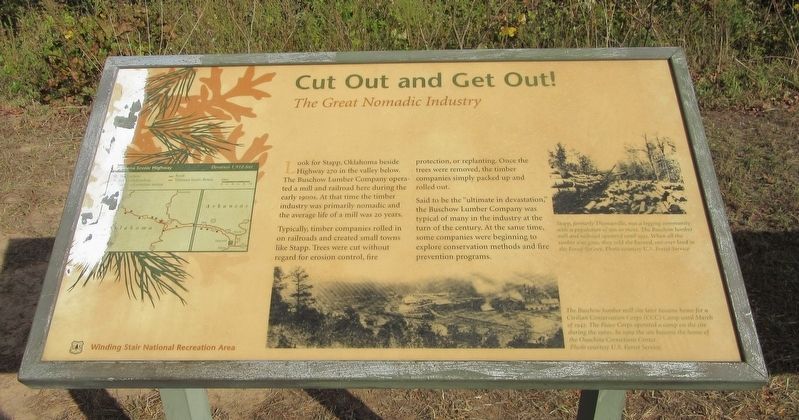
Cut Out and Get Out!
The Great Nomadic Industry
Look for Stapp, Oklahoma beside Highway 270 in the valley below. The Buschow Lumber Company operated a mill and railroad here during the early 1900s. At that time the timber industry was primarily nomadic and the average life of a mill was 20 years.
Typically, timber companies rolled in on railroads and created small towns like Stapp. Trees were cut without regard for erosion control, fire protection, or replanting. Once the trees were removed, the timber companies simply packed up and rolled out. Said to be the "ultimate in devastation," the Buschow Lumber Company was typical of many in the industry at the turn of the century. At the same time, some companies were beginning to explore conservation methods and fire prevention programs.
Captions: Stapp, formerly Thomasville, was a logging community with a population of 500 or more. The Buschow lumber mill and railroad operated until 1932. When all the timber was gone, they sold the burned, cut-over land to the Forest Service. Photo courtesy U.S. Forest Service.
The Buschow lumber mill site later became home for a Civilian Conservation Corps (CCC) Camp until March of 1942. The Peace Corps operated a camp on the site during the 1960s. In 1969 the site became the home of the Ouachita Corrections Center. Photo courtesy U.S. Forest Service.
Erected by US Forest Service.
Topics. This historical marker is listed in these topic lists: Horticulture & Forestry • Industry & Commerce • Parks & Recreational Areas • Railroads & Streetcars. A significant historical year for this entry is 1900.
Location. 34° 42.94′ N, 94° 40.451′ W. Marker is in Big Cedar, Oklahoma, in Le Flore County. Marker is on Emerald Vista Road north of Talimena National Scenic Byway. (Scenic Highway 1), on the right when traveling north. Touch for map. Marker is in this post office area: Hodgen OK 74939, United States of America. Touch for directions.
Other nearby markers. At least 8 other markers are within 5 miles of this marker, measured as the crow flies. Emerald Vista (here, next to this marker); Outside the Law In Indian Territory (approx. 3.4 miles away); Horsethief Spring (approx. 3.4 miles away); Where There is Water There Will Be People (approx. 3.4 miles away); Civilian Conservation Corps (CCC) (approx. 3.4 miles away); Life at Stapp (approx. 3.4 miles away); Don L. Hoyt Pavilion (approx. 4.3 miles away); Civilian Conservation Corps Co. 810 (approx. 4˝ miles away).
Credits. This page was last revised on April 23, 2022. It was originally submitted on April 21, 2022, by Jason Armstrong of Talihina, Oklahoma. This page has been viewed 132 times since then and 21 times this year. Photo 1. submitted on April 21, 2022, by Jason Armstrong of Talihina, Oklahoma. • J. Makali Bruton was the editor who published this page.
