Fort Meade in Anne Arundel County, Maryland — The American Northeast (Mid-Atlantic)
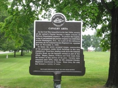
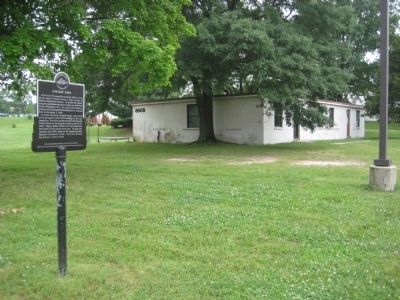
Cavalry Area
Fort George G. Meade
— United States Army —
To house the newly assigned troops, construction of the perimeter cinder block buildings in this area commenced. From here, heading south down 6th Armored Cavalry Road, are the barracks erected as part of this effort. Mapes, Dutton, O'Brien and York roads form the borders of this section of the post. Cavalry units remained until 1974, when the 6th Armored Cavalry Regiment transferred to Texas. Since then, the area has housed a variety of units.
This plaque erected in 1996 by the Fort Meade Museum.
Erected 1996 by Fort Meade Museum.
Topics. This historical marker is listed in these topic lists: Forts and Castles • War, Cold. A significant historical month for this entry is November 1832.
Location. 39° 5.864′ N, 76° 45.215′ W. Marker is in Fort Meade, Maryland, in Anne Arundel County. Marker is at the intersection of 6th Armored Cavalry Road and Mapes Road, on the left when traveling south on 6th Armored Cavalry Road. Touch for map. Marker is in this post office area: Fort George G Meade MD 20755, United States of America. Touch for directions.
Other nearby markers. At least 8 other markers are within walking distance of this marker. "Cav. Area" (within shouting distance of this marker); Chapultepec Avenue (within shouting distance of this marker); Tipton Army Airfield (approx. 0.3 miles away); Dedicated to all American Ex-Prisoners of War (approx. half a mile away); The Battle of the Bulge (approx. half a mile away); 29th Infantry Division, United States Army (approx. 0.6 miles away); Maj. Gen. Ralph H. Van Deman (approx. 0.7 miles away); Major General George G. Meade (approx. 0.8 miles away). Touch for a list and map of all markers in Fort Meade.
Credits. This page was last revised on January 4, 2020. It was originally submitted on June 4, 2009, by F. Robby of Baltimore, Maryland. This page has been viewed 1,387 times since then and 19 times this year. Photos: 1, 2. submitted on June 4, 2009, by F. Robby of Baltimore, Maryland.

