Near Millington in Kent County, Maryland — The American Northeast (Mid-Atlantic)
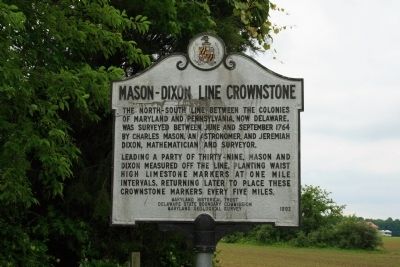
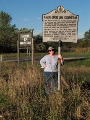
Mason-Dixon Line Crownstone
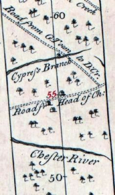
The North-South line between the colonies of Maryland and Pennsylvania, now Delaware, was surveyed between June and September 1764 by Charles Mason, an astronomer, and Jeremiah Dixon, a mathematician and surveyor.
Leading a party of thirty-nine, Mason and Dixon measured off the line, planting waist high limestone markers at one mile intervals, returning later to place these crownstone markers every five miles.
Erected 1992 by Maryland Historical Trust, Delaware State Boundary Commission, Maryland Geological Survey.
Topics. This historical marker is listed in this topic list: Colonial Era. A significant historical month for this entry is September 1764.
Location. 39° 15.475′ N, 75° 45.425′ W. Marker is near Millington, Maryland, in Kent County. Marker is on Cypress Road (Maryland Route 291), on the right when traveling east. Marker is on right-hand side of Maryland Route 291 just before crossing the Maryland-Delaware state line. Marker is easy to miss as it is facing the road, as opposed to perpendicular to, like most markers. If you crossover into Delaware, you've gone too far. Turn around and the marker will be on your left-hand side immediately after seeing the sign that welcomes you to Maryland. Touch for map. Marker is in this post office area: Millington MD 21651, United States of America. Touch for directions.
Other nearby markers. At least 8 other markers are within 5 miles of this marker, measured as the crow flies. Site of Blackiston Methodist Church (approx. 1.1 miles away in Delaware); Former Site Blackiston M.E. Church (approx. 1.1 miles away in Delaware); Chance-Vought F4U-1 Corsair (approx. 3.9 miles away); 1937 Douglas DC-3 (approx. 3.9 miles away); Meet our AN-2 (approx. 3.9 miles away); Antonov AN-2 (approx. 3.9 miles away); Cheney Clow's Rebellion (approx. 4 miles away in Delaware); Veterans Memorial (approx. 4.6 miles away).
Also see . . .
1. Mason-Dixon Line. Thought Co. website entry (Submitted on June 9, 2009, by Bill Pfingsten of Bel Air, Maryland.)
2. Mason Dixon Survey 55-Mile Crownstone. Maryland Historical Trust State Historic Sites Inventory Form (PDF). (Submitted on November 30, 2014, by Allen C. Browne of Silver Spring, Maryland.)
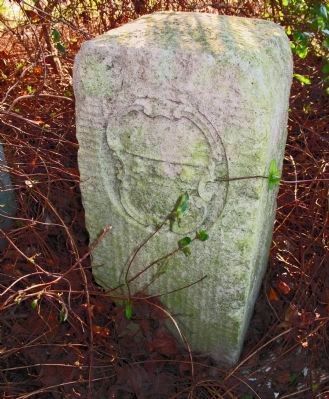
Photographed By Allen C. Browne, October 19, 2005
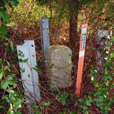
3. Mason-Dixon Tangent-Line Crownstone 55
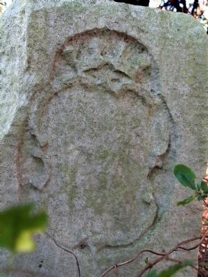
Delaware Side showing Penn Arms
Delaware Side showing Penn Arms
The crownstone marking 55 miles along the tangent line from the middle point of the Transpeninsular line to a tangent point on the 12-mile circle around New Castle was placed by Mason and Dixon in 1766.
Credits. This page was last revised on April 14, 2022. It was originally submitted on June 5, 2009, by Bob Marshall of Baltimore, Maryland. This page has been viewed 3,645 times since then and 106 times this year. Photos: 1. submitted on June 5, 2009, by Bob Marshall of Baltimore, Maryland. 2, 3, 4, 5, 6. submitted on November 30, 2014, by Allen C. Browne of Silver Spring, Maryland. • Bill Pfingsten was the editor who published this page.
