Near Joppatowne in Harford County, Maryland — The American Northeast (Mid-Atlantic)
Harry Gilmor's Raid
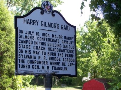
Photographed by Beverly Pfingsten, June 23, 2007
1. Harry Gilmor’s Raid Marker
Erected 1934 by State Roads Commission.
Topics and series. This historical marker is listed in these topic lists: Railroads & Streetcars • War, US Civil. In addition, it is included in the Maryland Historical Trust series list. A significant historical date for this entry is July 10, 1864.
Location. Marker has been reported missing. It was located near 39° 28.569′ N, 76° 22.815′ W. Marker was near Joppatowne, Maryland, in Harford County. It was at the intersection of Mountain Road (Maryland Route 152) and Old Joppa Road, on the right when traveling east on Mountain Road. Touch for map. Marker was in this post office area: Joppa MD 21085, United States of America. Touch for directions.

Regionally, this marker was in the Baltimore Metro Region and in Central Maryland. It was also in the American Mid-Atlantic, in the Chesapeake Bay Region, and on the Eastern Seaboard. Globally, it was in the
this page online
Other nearby markers. At least 8 other markers are within 2 miles of this location, measured as the crow flies: “Olney” (approx. 0.4 miles away); The Lime Kiln (approx. 0.9 miles away); a different marker also named Harry Gilmor's Raid (approx. one mile away); Gunpowder Falls State Park (approx. 1.1 miles away); Mill Race Entry (approx. 1.1 miles away); Site of the Upper Jericho Saw Mill (approx. 1.1 miles away); Jerusalem Mills (approx. 1.1 miles away); Milestone (approx. 1.1 miles away).
Another marker is no longer nearby. Harry Gilmor's Raid (was approx. one mile away but has been replaced with another marker now near it).
More about this marker. Marker was removed because it contained incorrect information.
Additional commentary.
1. Harry Gilmor could not keep
all his men supplied with sleep....
On July 10, 1864, Gilmor's raiders found themselves falling asleep in their saddles. Gilmor himself
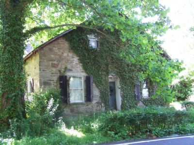
Photographed by William Pfingsten, June 23, 2007
2. Stage Coach Headquarters
Building is now occupied as a residence.
— Submitted August 31, 2014, by Allen C. Browne of Silver Spring, Maryland.
Additional keywords. Gunpowder River, Gunpowder Falls
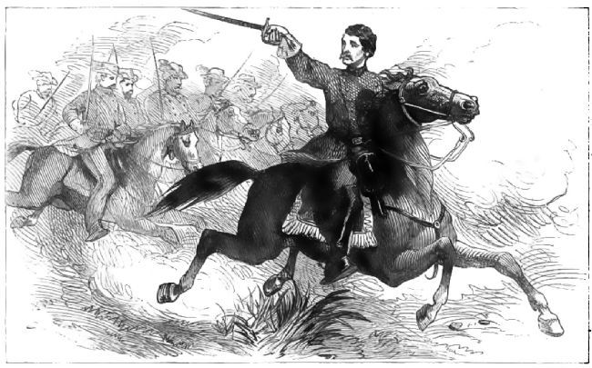
3. Harry Gilmor in the Saddle
Frontispiece of Four Years in the Saddle by Colonel Harry Gilmor, 1866.
Credits. This page was last revised on December 28, 2024. It was originally submitted on June 23, 2007, by Bill Pfingsten of Bel Air, Maryland. This page has been viewed 4,636 times since then and 225 times this year. Last updated on April 27, 2022. Photos: 1, 2. submitted on June 23, 2007, by Bill Pfingsten of Bel Air, Maryland. 3. submitted on August 28, 2014, by Allen C. Browne of Silver Spring, Maryland. • Bernard Fisher was the editor who published this page.
