Eatonville in Orange County, Florida — The American South (South Atlantic)
Kennedy Boulevard and Sewell’s Place
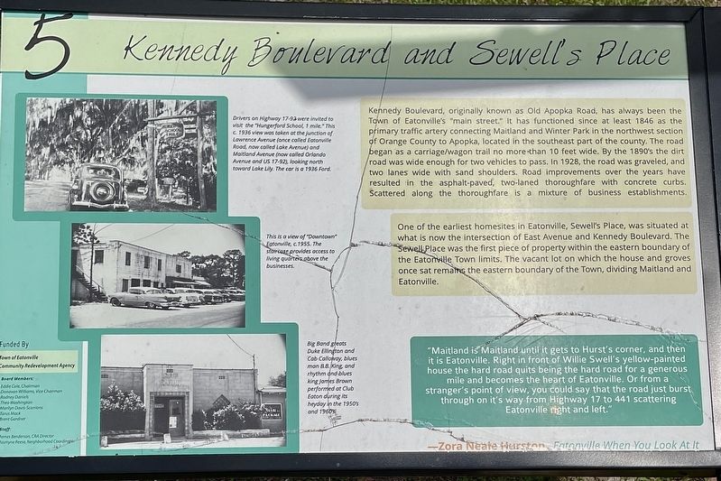
One of the earliest homesites in Eatonville, Sewell's Place, was situated at what is now the intersection of East Avenue and Kennedy Boulevard. The Sewell Place was the first piece of property within the eastern boundary of the Eatonville Town limits. The vacant lot on which the house and groves once sat remains the eastern boundary of the Town, dividing Maitland and Eatonville.
"Maitland is Maitland until it gets to Hurst's corner, and then it is Eatonville. Right in front of Willie Swell's yellow-painted house the hard road quits being the hard road for a generous mile and becomes the heart of Eatonville. Or from a stranger's point of view, you could say that the road just burst through on it's way from Highway 17 to 441 scattering Eatonville right and left."
—Zora Neale Hurston, Eatonville When You Look At It
(captions)
Drivers on Highway 17-92 were invited to visit the "Hungerford School, 1 mile." This c. 1936 view was taken at the junction of Lawrence Avenue (once called Eatonville Road, now called Lake Avenue) and Maitland Avenue (now called Orlando Avenue and US 17-92), looking north toward Lake Lily. The car is a 1936 Ford.
This is a view of "Downtown" Eatonville, c.1955. The staircase provides access to living quarters above the businesses.
Band greats Duke Ellington and Cab Calloway, bluesman B.B. King, and rhythm and blues king James Brown performed at Club Eaton during its heyday in the 1950's and 1960's.
Erected by The Town of Eatonville Community Redevelopment Agency. (Marker Number 5.)
Topics. This historical marker is listed in these topic lists: African Americans • Entertainment • Notable Places • Roads & Vehicles • Settlements & Settlers.
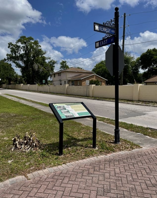
Location. 28° 37.119′ N, 81° 22.544′ W. Marker is in Eatonville, Florida, in Orange County. Marker is at the intersection of East Kennedy Boulevard and East Street, on the left when traveling east on East Kennedy Boulevard. Touch for map. Marker is at or near this postal address: 558 E Kennedy Blvd, Maitland FL 32751, United States of America. Touch for directions.
Other nearby markers. At least 8 other markers are within walking distance of this marker. St. Lawrence African Methodist Episcopal Church (here, next to this marker); Eatonville Water Tower (a few steps from this marker); Thomas House (a few steps from this marker); St. Lawrence African Methodist Church and the Mosley House (within shouting distance of this marker); Matilda Mosley Home (within shouting distance of this marker); Moseley House (within shouting distance of this marker); The Hurston and Joe Clark’s (about 400 feet away, measured in a direct line); Missionary Baptist Church (approx. 0.2 miles away). Touch for a list and map of all markers in Eatonville.
Also see . . . Keeping the Memory of the Chitlin Circuit Alive. (Submitted on April 27, 2022, by Brandon D Cross of Flagler Beach, Florida.)
Credits. This page was last revised on April 28, 2022. It was originally submitted on April 27, 2022, by Brandon D Cross of Flagler Beach, Florida. This page has been viewed 188 times since then and 61 times this year. Photos: 1, 2. submitted on April 27, 2022, by Brandon D Cross of Flagler Beach, Florida. • Bernard Fisher was the editor who published this page.

