Los Lunas in Valencia County, New Mexico — The American Mountains (Southwest)
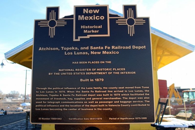
Atchison, Topeka, and Santa Fe Railroad Depot
Los Lunas, New Mexico

cmh2315fl via Flickr (CC BY-NC 2.0), December 27, 2015
1. Atchison, Topeka, and Santa Fe Railroad Depot Marker
National Register of Historic Places
by the United States Department of the Interior
Built in 1879
Through the political influence of the Luna family, the county seat moved from Tome to Los Lunas in 1876. When the Santa Fe Railroad line arrived in Los Lunas, the Atchison, Topeka & Santa Fe Railroad depot was built in 1879 which facilitated the movement of livestock, hay, supplies and general merchandise. The depot was also used for telegraph communications as well as passenger and baggage service. The political influence and the location of the depot built in Valencia County contributed to Los Lunas becoming the center of business in the county.
Topics. This historical marker is listed in these topic lists: Architecture • Industry & Commerce • Railroads & Streetcars. A significant historical year for this entry is 1879.
Location. 34° 47.714′ N, 106° 44.335′ W. Marker is in Los Lunas, New Mexico, in Valencia County. Marker is on New Mexico 314, 0.2 miles south of Park Lane SW, on the right when traveling south. Touch for map. Marker is at or near this postal address: 1103 NM-314, Los Lunas NM 87031, United States of America. Touch for directions.
Other nearby markers. At least 8 other markers are within 10 miles of this marker, measured as the crow flies. The Luna Mansion (approx. 0.9 miles away); Valencia (approx. 2.4 miles away); Tomé (approx. 3.8 miles away); Peralta (approx. 4 miles away); Vásquez de Coronado's Route (approx. 4.8 miles away); Pueblo of Isleta (approx. 7.7 miles away); Pueblo of Isleta Tuei (approx. 8.4 miles away); The Belen Hotel (approx. 9½ miles away). Touch for a list and map of all markers in Los Lunas.

cmh2315fl via Flickr (CC BY-NC 2.0), December 27, 2015
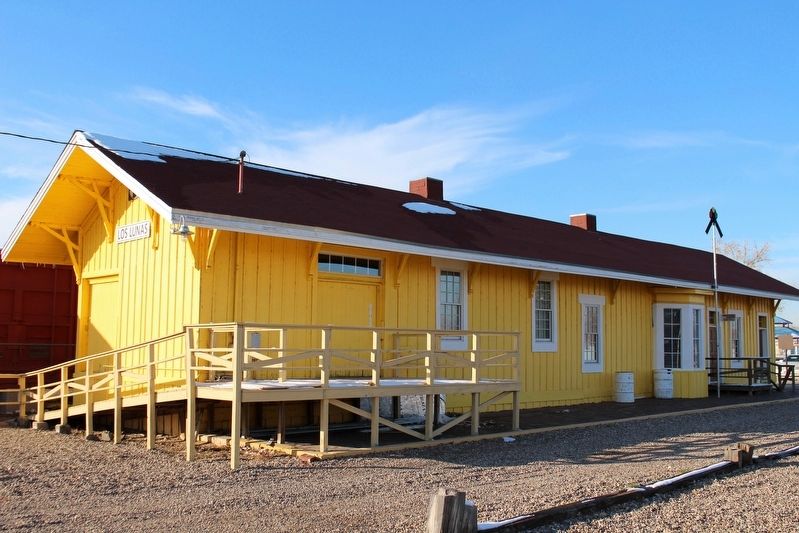
2. Atchison, Topeka, and Santa Fe Railroad Depot

via NPS, unknown
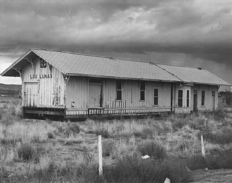
3. Atchison, Topeka, and Santa Fe Railroad Depot
NPGallery Digital Asset Management System
Click for more information.
Click for more information.
Credits. This page was last revised on January 6, 2024. It was originally submitted on April 27, 2022, by Duane and Tracy Marsteller of Murfreesboro, Tennessee. This page has been viewed 178 times since then and 32 times this year. Photos: 1, 2. submitted on April 27, 2022, by Duane and Tracy Marsteller of Murfreesboro, Tennessee. 3. submitted on April 28, 2022, by Larry Gertner of New York, New York.
Editor’s want-list for this marker. Wide shot of marker and surrounding area in context. • Can you help?