Near Pensacola Beach in Escambia County, Florida — The American South (South Atlantic)
Massive Smoothbore
Courtesy of Thomas P. Martin, March 14, 2017
1. Massive Smoothbore Marker
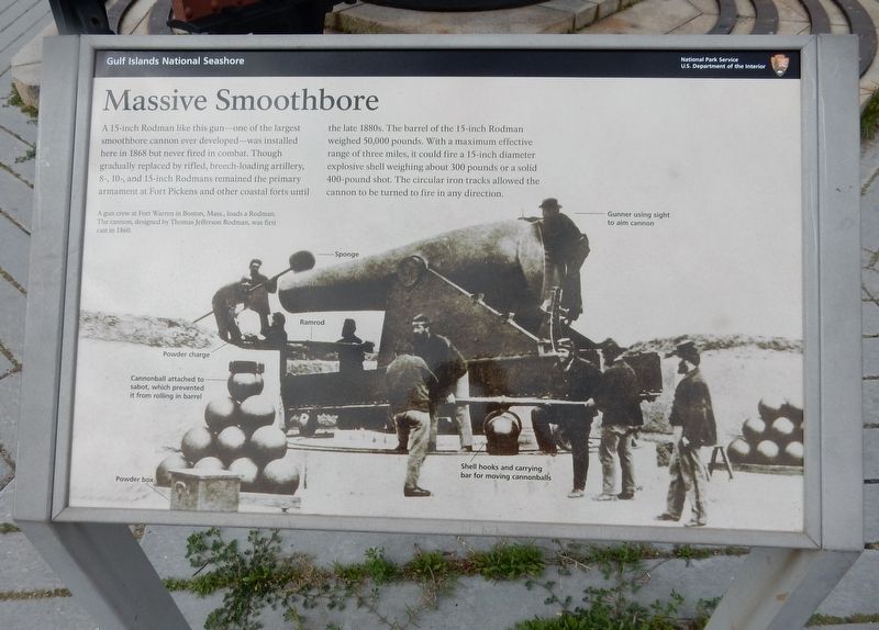
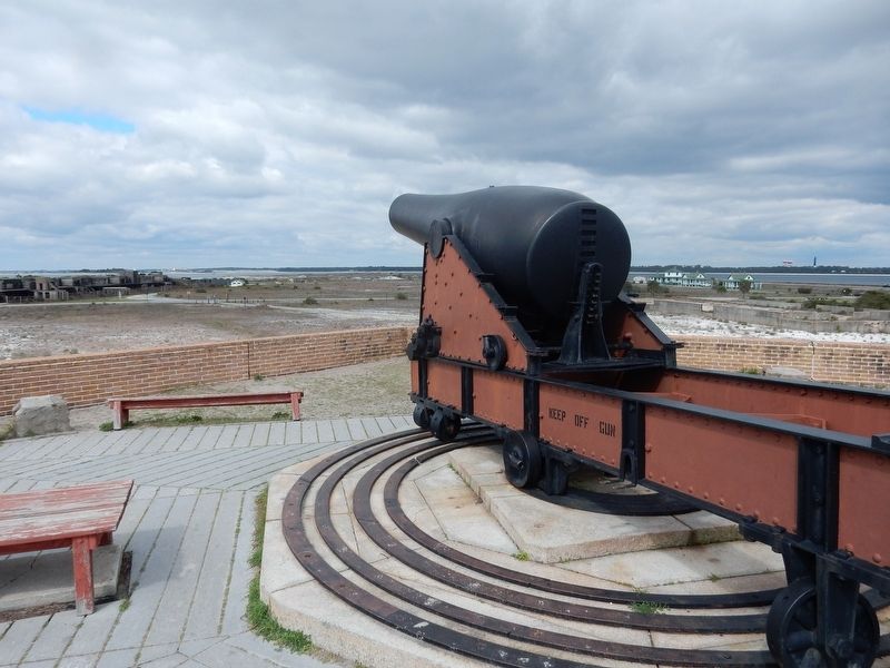
A 15-inch Rodman like this gun – one of the largest smoothbore cannon ever developed – was installed here in 1868 but never fired in combat. Though gradually replaced by rifled, breech-loading artillery, 8-, 10- and 15-inch Rodmans remained the primary armament at Fort Pickens and other coastal forts until the late 1880s. The barrel of the 15-inch Rodman weighed 50,000 pounds. With a maximum effective range of three miles, it could fire a 15-inch diameter explosive shell weighing about 300 pounds or a solid 400-pound shot. The circular iron tracks allowed the cannon to be turned to fire in any direction.
[Caption:]
A gun crew at Fort Warren in Boston, Mass., loads a Rodman. The cannon, designed by Thomas Jefferson Rodman, was first cast in 1860.
Erected by National Park Service, U.S. Department of the Interior.
Topics. This historical marker is listed in this topic list: Forts and Castles. A significant historical year for this entry is 1868.
Location. 30° 19.641′ N, 87° 17.477′ W. Marker is near Pensacola Beach, Florida, in Escambia County. It can be reached from Fort Pickens Road 9.8 miles west of Pensacola Beach
this page online

Regionally, this marker is in Greater Pensacola and on the Florida Panhandle. It is also in the American South, specifically in the Deep South, and on the Gulf Coast. Globally, it is in the North Atlantic Region, North America, a Gulf of Mexico state, the Western Hemisphere, the Western World, and the Anglosphere. Historically, it finds itself in what was once New Spain, the territory of the Mississippian Culture, one of the Confederate States of America, and the Antebellum South.
Other nearby markers. At least 8 other markers are within walking distance of this marker: Fort within a Fort (within shouting distance of this marker); Converting a Cannon (within shouting distance of this marker); Apache Prisoners (about 300 feet away, measured in a direct line); Deadly Explosion (about 300 feet away); Swatting Mosquitoes (about 400 feet away);
Courtesy of Thomas P. Martin, March 14, 2017
2. Rodman smoothbore cannon
Another marker is no longer nearby. Captain Richard G. Bradford (was about 500 feet away but has been confirmed missing).
Credits. This page was last revised on September 29, 2022. It was originally submitted on April 29, 2022, by Duane and Tracy Marsteller of Murfreesboro, Tennessee. This page has been viewed 587 times since then and 84 times this year. Photos: 1, 2. submitted on April 29, 2022, by Duane and Tracy Marsteller of Murfreesboro, Tennessee.
