Middlebury in New Haven County, Connecticut — The American Northeast (New England)
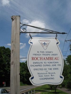
Rochambeau Route 1781 – 82
French Troops under
Rochambeau
enroute to Yorktown
encamped during June 1781
Erected by the state
and
Mattatuck Branch,
Sons Amer. Rev.
Cooperating
Erected by State of Connecticut, Mattatuck Branch Sons American Revolution.
Topics and series. This historical marker is listed in these topic lists: Notable Places • War, US Revolutionary. In addition, it is included in the The Washington-Rochambeau Route series list. A significant historical year for this entry is 1781.
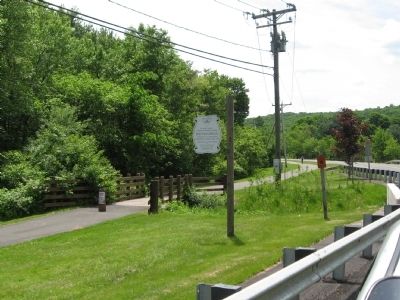
Location. 41° 32.24′ N, 73° 7.263′ W. Marker is in Middlebury, Connecticut, in New Haven County. Marker is on Middlebury Road (Connecticut Route 64) 0.1 miles west of Charcoal Avenue, on the right when traveling east. Where Middlebury Road crosses over Goat Brook next to Fenn Pond. Touch for map. Marker is in this post office area: Middlebury CT 06762, United States of America. Touch for directions.
Other nearby markers. At least 8 other markers are within 2 miles of this marker, measured as the crow flies. Julius and Augusta Bronson Farm (approx. 0.3 miles away); Middlebury Veterans Memorial (approx. 0.7 miles away); Middlebury Blacksmith Shop (approx. 0.7 miles away); Middlebury (approx. 0.7 miles away); Bissel's Store, Middlebury Station (approx. ¾ mile away); The Middlebury Fire House (approx. ¾ mile away); The Trolley (approx. 1.3 miles away); Lake Quassapaug Station (approx. 1.8 miles away). Touch for a list and map of all markers in Middlebury.
Credits. This page was last revised on November 14, 2020. It was originally submitted on June 5, 2009, by Michael Herrick of Southbury, Connecticut. This page has been viewed 1,623 times since then and 14 times this year. Photos: 1, 2. submitted on June 5, 2009, by Michael Herrick of Southbury, Connecticut. • Syd Whittle was the editor who published this page.

