Chesnee in Spartanburg County, South Carolina — The American South (South Atlantic)
Approaching Cowpens
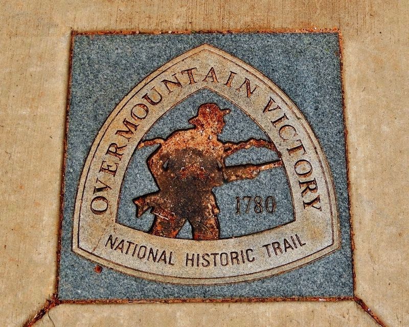
Overmountain Victory National Historic Trail
Inscription.
Prelude to the Battle of Kings Mountain
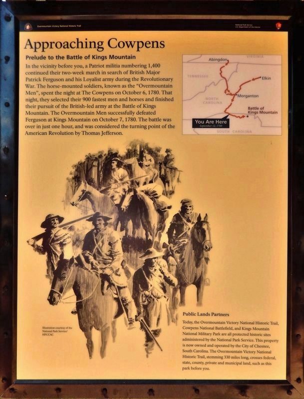
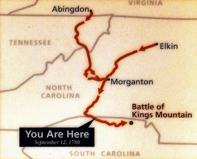
In the vicinity before you, a Patriot militia numbering 1,400 continued their two-week march in search of British Major Patrick Ferguson and his Loyalist army during the Revolutionary War. The horse-mounted soldiers, known as the "Overmountain Men", spent the night at The Cowpens on October 6, 1780. That night, they selected their 900 fastest men and horses and finished their pursuit of the British-led army at the Battle of Kings Mountain. The Overmountain Men successfully defeated Ferguson at Kings Mountain on October 7, 1780. The battle was over in just one hour and was considered the turning point of the American Revolution by Thomas Jefferson.
Public Lands Partners
Today, the Overmountain Victory National Historic Trail, Cowpens National Battlefield, and Kings Mountain National Military Park are all protected historic sites administered by the National Park Service. This property is now owned and operated by the City of Chesnee, South Carolina. The Overmountain Victory National Historic Trail, stemming 330 miles long, crosses federal, state, county, private and municipal land, such as this park before you.
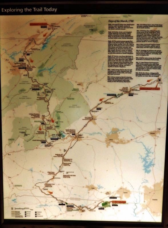
Days of the March, 1780
Sept. 24 Virginia militia from Washington County, under Campbell, muster at Abingdon, Va., Sept. 24. This now marks the route's northern branch.
Sept. 25 Shelby, Sevier, and Campbell muster Watauga and Holston valleys militia at Sycamore Shoals, Watauga River, to join Burke County (North Carolina then) militia under Charles McDowell.
Sept. 26 This patriot group spends first night in the Shelving Rock, using its overhang to shelter powder from rain. Also on Sept. 26, 350 North Carolina Patriot militia from Surrey and Wilkes counties, commanded by Col. Benjamin Cleveland and Maj. Joseph Winston, muster at today's Elkin, depart the next morning, and join up with other patriots at Quaker Meadows.
Sept. 27 Patriots cross Roan Mountain in recent snow, two to three inches deep, at 4,682-foot Yellow Mountain Gap, highest point on the Trail. Two men desert here to warn Ferguson about the patriot army. On Sept. 28-30 the patriot force splits so that loyalists can't slip by, and then it reunites at Quaker Meadows.
Oct. 1 and 2 Army stops to dry out and to prepare for battle expected soon. McDowell agrees to step aside, and Campbell takes command.
Oct. 3 Army camps by Marlin's Knob by Cane Creek. South Carolina patriots under William Hill and Edward Lacey camp nearby at Flint Hill (Cherry Mountain).
Oct. 4 At Gilbert Town, Army finds Ferguson gone, possibly headed toward Ninety Six in South Carolina.
Oct. 5 Thinking they follow Ferguson, Army moves to the Green River, away from Kings Mountain. Small parties of Georgians under William Candler and North Carolinians under William Chronicle join the Overmountain men. With new news that Ferguson is headed east, patriots decide to reverse direction.
Oct. 6 Now convinced Ferguson heads east toward Charlotte, patriots race to meet Lacey and Hill's South Carolinians.
Oct. 6, evening At Cowpens the groups unite, select 900 best mounted and armed men to pursue Ferguson, eat hastily, and push on despite rain.
Oct. 7 Patriot army crosses the flooding Broad River at Cherokee Ford at 8 am.
Oct. 7, 3 pm Patriots find Ferguson's 1,000-strong Loyalist army atop Kings Mountain. In fierce fighting Ferguson and 120 loyalists are killed, with nearly all the rest wounded or captured. Patriots suffer 28 killed, 62 wounded.
Oct. 14 On the return, at Biggerstaff's Old Fields (Biggerstaffs or Red Chimneys), 30 loyalists are tried. Nine are hanged.
Erected by National Park Service, United States Department of the Interior.
Topics. This historical marker is listed in these topic lists: Parks & Recreational Areas • War, US Revolutionary. A significant historical date for this entry is October 6, 1780.
Location.
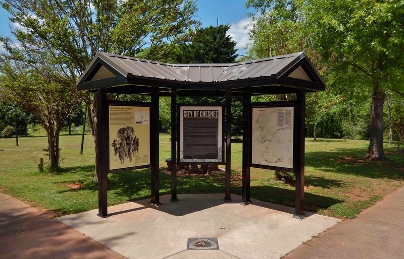
35° 8.949′ N, 81° 51.752′ W. Marker is in Chesnee, South Carolina, in Spartanburg County. Marker is on North Carolina Avenue just north of West Cherokee Street (State Route 11), on the left when traveling north. Marker kiosk is located at the Cada Park entrance, on the west side of the parking lot. Touch for map. Marker is at or near this postal address: 232 West Cherokee Street, Chesnee SC 29323, United States of America. Touch for directions.
Other nearby markers. At least 8 other markers are within 3 miles of this marker, measured as the crow flies. City of Chesnee (here, next to this marker); Thorne (approx. 1.9 miles away); Battle of Cowpens Monument (approx. 2.7 miles away); U.S. Memorial Monument (approx. 2.7 miles away); The Battle of Cowpens: Prelude to Victory (approx. 2.7 miles away); Welcome to Cowpens National Battlefield (approx. 2.7 miles away); Morgan's Flying Army (approx. 2.8 miles away); Spirit up the People (approx. 2.8 miles away). Touch for a list and map of all markers in Chesnee.
Also see . . . Overmountain Victory National Historic Trail.
The Overmountain Victory National Historic Trail is a cooperative effort of the National Park Service, the U.S. Forest Service, the U.S. Army Corps of Engineers, the Overmountain Victory Trail Association, the N.C. Division of Parks and Recreation, local governments, local citizens' associations, local historical societies and the states of Virginia, Tennessee, North Carolina, and South Carolina. It recognizes the Revolutionary War Overmountain Men, Patriots from what is now East Tennessee who crossed the Unaka Mountains and then fought in the Battle of Kings Mountain in South Carolina.(Submitted on April 30, 2022, by Cosmos Mariner of Cape Canaveral, Florida.)
Credits. This page was last revised on April 30, 2022. It was originally submitted on April 30, 2022, by Cosmos Mariner of Cape Canaveral, Florida. This page has been viewed 202 times since then and 19 times this year. Photos: 1, 2, 3, 4, 5. submitted on April 30, 2022, by Cosmos Mariner of Cape Canaveral, Florida.
