Drumheller in Southern Alberta, Alberta — Canada’s Prairie Region (North America)
Atlas No. 3 Coal Mine/La mine de charbon Atlas numéro trois

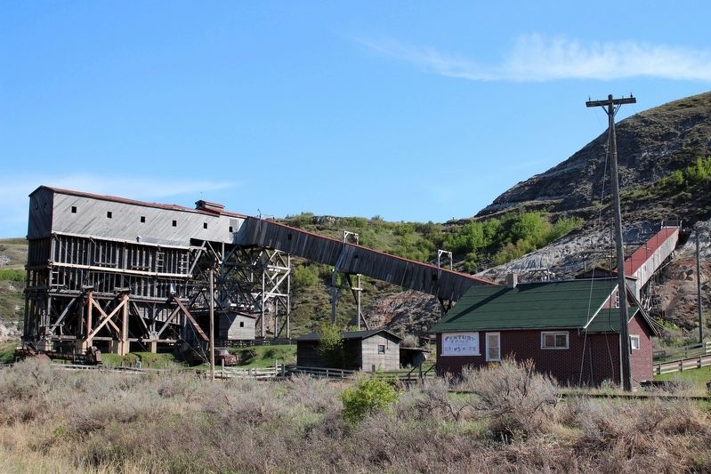
cmh2315fl via Flickr (CC BY-NC 2.0), May 18, 2015
1. Atlas No. 3 Coal Mine/La mine de charbon Atlas numéro trois Marker
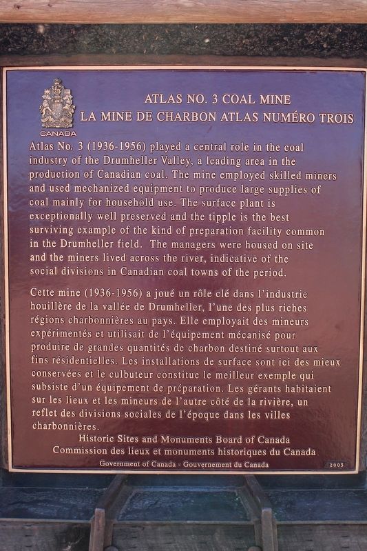
[English] Atlas No. 3 (1936-1956) played a central role in the coal industry of the Drumheller Valley, a leading area in the production of Canadian coal. The mine employed skilled miners and used mechanized equipment to produce large supplies of coal mainly for household use. The surface plant is exceptionally well preserved and the tipple is the best surviving example of the kind of preparation facility common in the Drumheller field. The managers were housed on site and the miners lived across the river, indicative of the social divisions in Canadian coal towns of the period.
Erected by Historic Sites and Monuments Board of Canada/Commission des lieux et monuments historiques du Canada.
Topics and series. This historical marker is listed in this topic list: Industry & Commerce. In addition, it is included in the Canada, Historic Sites and Monuments Board series list. A significant historical year for this entry is 1936.
Location. 51° 19.736′ N, 112° 28.892′ W. Marker is in Drumheller, Alberta, in Southern Alberta. Marker can be reached from Century Drive West, 0.2 kilometers west of Provincial Highway 10, on the left when traveling west. Touch for map. Marker is at or near this postal address: 110 Century Dr W, Drumheller AB T0J 1B0, Canada. Touch for directions.
Other nearby markers. At least 1 other marker is within 14 kilometers of this marker, measured as the crow flies. The Star Mine Suspension Bridge (approx. 13.7 kilometers away).
Also see . . .
1. Atlas No. 3 Coal Mine National Historic Site of Canada. Description, heritage value and character-defining elements of the mine, which was designated a national historic site in 2001. (Parks Canada) (Submitted on May 1, 2022, by Duane and Tracy Marsteller of Murfreesboro, Tennessee.)
2. Atlas Coal Mine National Historic Site
Credits. This page was last revised on September 29, 2022. It was originally submitted on May 1, 2022, by Duane and Tracy Marsteller of Murfreesboro, Tennessee. This page has been viewed 91 times since then and 3 times this year. Photos: 1, 2. submitted on May 1, 2022, by Duane and Tracy Marsteller of Murfreesboro, Tennessee.
Editor’s want-list for this marker. Wide shot of marker and surrounding area in context. • Can you help?
