Watts Township near Duncannon in Perry County, Pennsylvania — The American Northeast (Mid-Atlantic)
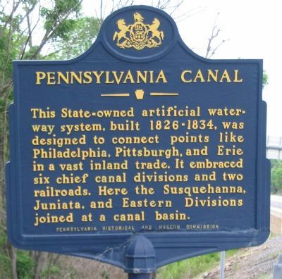
Pennsylvania Canal
Erected 1952 by Pennsylvania Historical and Museum Commission.
Topics and series. This historical marker is listed in this topic list: Waterways & Vessels. In addition, it is included in the Pennsylvania Canal, and the Pennsylvania Historical and Museum Commission series lists.
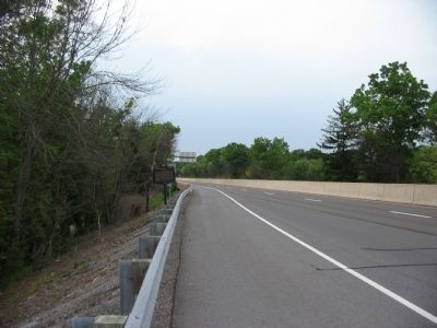
Location. 40° 25.588′ N, 77° 0.64′ W. Marker is near Duncannon, Pennsylvania, in Perry County. It is in Watts Township. Marker is at the intersection of William Penn Highway (U.S. 22/322) and U.S. 11/15, on the right when traveling south on William Penn Highway. Located on an exit ramp at the highway interchange. An overpass of US 11/15 is just north of the marker. Touch for map. Marker is in this post office area: Duncannon PA 17020, United States of America. Touch for directions.
Other nearby markers. At least 8 other markers are within 3 miles of this marker, measured as the crow flies. A different marker also named Pennsylvania Canal (approx. 0.6 miles away); Clark's Ferry Bridge Company (approx. 1.7 miles away); Lightning Guider Sleds (approx. 2.1 miles away); a different marker also named Pennsylvania Canal (approx. 2.1 miles away); a different marker also named Pennsylvania Canal (approx. 2.2 miles away); Clark's Ferry Tavern (approx. 2.2 miles away); Duncannon Area Schools (approx. 2˝ miles away); Ross McHugh Hood (approx. 2.6 miles away). Touch for a list and map of all markers in Duncannon.
More about this marker. The state database lists this marker in Perry County, but the actual plotted location is just into a section of Dauphin County which sits on the west side of the Susquehanna River.
Credits. This page was last revised on December 19, 2023. It was originally submitted on June 6, 2009, by Craig Swain of Leesburg, Virginia. This page has been viewed 1,129 times since then and 47 times this year. Photos: 1, 2. submitted on June 6, 2009, by Craig Swain of Leesburg, Virginia.

