
New Tacoma in Pierce County, Washington — The American West (Northwest)
Old City Hall
Registered National Historic Place
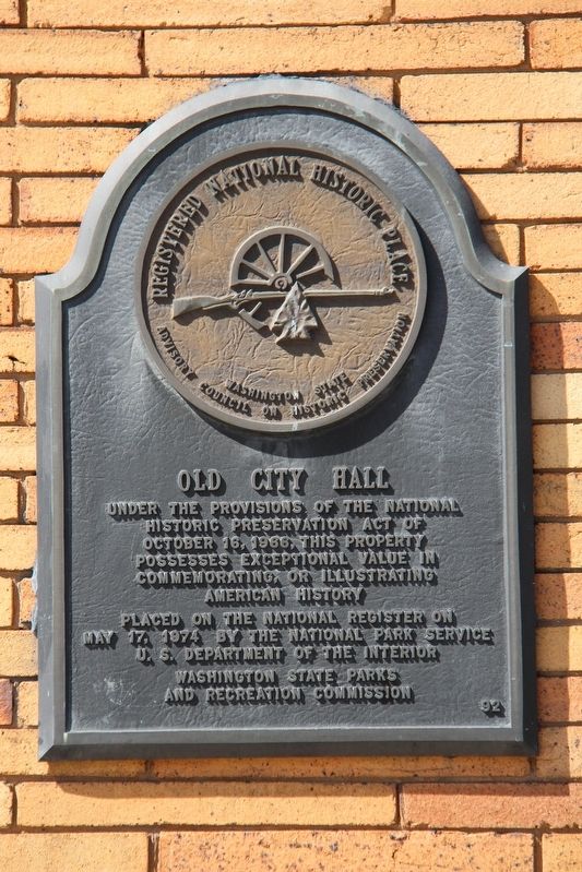
Historic Preservation Act of
October 16, 1966, this property
possesses exceptional value in
commemorating or illustrating
American history
Placed on the National Register on
May 17, 1974 by the National Park Service
U.S. Department of the Interior
Washington State Parks
and Recreation Commission
Erected by Washington State Parks and Recreation Commission.
Topics. This historical marker is listed in these topic lists: Architecture • Government & Politics. A significant historical date for this entry is April 23, 1893.
Location. 47° 15.44′ N, 122° 26.408′ W. Marker is in Tacoma, Washington, in Pierce County. It is in New Tacoma. It is at the intersection of Commerce Street and South 7th Street, on the right when traveling north on Commerce Street. Touch for map. Marker is at or near this postal address: 625 Commerce St, Tacoma WA 98402, United States of America. Touch for directions.

Regionally, this marker is in the Puget Sound Region and in Greater Seattle. It is also on the American Pacific Coast, in the Pacific Northwest, and in the Lewis & Clark Corridor. Globally, it is in North America, in the Cascade Range, in the Inside Passage, on the Ring of Fire, in the Pacific Rim, in the Western Hemisphere, in the Western World, and in the Anglosphere.
Other nearby markers. At least 8 other markers are within walking distance of this marker: George Francis Train (approx. 0.2 miles away); Murray Morgan Bridge Rehabilitation (approx. 0.3 miles away); The Shul: Talmud Torah - Sinai Temple (approx. half a mile away); Bishop John and Fannie C. Paddock (approx. 0.6 miles away); Welcome Figure (approx. 0.7 miles away); Commemorating Nihongo Gakko 日本語学校 (approx. ¾ mile away); Then and Now: South End of the Thea Foss Waterway
this page online
Another marker is no longer nearby. In Honor of Rossell G. O’Brien (was about 600 feet away, measured in a direct line but has been permanently removed).
Regarding Old City Hall. Excerpt from the National Register of Historic Places nomination:
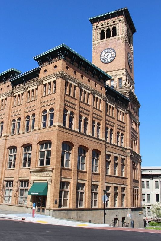
… The building was designed by the San Francisco firm, Hatherton and McIntosh. Hatherton was the official architect for San Francisco and had designed that municipality's city hall. The old Tacoma City Hall was completed April 23, 1893 at a cost of $257,965 and was used by the city until 1957.
Also see . . . Old City Hall (PDF). National Register nomination for the building. (National Archives) (Submitted on May 4, 2022, by Duane and Tracy Marsteller of Murfreesboro, Tennessee.)
Credits. This page was last revised on February 7, 2023. It was originally submitted on May 4, 2022, by Duane and Tracy Marsteller of Murfreesboro, Tennessee. This page has been viewed 262 times since then and 24 times this year. Photos: 1, 2. submitted on May 4, 2022, by Duane and Tracy Marsteller of Murfreesboro, Tennessee.
