New Tacoma in Pierce County, Washington — The American West (Northwest)
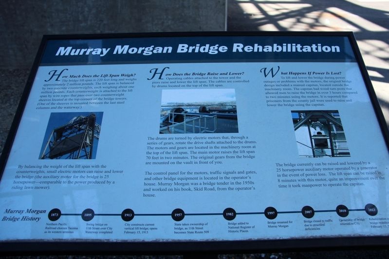
Murray Morgan Bridge Rehabilitation
1873 Northern Pacific Railroad chooses Tacoma as its western terminus
1895 Swing bridge on 11th Street over City Waterway completed
1913 City constructs current vertical lift bridge; opens February 15, 1913
1957 State takes ownership of bridge, as 11th Street becomes State Route 509
1982 Bridge added to National Register of Historic Places
1997 Bridge renamed for Murray Morgan
2007 Bridge closed to traffic due to structural deficiencies
2010 Ownership of bridge returned to City
2013 Rehabilitation complete; bridge rededicated February 15, 2013
How Much Does the Lift Span Weigh?
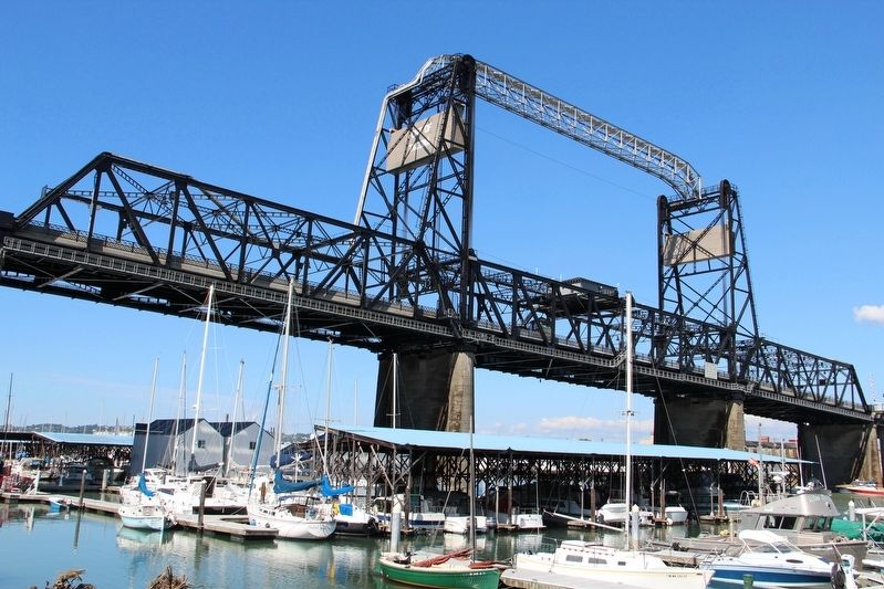
The bridge lift span is 220 feet long and weighs approximately 2 million pounds. The lift span is balanced by two concrete counterweights, each weighing about one million pounds. Each counterweight is attached to the lift span by wire ropes that pass over two counterweight sheaves located at the top corners of the bridge towers. (One of the sheaves is mounted between the last steel columns and the waterway.)
By balancing the weight of the lift span with the counterweights, small electric motors can raise and lower the bridge (the auxiliary motor for the bridge is 25 horsepower –comparable to the power produced by a riding lawn mower).
How Does the Bridge Raise and Lower?
Operating cables attached to the tower and the piers raise and lower the lift span. The cables are controlled by drums located on the top of the lift span.
The drums are turned by electric motors that, through a series of gears, rotate the drive shafts attached to the drums. The motors and gears are located in the machinery room at the top of the lift span. The main motor raises the lift span 70 feet in two minutes. The original gears from the bridge are mounted on the vault in front of you.
The control panel for the motors, traffic signals and gates, and other bridge equipment is located in the operator's house. Murray Morgan was a bridge tender in the 1950s and worked on his book, Skid Road, from the operator's house.
What Happens If Power Is Lost?
To lift and lower the bridge during power outages or problems with the motors, the original bridge design included a manual capstan, located outside the machinery room. The capstan had wood turn posts that allowed men to raise the bridge in over 3 hours compared to two minutes using the motors. It is reported that prisoners from the county jail were used to raise and lower the bridge using the capstan.
The bridge currently can be raised and lowered by a 25 horsepower auxiliary motor operated
Topics. This historical marker is listed in these topic lists: Arts, Letters, Music • Bridges & Viaducts. A significant historical date for this entry is February 15, 1913.
Location. 47° 15.224′ N, 122° 26.128′ W. Marker is in Tacoma, Washington, in Pierce County. It is in New Tacoma. Marker is on Dock Street, ¼ mile East 15th Street, on the right when traveling north. Marker is directly underneath the bridge, near the stairs. Touch for map. Marker is in this post office area: Tacoma WA 98402, United States of America. Touch for directions.
Other nearby markers. At least 8 other markers are within 2 miles of this marker, measured as the crow flies. George Francis Train (approx. ¼ mile away); In Honor of Rossell G. O’Brien (approx. ¼ mile away); Old City Hall (approx. 0.3 miles away); Birthplace of Harry Lillis "Bing" Crosby (approx. 1.6 miles away); Fannie C. Paddock (approx. 2 miles away); Janet Elder Steele (approx. 2 miles away); Margaret Meeker Davis (approx. 2 miles away); Nettie Asberry (approx. 2 miles away). Touch for a list and map of all markers in Tacoma.
Credits. This page was last revised on February 7, 2023. It was originally submitted on May 4, 2022, by Duane and Tracy Marsteller of Murfreesboro, Tennessee. This page has been viewed 212 times since then and 33 times this year. Photos: 1, 2. submitted on May 4, 2022, by Duane and Tracy Marsteller of Murfreesboro, Tennessee.

