Chowchilla in Madera County, California — The American West (Pacific Coastal)
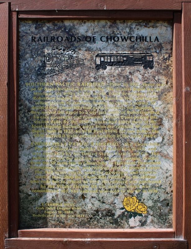
Railroads of Chowchilla
Southern Pacific Railroad
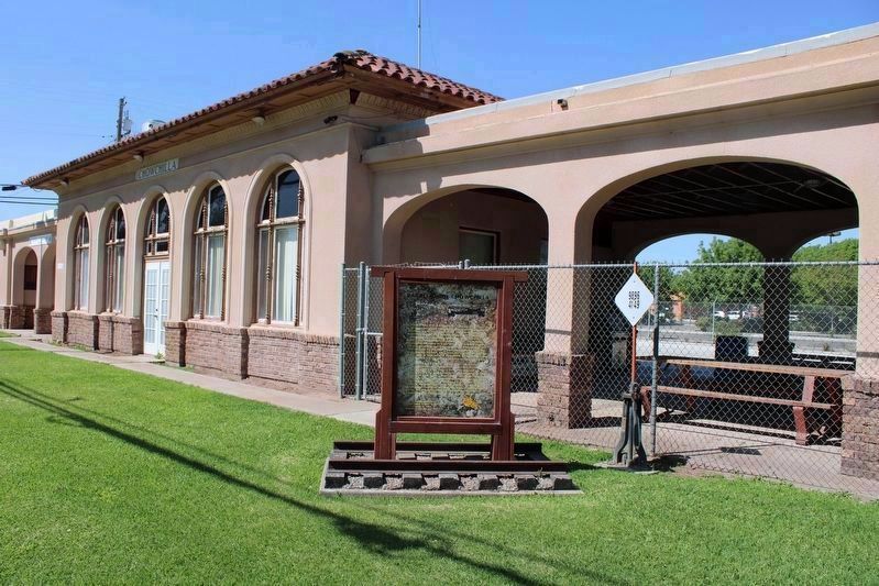
Prior to 1912, there was no SP depot located in Chowchilla. The nearest depot was in Minturn, six miles to the north. Land developer O.A. Robertson bought the Chowchilla Ranch in 1912, and began selling parcels to ranchers, hoping to create a colony. SP decided that Chowchilla had great prospects for shipping, so they moved the depot to a site just south of Robertson Blvd. Twenty passenger and numerous freight trains passed this station daily. By the 1950's, trucks had taken most of the local shipping business away from the railroad. SP sold the depot, built in 1923, to VFW Post #9896 for one dollar. The VFW moved it to its present location in the early 1960's.
Chowchilla Pacific Railroad
The Chowchilla Pacific Railroad was built by O.A. Robertson in 1915, and was operated by his United States Farm Land Co. The railroad served the area for over 40 years, running 13 miles from the SP main line in Chowchilla to Dairyland. Household belongings, farm stock, and children were its primary cargo. The Hall Scott coach, used for passengers and express service, was called the "Chowchilla Terrific" by the children who rode her to school. In 1924, the railroad was purchased by the Visalia Electric RR Co, and the coach was renumbered 301. The railroad was sold to the SP in 1936.
Erected 2021 by Grub Gulch Chapter 41-49, E Clampus Vitus.
Topics and series. This historical marker is listed in these topic lists: Agriculture • Railroads & Streetcars. In addition, it is included in the E Clampus Vitus, and the Southern Pacific Railroad series lists. A significant historical year for this entry is 1912.
Location. 37° 7.168′ N, 120° 15.675′ W. Marker is in Chowchilla, California, in Madera County. Marker is on South 5th Street, on the right when traveling north. Touch for map. Marker is at or near this postal address: 245 S 5th St, Chowchilla CA 93610, United States of America. Touch for directions.
Other nearby markers. At least 8 other markers are within 16 miles of this marker, measured as the crow flies. A different marker also named Railroads of Chowchilla (within shouting distance of this marker); Chowchilla Union High School (approx. ¼ mile away); Mammoth Orange (approx. 5½ miles away); Dairyland School (approx. 7½ miles away); Dixieland School (approx. 7.8 miles away); Berenda (approx. 8.2 miles away); Madera to Yosemite Stage Route (approx. 15.6 miles away); Madera County Library Service (approx. 15.6 miles away). Touch for a list and map of all markers in Chowchilla.
More about this marker. This new marker replaced a similar maker that was destroyed in a 2021 vehicle accident.
Credits. This page was last revised on May 23, 2022. It was originally submitted on May 4, 2022, by Joseph Alvarado of Livermore, California. This page has been viewed 158 times since then and 21 times this year. Photos: 1, 2. submitted on May 4, 2022, by Joseph Alvarado of Livermore, California. • Syd Whittle was the editor who published this page.

