Woonsocket in Providence County, Rhode Island — The American Northeast (New England)
Woonsocket Falls
The Power of Falling Water
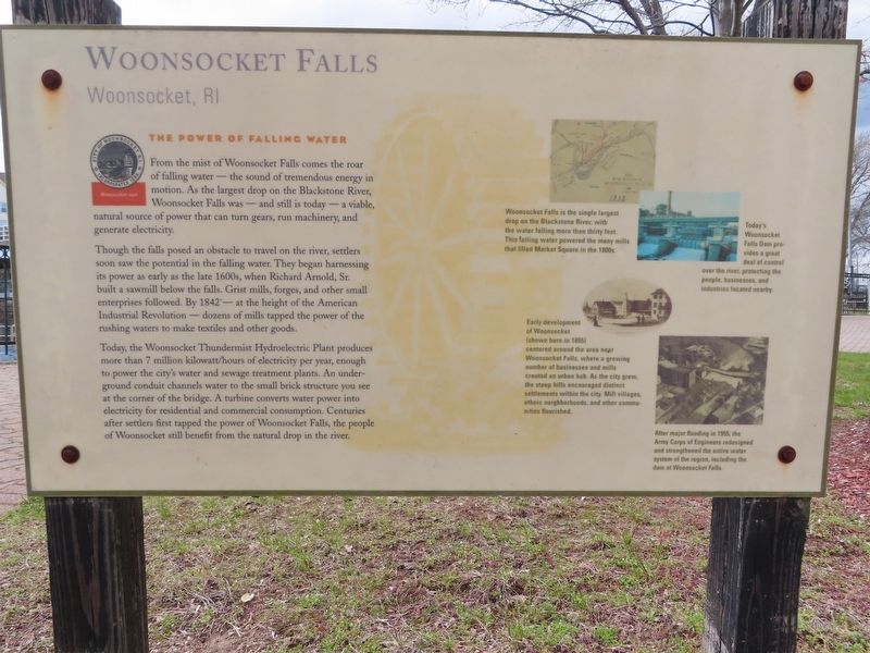
From the mist of Woonsocket Falls comes the roar of falling water — the sound of tremendous energy in motion. As the largest drop on the Blackstone River, Woonsocket Falls was — and still is today — a viable, natural source of power that can turn gears, run machinery, and generate electricity.
Though the falls posed an obstacle to travel on the river, settlers soon saw the potential in the falling water. They began harnessing its power as early as the late 1600s, when Richard Arnold, Sr. built a sawmill below the falls. Grist mills, forges, and other small enterprises followed. By 1842 — at the height of the American Industrial Revolution — dozens of mills tapped the power of the rushing waters to make textiles and other goods.
Today, the Woonsocket Thundermist Hydroelectric Plant produces more than 7 million kilowatt/hours of electricity per year, enough to power the city's water and sewage treatment plants. An underground conduit channels water to the small brick structure you see at the corner of the bridge. A turbine converts water power into electricity for residential and commercial consumption. Centuries after settlers first tapped the power of Woonsocket Falls, the people of Woonsocket still benefit from the natural drop in the river.
( photo captions )
— Woonsocket Falls is the single largest drop on the Blackstone River, with the water falling more than thirty feet. This falling water powered the many mills that filled Market Square in the 1800s.
— Early development of Woonsocket (shown here in 1855) centered around the area near Woonsocket Falls, where a growing number of businesses and mills created an urban hub. As the city grew, the steep hills encouraged distinct settlements within the city. Mill villages, ethnic neighborhoods, and other communities flourished.
— Today's Woonsocket Falls Dam provides a great deal of control over the river, protecting the people, businesses, and industries located nearby.
— After major flooding in 1955, the Army Corps of Engineers redesigned and strengthened the entire water system of the region, including the dam at Woonsocket Falls.
Topics. This historical marker is listed in these topic lists: Industry & Commerce • Waterways & Vessels. A significant historical year for this entry is 1842.
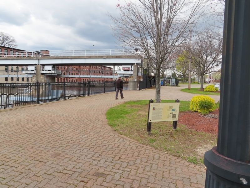
Location. 41° 59.965′ N, 71° 31.044′ W. Marker is in Woonsocket, Rhode Island, in Providence County. Marker is at the intersection of S Main Street and River Street, on the left when traveling north on S Main Street. Located next to the Woonsocket Falls Dam. Touch for map. Marker is in this post office area: Woonsocket RI 02895, United States of America. Touch for directions.
Other nearby markers. At least 8 other markers are within walking distance of this marker. Blackstone Canal (a few steps from this marker); Blackstone River Valley (within shouting distance of this marker); Ethnicity (within shouting distance of this marker); Community Development (within shouting distance of this marker); Market Square (about 300 feet away, measured in a direct line); Power Trenches (about 300 feet away); Cross of Malta (approx. 0.2 miles away); Veterans Memorial Park (approx. 0.3 miles away). Touch for a list and map of all markers in Woonsocket.
Credits. This page was last revised on May 4, 2022. It was originally submitted on May 4, 2022, by Michael Herrick of Southbury, Connecticut. This page has been viewed 357 times since then and 106 times this year. Photos: 1, 2. submitted on May 4, 2022, by Michael Herrick of Southbury, Connecticut.

