Lost Peninsula in Monroe County, Michigan — The American Midwest (Great Lakes)
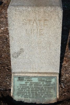
State Line
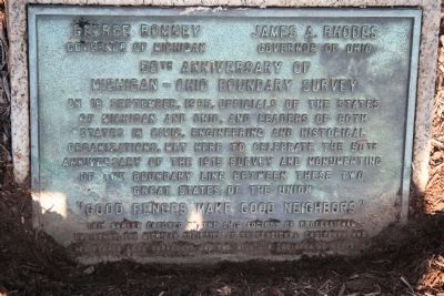
50th Anniversary of Michigan - Ohio Boundary Survey
Photographed by Dale K. Benington
1. 50th Anniversary of Michigan - Ohio Boundary Survey Marker
Surveyed By
S. S. Gannet
Geographer
United States
Geological Survey
1915
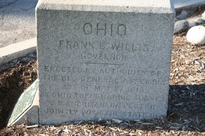
Frank B. Willis
Governor
- - - - -
Erected by Authority of
The 81st General Assmebly
Act of May 27, 1915
By Ohio Topographic Survey
C. E. Sherman Inspector
Jointly with the state of
Michigan
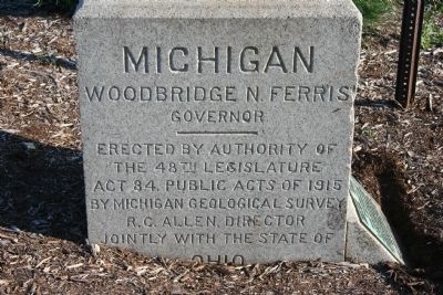
[Michigan Side of Marker]
Woodbridge N. Ferris
Governor
- - - - -
Erected by authority of
The 48th Legislature
Act 84 Public Acts of 1915
By Michigan Geological Survey
R. C. Allen, Director
Jointly with the state of
Ohio
Governor of Michigan - - Governor of Ohio
50th ANNIVERSARY OF
MICHIGAN - OHIO BOUNDARY SURVEY
"Good fences make Good Neighbors"
Erected 1915.
Topics. This historical
this page online
Location. 41° 43.962′ N, 83° 27.82′ W. Marker is in Lost Peninsula, Michigan, in Monroe County. It is at the intersection of Edgewater Drive and Lost Peninsula Marina Drive, on the right when traveling north on Edgewater Drive. From Summit Street in Toledo go to 131st Street and from there to Edgewater Drive and then head north to the "State Line" historical marker. Touch for map. Marker is in this post office area: Erie MI 48133, United States of America. Touch for directions.

Regionally, this marker is in Southeast Michigan and in Greater Detroit. It is also in the American Midwest. Globally, it is in North America, on the Great Lakes, in the Western Hemisphere, in the Western World, and in the Anglosphere. Historically, it finds itself in what was once the Northwest Territory.
Other nearby markers. At least 8 other markers are within 3 miles of this marker, measured as the crow flies: Point Place Veterans Memorial (approx. 0.9 miles away in Ohio); Toledo (approx. one mile away in Ohio); Veterans Memorial Grove (approx.
Photographed by Dale K. Benington, July 16, 2009
2. State Line Marker
View of the front side of the historical marker.
More about this marker. This historical marker, that marks the boundary between Ohio and Michigan, is located in the Lost Peninsula. The Lost Peninsula, "is 240 acres of Michigan land that can be reached only by water or through Ohio. The Lost Peninsula can be found in Maumee Bay, squeezed between the Ottawa River and the bay. Michigan owns the tip that extends as a spur of land north of Toledo." (The Toledo War," by Don Faber)
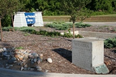
The lower plaque was provided by The Ohio Society of Professional Engineers and Michigan Societies of Professional Engineers and Registered Land Surveyors and the Michigan Engineering Society in 1965.
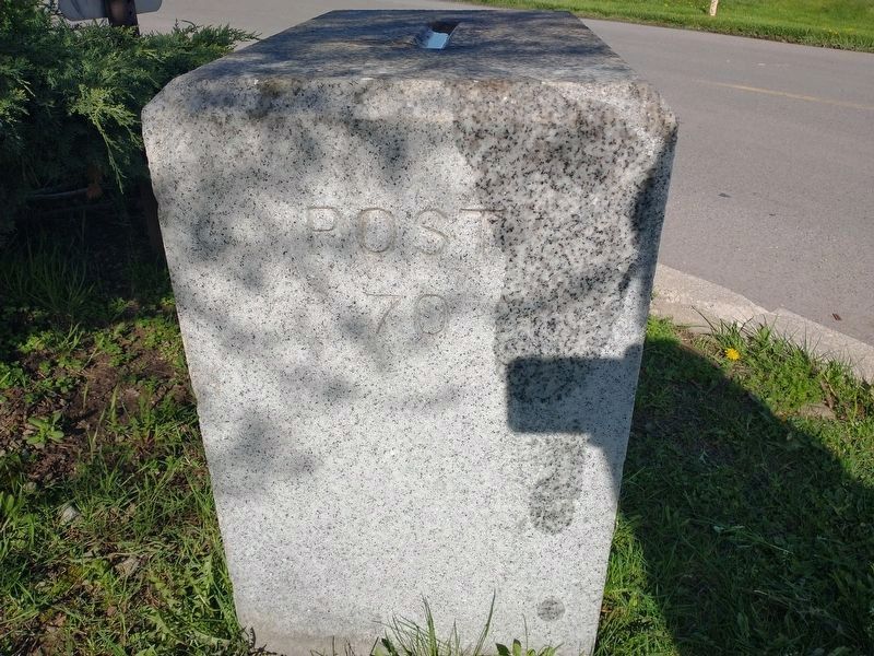
Regarding State Line. Regarding this historical marker, in book entitled "The Toledo War," author Don Faber states the following: "On November 24, 1915, Michigan governor Woodbridge Ferris and Ohio governor Frank B. Willis met at the end of Point Place Road, now known as Edgewater Drive, in the Lost Peninsula. Standing before the American flag, the governors declared that the "War of the States" had finally ended and dedicated a monument that pinpoints the Ohio-Michigan boundary line. A survey marking the state line was finished in 1915 after taking three months; the last land marker to be erected, post 70, was the one the governors dedicated on the Lost Peninsula....."
Related markers. Click here for a list of markers that are related to this marker. To better understand the relationship, study each marker in the order shown.
Also see . . . Toledo War.
Photographed by Dale K. Benington, July 16, 2009
3. State Line Marker
View of the Ohio side of this historical marker.
Photographed by Dale K. Benington, July 16, 2009
4. State Line Marker
View of the Michigan side of this historical marker.
Photographed by Dale K. Benington, July 16, 2009
5. State Line Marker
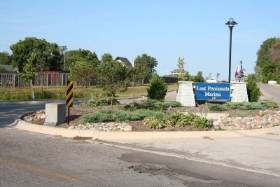
View of the landscape around this historical marker.
Photographed by Craig Doda, May 7, 2022
6. State Line Marker
Photographed by Dale K. Benington, July 16, 2009
7. State Line Marker
Credits. This page was last revised on March 14, 2025. It was originally submitted on July 22, 2009, by Dale K. Benington of Toledo, Ohio. This page has been viewed 2,925 times since then and 58 times this year. Last updated on May 8, 2022, by Craig Doda of Napoleon, Ohio. Photos: 1, 2, 3, 4, 5. submitted on July 22, 2009, by Dale K. Benington of Toledo, Ohio. 6. submitted on May 8, 2022, by Craig Doda of Napoleon, Ohio. 7. submitted on July 22, 2009, by Dale K. Benington of Toledo, Ohio. • J. Makali Bruton was the editor who published this page.
