Lorton in Fairfax County, Virginia — The American South (Mid-Atlantic)
This "temple"…
George Mason's Gunston Hall
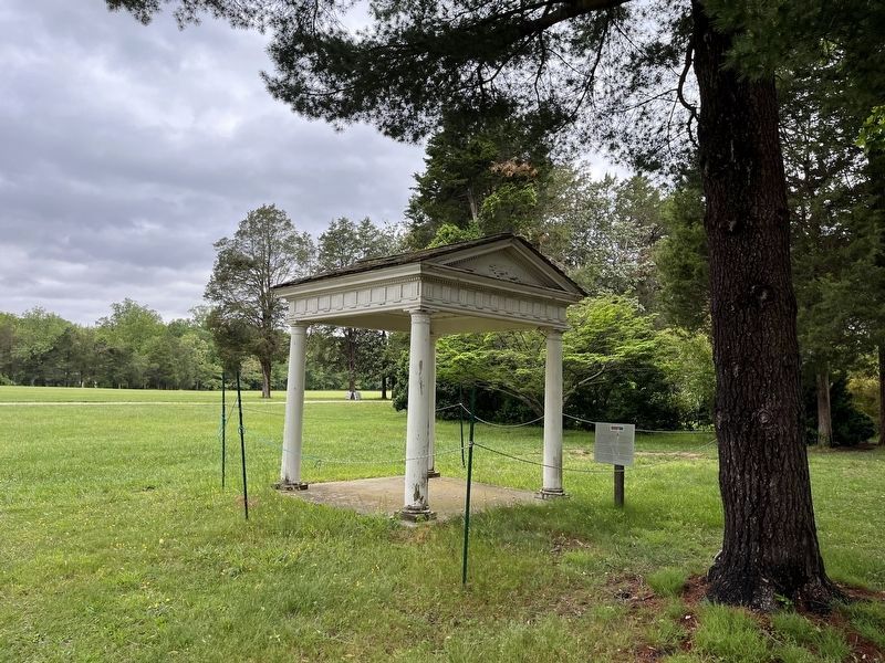
This "temple" was one of many colonial-revival inspired improvements made by Gunston Hall's last private owner, Louise Hertle. Mr. Hertle and his second wife, Eleanor, cherished Gunston Hall's connection to the founding of our country. Their use of colonial-style buildings celebrated this era.
Constructed in the early 1900s, this structure sheltered the well located near the mansion. The structure was moved to this site when the kitchen yard, including a historically-accurate well covering, was reconstructed to create a more authentic experience for museum visitors.
We ask that you enjoy this structure from afar and view it as part of our larger landscape. It is kept in a state of suspended preservation and is not safe to touch or walk under.
Erected by George Mason's Gunston Hall.
Topics. This historical marker is listed in this topic list: Architecture.
Location. 38° 39.878′ N, 77° 9.621′ W. Marker is in Lorton, Virginia, in Fairfax County. Marker can be reached from Gunston Road (Virginia Route 242) 0.8 miles east of Springfield Drive, on the left when traveling east. Touch for map. Marker is at or near this postal address: 10709 Gunston Rd, Lorton VA 22079, United States of America. Touch for directions.
Other nearby markers. At least 8 other markers are within 2 miles of this marker, measured as the crow flies. A “Considerable Force” (within shouting distance of this marker); “Resources within Themselves” (within shouting distance of this marker); Organizing Nature (about 300 feet away, measured in a direct line); Out of Retirement (about 400 feet away); What Lies Beneath (about 800 feet away); Shiloh Baptist Church (approx. 0.6 miles away); This is Pohick Bay! (approx. ¾ mile away); Elizabeth Hartwell Mason Neck National Wildlife Refuge (approx. 1.1 miles away). Touch for a list and map of all markers in Lorton.
Credits. This page was last revised on May 8, 2022. It was originally submitted on May 8, 2022, by Devry Becker Jones of Washington, District of Columbia. This page has been viewed 69 times since then and 12 times this year. Photos: 1, 2. submitted on May 8, 2022, by Devry Becker Jones of Washington, District of Columbia.

