Grandview in Raleigh County, West Virginia — The American South (Appalachia)
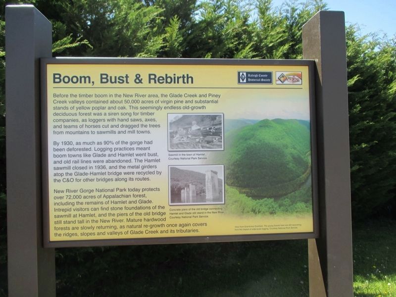
Boom, Bust & Rebirth
Before the timber boom in the New River area, the Glade Creek and Piney Creek valleys contained about 50,000 acres of virgin pine and substantial stands of yellow poplar and oak. This seemingly endless old-growth deciduous forest was a siren song for timber companies, as loggers with hand saws, axes, and teams of horses cut and dragged the trees from the mountains to sawmills and mill towns.
By 1930, as much as 90% of the gorge had been deforested. Logging practices of the time meant that ‘boom’ towns like Glade and Hamlet went ‘bust,’ and old rail lines were abandoned. The Hamlet sawmill closed in 1936, and the metal girders atop the Glade-Hamlet bridge were recycled by the Chesapeake and Ohio (C&O) at other bridges along its routes.
New River Gorge National River, a unit of the National Park Service, today protects over 72,000 acres of Appalachian forest, including the remains of Hamlet and Glade. Today’s intrepid visitor can find stone foundations of the sawmill at Hamlet, and the piers of the old bridge still stand tall in the New River. The mature hardwood forests are slowly returning, as natural re-growth once again covers the ridges, slopes and valleys of Glade Creek and its tributaries.
Erected by Raleigh County Historical Society and National Coal Heritage Area Authority.
Topics. This historical marker is listed in these topic lists: Horticulture & Forestry • Industry & Commerce • Natural Resources • Railroads & Streetcars. A significant historical year for this entry is 1930.
Location. 37° 46.197′ N, 81° 4.13′ W. Marker is in Grandview, West Virginia, in Raleigh County. Marker is on Grandview Road (West Virginia Route 307) 0.1 miles east of Jewel Road, on the left when traveling north. Marker is located at Grandview Shell Station. Touch for map. Marker is at or near this postal address: 2267 Grandview Rd, Beaver WV 25813, United States of America. Touch for directions.
Other nearby markers. At least 8 other markers are within 6 miles of this marker, measured as the crow flies. Skidders and Boomboats (here, next to this marker); Glade Creek Timber (here, next to this marker); Grandview Park (approx. 3˝ miles away); Big Beaver Creek Ancient Fortification (approx. 4˝ miles away); Shady Spring (approx. 4˝ miles away); Beckley Mill (approx. 5 miles away); Colonel Ernest E. Chilson (approx. 5.1 miles away); Green Beret Birthplace (approx. 5.2 miles away). Touch for a list and map of all markers in Grandview.
Related markers. Click here for a list of markers that are related to this marker.
Credits. This page was last revised on May 23, 2022. It was originally submitted on May 7, 2022, by Merle T. Cole of Daniels, West Virginia. This page has been viewed 121 times since then and 17 times this year. Last updated on May 9, 2022, by Merle T. Cole of Daniels, West Virginia. Photo 1. submitted on May 9, 2022, by Merle T. Cole of Daniels, West Virginia. • J. Makali Bruton was the editor who published this page.
