Cave Spring in Floyd County, Georgia — The American South (South Atlantic)
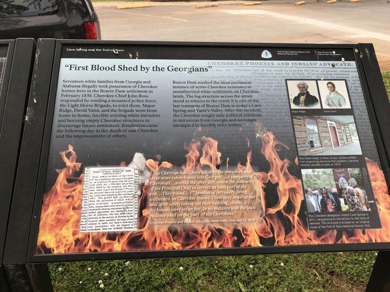
“First Blood Shed by the Georgians”
Inscription.
Seventeen white families from Georgia and Alabama illegally took possession of Cherokee homes here in the Beaver Dam settlement in February 1830. Cherokee Chief John Ross responded by sending a mounted police force, the Light Horse Brigade, to evict them. Major Ridge, David Vann, and the brigade went from home to home, forcibly evicting white intruders and burning empty Cherokee structures to discourage future settlement. Retaliation came the following day in the death of one Cherokee and the imprisonment of others.
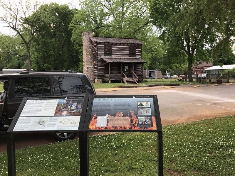
Beaver Dam marked the most prominent instance of active Cherokee resistance to unauthorized white settlement on Cherokee lands. The log structure across the street stood as witness to the event; it is one of last remnants of Beaver Dam in today's Cave Spring and Vann's Valley. After this incident, the Cherokee sought only political solutions to intrusions from Georgia and no longer attempted to forcibly evict whites.
“… a Cherokee has … been killed by the intruders, and three more taken bound into Georgia! … A company of Cherokees … started the other day, under the authority of the Principal Chief to correct, at least part of the evil … They found … 17 families of intruders, living, we believe, in Cherokee houses. These they ordered out and after safely taking out their bedding, chairs, &c. the houses were set on fire. In no instance was the least violence used on the part of the Cherokees.” — Cherokee Phoenix and Indians' Advocate, Wednesday, February 10, 1830
[Captions (Right side, top to bottom)]
• Major Ridge; David Vann
• The Green Hotel, in front of you, contains within it an original log structure that predates Cherokee removal, possibly as early as 1810.
• This Cherokee delegation visited Cave Spring in 2011, recognizing its connection to the story of removal. The structure is located on an original route of the Trail of Tears National Historic Trail.
Erected by National Park Service • City of Cave Spring • Trail of Tears Association.
Topics and series. This historical marker is listed in these topic lists: Government & Politics • Native Americans • Settlements & Settlers. In addition, it is included in the Trail of Tears series list. A significant historical month for this entry is February 1830.
Location. 34° 6.411′ N, 85° 20.188′ W. Marker is in Cave Spring, Georgia, in Floyd County. Marker is at the intersection of Broad Street and Love Street, on the left when traveling south on Broad Street. Touch for map. Marker is at or near this postal address: 24 Broad St, Cave Spring GA 30124, United States of America. Touch for directions.
Other nearby markers. At least 8 other markers are within 8 miles of this marker, measured as the
crow flies. The Trail Where They Cried (here, next to this marker); 1920 Chesapeake & Ohio RR Caboose (within shouting distance of this marker); Georgia School for the Deaf (about 800 feet away, measured in a direct line); The Cedartown Water Works, Woman's Building, Big Spring Park Historic District (approx. 7.8 miles away); Trail of Tears Cherokee (approx. 7.8 miles away); Big Spring Park (approx. 7.8 miles away); Ivy Ledbetter Lee (approx. 7.9 miles away); Hawkes Children's Library (approx. 7.9 miles away). Touch for a list and map of all markers in Cave Spring.
Credits. This page was last revised on May 9, 2022. It was originally submitted on May 9, 2022, by Duane and Tracy Marsteller of Murfreesboro, Tennessee. This page has been viewed 240 times since then and 38 times this year. Photos: 1, 2. submitted on May 9, 2022, by Duane and Tracy Marsteller of Murfreesboro, Tennessee.

