Lawrenceville in Gwinnett County, Georgia — The American South (South Atlantic)
Fort Daniel and the Georgia Frontier
Photographed by Duane and Tracy Marsteller, May 6, 2022
1. Fort Daniel and the Georgia Frontier Marker (left panel)
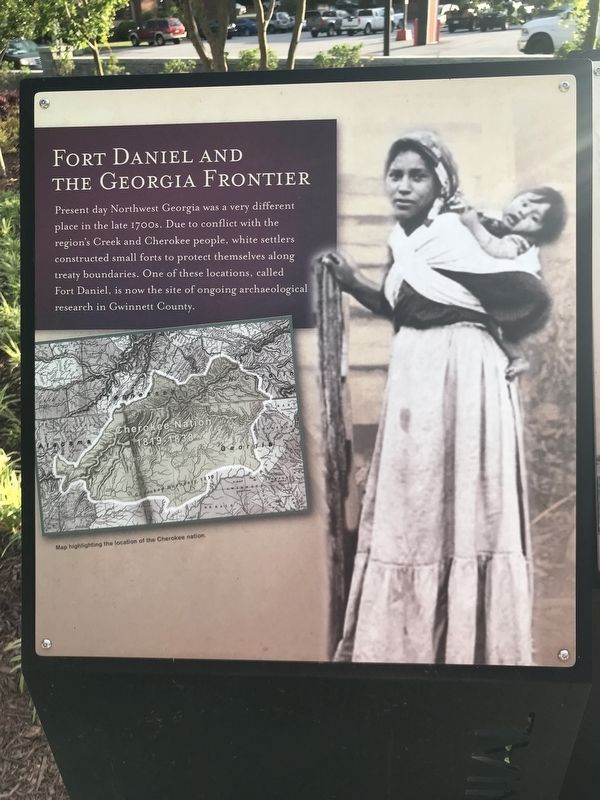
Present day Northwest Georgia was a very different place in the late 1700s. Due to conflict with the region's Creek and Cherokee people, white settlers constructed small forts to protect themselves along treaty boundaries. One of these locations, called Fort Daniel, is now the site of ongoing archaeological research in Gwinnett County.
[Caption] Map highlighting the location of the Cherokee nation.
[Right panel]
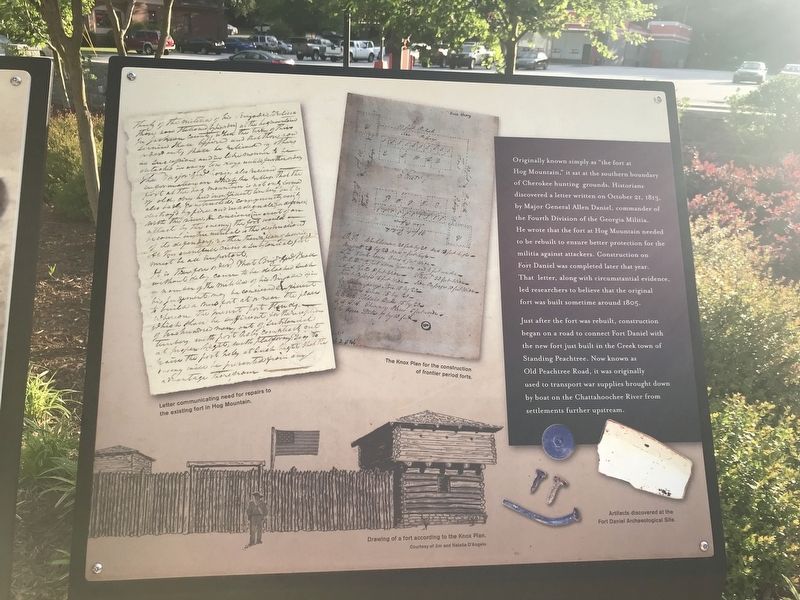
Originally known simply as “the fort at Hog Mountain,” it sat at the southern boundary of Cherokee hunting grounds. Historians discovered a letter written on October 21, 1813, by Major General Allen Daniel, commander of the Fourth Division of the Georgia Militia. He wrote that the fort at Hog Mountain needed to be rebuilt to ensure better protection for the militia against attackers. Construction on Fort Daniel was completed later that year. That letter, along with circumstantial evidence, led researchers to believe that the original fort was built sometime around 1805.
Just after the fort was rebuilt, construction began on a road to connect Fort Daniel with the new fort just built in the Creek
this page online
Captions (clockwise from top left)
• Letter communicating need for repairs to the existing fort in Hog Mountain.
• The Knox Plan for the construction of frontier period forts.
• Artifacts discovered at the Fort Daniel Archaeological Site.
• Drawing of a fort according to the Knox Plan. Courtesy of Jim and Natalia D'Angelo
Erected 2018 by Gwinnett County.
Topics. This historical marker is listed in these topic lists: Forts and Castles • Roads & Vehicles • Settlements & Settlers. A significant historical year for this entry is 1805.
Location. 33° 57.286′ N, 83° 59.351′ W. Marker is in Lawrenceville, Georgia, in Gwinnett County. It can be reached from the intersection of South Perry Street (Georgia Route 20) and Luckie Street, on the left when traveling south. Marker is located on the northwest side of Gwinnett County Bicentennial Park. Touch for map. Marker is at or near this postal address: 275 S Perry St, Lawrenceville GA 30046,
Photographed by Duane and Tracy Marsteller, May 6, 2022
2. Fort Daniel and the Georgia Frontier Marker (right panel)

Regionally, this marker is in the Piedmont and in Metro Atlanta. It is also in the American South and specifically in the Deep South. Globally, it is in North America, the Western Hemisphere, the Western World, and the Anglosphere. Historically, it finds itself in what was once the territory of the Mississippian Culture, one of the original Thirteen Colonies, one of the Confederate States of America, and the Antebellum South.
Other nearby markers. At least 8 other markers are within walking distance of this marker: The Land Lottery of 1820 (a few steps from this marker); Gwinnett County Creation (a few steps from this marker); From Near and Far (within shouting distance of this marker); Gwinnett County Bicentennial Time Capsule (within shouting distance of this marker); Gwinnett: A Great Investment (within shouting distance of this marker); Unsurpassed Quality of Life (within shouting distance of this marker); The Land We Love (within shouting distance of this marker); Lake Lanier is Born (within shouting distance of this marker). Touch for a list and map of all markers in Lawrenceville.
Credits. This page was last revised on May 12, 2022. It was originally submitted on May 12, 2022, by Duane and Tracy Marsteller of Murfreesboro, Tennessee. This page has been viewed 875 times since then and 33 times this year. Photos: 1, 2. submitted on May 12, 2022, by Duane and Tracy Marsteller of Murfreesboro, Tennessee.
