Lawrenceville in Gwinnett County, Georgia — The American South (South Atlantic)
The History of Peachtree
Inscription.
[Left panel]
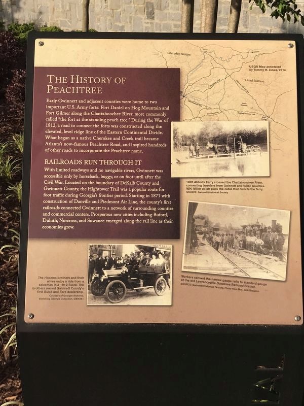
Early Gwinnett and adjacent counties were home to two important U.S. Army forts: Fort Daniel on Hog Mountain and Fort Gilmer along the Chattahoochee River, more commonly called "the fort at the standing peach tree.” During the War of 1812, a road to connect the forts was constructed along the elevated, level ridge line of the Eastern Continental Divide. What began as a native Cherokee and Creek trail became Atlanta's now-famous Peachtree Road, and inspired hundreds of other roads to incorporate the Peachtree name.
Railroads Run Through It
With limited roadways and no navigable rivers, Gwinnett was accessible only by horseback, buggy, or on foot until after the Civil War. Located on the boundary of DeKalb County and Gwinnett County, the Hightower Trail was a popular route for foot traffic during Georgia's frontier period. Starting in 1871 with construction of Danville and Piedmont Air Line, the county's first railroads connected Gwinnett to a network of surrounding counties and commercial centers. Prosperous new cities including Buford, Duluth, Norcross, and Suwanee emerged along the rail line as their economies grew.
[Captions (clockwise from top right)]
• USGS Map annotated by Tommy H. Jones, 2014
• 1897 Abbot's Ferry crossed the Chattahoochee River, connecting travelers from Gwinnett and Fulton Counties. W.H. Miller at left pulls the cable that directs the ferry. Source: Gwinnett Historical Society
• Workers convert the narrow gauge rails to standard gauge at the old Lawrenceville Suwanee Railroad Station. Source: Gwinnett Historical Society, Photo from Mrs. Jack Brogdon
• The Hopkins brothers and their wives enjoy a ride from a salesman in a 1912 Buick. The brothers owned Gwinnett County's first Buick and Ford dealership. Courtesy of Georgia Archives, Vanishing Georgia Collection, GWN261.
[Right panel]
From Traffic to Transit
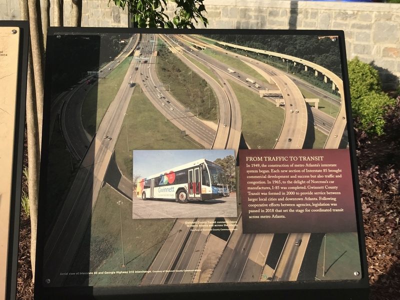
In 1949, the construction of metro Atlanta's interstate system began. Each new section of Interstate 85 brought commercial development and success but also traffic and congestion. In 1965, to the delight of Norcross' car manufactures, I-85 was completed. Gwinnett County Transit was formed in 2000 to provide service between larger local cities and downtown Atlanta. Following cooperative efforts between agencies, legislation was passed in 2018 that set the stage for coordinated transit across metro Atlanta.
[Captions]
• (Background) Aerial view of Interstate 85 and Georgia Highway 316 interchange. Courtesy Gwinnett County Communications
• (Inset)
Gwinnett County Transit connects riders to metro Atlanta and across the county. Courtesy Gwinnett County Communications
Erected 2018 by Gwinnett County.
Topics. This historical marker is listed in these topic lists: Railroads & Streetcars • Roads & Vehicles. A significant historical year for this entry is 1871.
Location. 33° 57.271′ N, 83° 59.307′ W. Marker is in Lawrenceville, Georgia, in Gwinnett County. Marker can be reached from South Clayton Street (Georgia Route 20) south of Luckie Street, on the right when traveling south. Marker is in the southeast corner of Gwinnett County Bicentennial Plaza. Touch for map. Marker is at or near this postal address: 42 S Clayton St, Lawrenceville GA 30046, United States of America. Touch for directions.
Other nearby markers. At least 8 other markers are within walking distance of this marker. The Land We Love (a few steps from this marker); African American Roles in the Community (a few steps from this marker); Lake Lanier is Born (within shouting distance of this marker); Unsurpassed Quality of Life (within shouting distance of this marker); Gwinnett County Bicentennial Time Capsule (within shouting distance of this marker); Gwinnett: A Great Investment (within shouting distance of this marker); From Near and Far (within shouting
distance of this marker); The Land Lottery of 1820 (within shouting distance of this marker). Touch for a list and map of all markers in Lawrenceville.
Credits. This page was last revised on May 12, 2022. It was originally submitted on May 12, 2022, by Duane and Tracy Marsteller of Murfreesboro, Tennessee. This page has been viewed 115 times since then and 22 times this year. Photos: 1, 2, 3. submitted on May 12, 2022, by Duane and Tracy Marsteller of Murfreesboro, Tennessee.


