Eatonton in Putnam County, Georgia — The American South (South Atlantic)
Putnam County Court House
Eatonton, Georgia
— March to the Sea Heritage Trail —
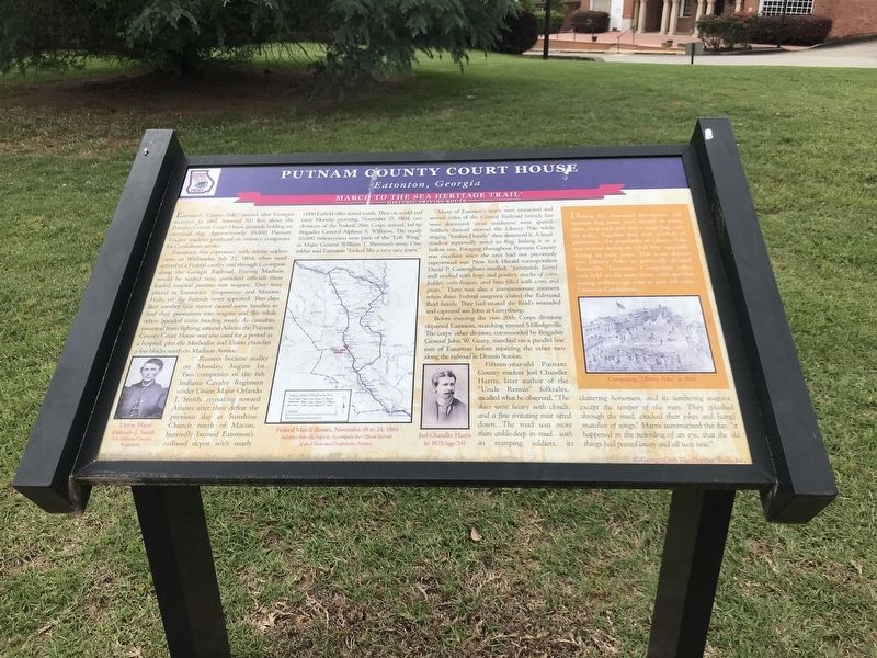
Eatonton's first experience with enemy soldiers came on Wednesday, July 22, 1864, when word arrived of a Federal cavalry raid through Covington along the Georgia Railroad. Fearing Madison would be raided next, panicked officials there loaded hospital patients into wagons. They were placed in Eatonton's Temperance and Masonic Halls, yet the Federals never appeared. Two days later another false rumor caused some families to load their possessions onto wagons and flee while others boarded trains heading south. As casualties mounted from fighting around Atlanta the Putnam County Court House was also used for a period as a hospital, plus the Methodist and Union churches a few blocks north on Madison Avenue.
Rumors became reality on Monday, August 1st. Two companies of the 6th Indiana Cavalry Regiment under Union Major Orlando J. Smith, retreating toward Atlanta after their defeat the previous day at Sunshine Church north of Macon, hurriedly burned Eatonton's railroad depot with nearly 1,000 Enfield rifles stored inside. Then on a cold and rainy Monday morning, November 21, 1864, two divisions of the Federal 20th Corps arrived, led by Brigadier General Alpheus S. Williams. The nearly 10,000 infantrymen were parts of the “Left Wing” in Major General William T. Sherman's army. One soldier said Eatonton “looked like a very nice town.”
Many of Eatonton's stores were ransacked and several miles of the Central Railroad branch line were destroyed; most residences were spared. Soldiers danced around the Liberty Pole while singing “Yankee Doodle” then destroyed it. A local resident reportedly saved its flag, hiding it in a hollow tree. Foraging throughout Putnam County was excellent since the area had not previously experienced war. New York Herald correspondent David P. Conyngham recalled, “farmyards [were] well stoked with hogs and poultry, stacks of corn, fodder, corn-houses, and bins filled with corn and grain.” There was also a compassionate moment when three Federal surgeons visited the Edmund Reid family. They had treated the Reids' wounded and captured son at Gettysburg.
Before evening the two 20th Corps divisions departed Eatonton, marching toward Milledgeville. The corps' other division, commanded by Brigadier General John W. Geary, marched on a parallel line east of Eatonton before rejoining the other two along the railroad at Dennis Station.
Fifteen-year-old Putnam County resident Joel Chandler Harris, later author of the “Uncle Remus” folktales, recalled what he observed. “The skies were heavy with clouds, and a fine irritating mist sifted down … The road was more than ankle-deep in mud … with its trampling soldiers, its clattering horsemen, and its lumbering wagons, except the temper of the men. They splashed through the mud, cracked their jokes and [sang] snatches of songs.” Harris summarized the day, “it happened in the twinkling of an eye, that the old things had passed away and all was new.”
[Sidebar]
During the American Revolution, tall wooden flag poles were erected in many cities. Atop each pole flew a huge flag, seen for miles. Together they were symbols of patriotism. The popularity of Liberty Poles was revived during the Civil War, especially during its early years. This scene depicts two Liberty Poles in politically divided Knoxville, Tennessee. Competing rallies were held on the same street, with speeches urging military-age men to join the army, Union or Confederate.
[Captions (left to right)]
• Union Major Orlando J. Smith 6th Indiana Cavalry Regiment
• Federal march routes, November 18 to 24, 1864 (adapted from the Atlas to Accompany the Official Records of the Union and Confederate Armies)
• Joel Chandler Harris in 1873 (age 24)
• Competing “Liberty Poles” in 1861
Erected by Georgia Civil War Heritage Trails.
Topics and series. This historical marker is listed in this topic list: War, US Civil. In addition, it is included in the Georgia Civil War Trails series list. A significant historical date for this entry is July 22, 1864.
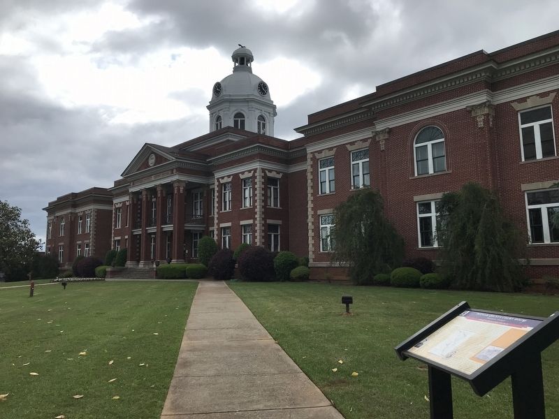
Location. 33° 19.554′ N, 83° 23.362′ W. Marker is in Eatonton, Georgia, in Putnam County. Marker is at the intersection of West Marion Street and South Madison Avenue, on the right when traveling east on West Marion Street. Marker is at the northwest corner of the Putnam County Courthouse grounds. Touch for map. Marker is in this post office area: Eatonton GA 31024, United States of America. Touch for directions.
Other nearby markers. At least 8 other markers are within walking distance of this marker. The Stoneman Raid (a few steps from this marker); Putnam County Confederate Monument (within shouting distance of this marker); Putnam County (within shouting distance of this marker); The March to the Sea (within shouting distance of this marker); Putnam County Veterans Monument (about 300 feet away, measured in a direct line); Veterans Flagpole (about 300 feet away); Branch Bank of the State of Georgia at Eatonton (about 400 feet away); The Bronson House (about 500 feet away). Touch for a list and map of all markers in Eatonton.
Credits. This page was last revised on May 13, 2022. It was originally submitted on May 13, 2022, by Duane and Tracy Marsteller of Murfreesboro, Tennessee. This page has been viewed 215 times since then and 61 times this year. Photos: 1, 2. submitted on May 13, 2022, by Duane and Tracy Marsteller of Murfreesboro, Tennessee.

