Statesboro in Bulloch County, Georgia — The American South (South Atlantic)
Statesboro, Georgia
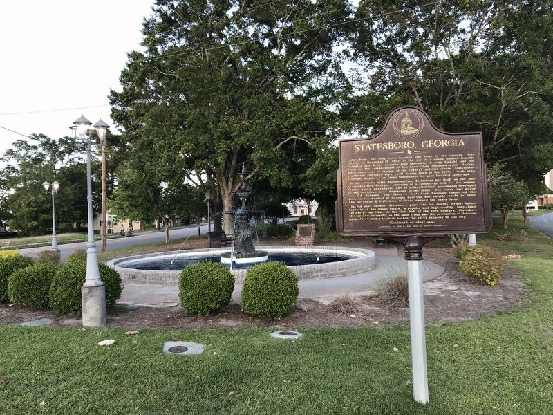
In the decades after Reconstruction, Statesboro put itself on the map of southeastern Georgia, emerging as a commercial hub for the region. Stores, banks, newspapers, and an influential local government developed in the downtown area beginning in the 1880s. The town's first mayor was J. A. Brannen. The Dover & Statesboro Railroad connected the town to the Central of Georgia Railroad and outside world in 1889. The Savannah & Statesboro Railroad opened ten years later.
In the next decade, Statesboro grew into the world's largest inland exporter of Sea Island cotton, a popular and high-quality, long-staple variety of the fiber. In the first half of the 20th century, Statesboro also ranked nationally in the mule trade and the production of tobacco. Agriculture and education anchor the city's economy to this day.
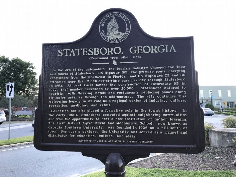
In the era of the automobile, the tourism industry changed the face and fabric of Statesboro. US Highway 301, the primary route carrying vacationers from the Northeast to Florida, and US Highways 25 and 80 attracted more than 3,640 out-of-state cars per day through Statesboro in 1953. At peak times before the construction of Interstate 95 in 1977, that number increased to over 20,000. Statesboro catered to tourists, with thriving motels and restaurants replacing homes along its major arteries through the mid-century. The city continues this welcoming legacy in its role as a regional center of industry, culture, recreation, medicine, and retail.
Education has also played a formative role in the town's history. In the early 1900s, Statesboro competed against neighboring communities and won the opportunity to host a new institution of higher learning. The First District Agricultural and Mechanical School, now known as Georgia Southern University, was founded in 1906 on a hill south of town. For over a century, the University has served as a magnet and distributor for education, culture, and ideas.
Erected by Bulloch County Historical Society.
Topics. This historical marker is listed in these topic lists: Education • Industry & Commerce • Political Subdivisions • Roads & Vehicles. A significant historical date for this entry is December 19, 1803.
Location. 32° 26.916′ N, 81° 46.795′ W. Marker is in Statesboro, Georgia, in Bulloch County. Marker is at the intersection of East Main Street and Savannah Avenue, on the right when traveling east on East Main Street. Touch for map. Marker is in this post office area: Statesboro GA 30458, United States of America. Touch for directions.
Other nearby markers. At least 8 other markers are within walking distance of this marker. Statesboro Vietnam Memorial (a few steps from this marker); The Fabulous Fifty of 1906 / The Delegates (within shouting distance of this marker); Willie McTell Trail (within shouting distance of this marker); Mathews Building (about 500 feet away, measured in a direct line); Jaeckel Hotel (about 500 feet away); “Flame of Freedom” (about 500 feet away); 32 East Main Street (about 700 feet away); Preetorius Building (about 700 feet away). Touch for a list and map of all markers in Statesboro.
Credits. This page was last revised on May 14, 2022. It was originally submitted on May 14, 2022, by Duane and Tracy Marsteller of Murfreesboro, Tennessee. This page has been viewed 204 times since then and 61 times this year. Photos: 1, 2, 3. submitted on May 14, 2022, by Duane and Tracy Marsteller of Murfreesboro, Tennessee.


