
Statesboro in Bulloch County, Georgia — The American South (South Atlantic)
Statesboro's First BBQ Restaurant
27 West Main Street
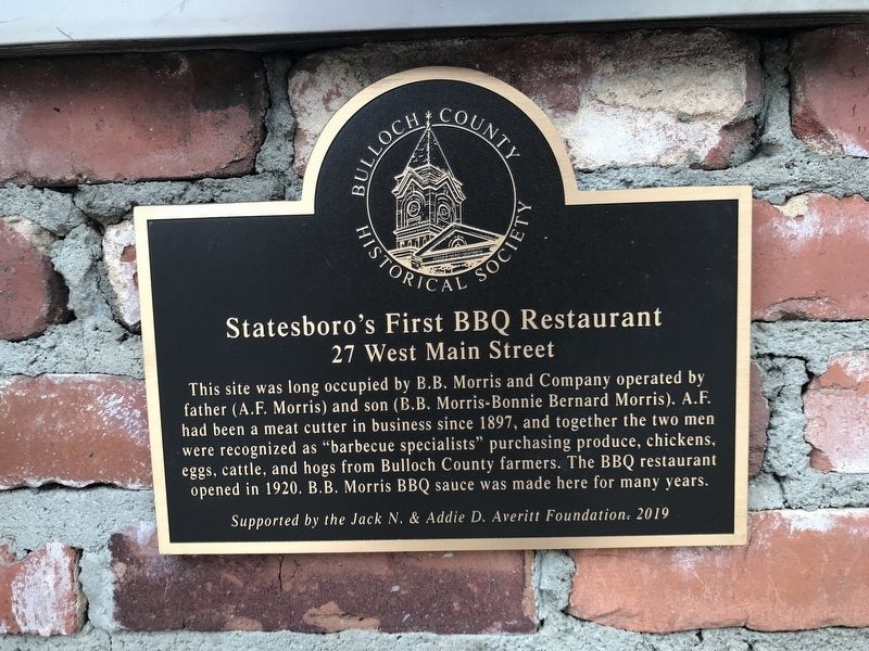
Photographed by Duane and Tracy Marsteller, May 8, 2022
1. Statesboro's First BBQ Restaurant Marker
Erected 2019 by Bulloch County Historical Society.
Topics. This historical marker is listed in this topic list: Industry & Commerce. A significant historical year for this entry is 1920.
Location. 32° 26.945′ N, 81° 47.071′ W. Marker is in Statesboro, Georgia, in Bulloch County. It is at the intersection of West Main Street and North Walnut Street, on the right when traveling west on West Main Street. Touch for map. Marker is at or near this postal address: 29 W Main St, Statesboro GA 30458, United States of America. Touch for directions.

Regionally, this marker is in Georgia’s Coastal Plain. It is also in the American South and specifically
this page online
Other nearby markers. At least 8 other markers are within walking distance of this marker: Brannen Buildings (a few steps from this marker); "River People" (within shouting distance of this marker); Blue Front (within shouting distance of this marker); Corner of Banking (about 300 feet away, measured in a direct line); Vandy's Bar-B-Que (about 300 feet away); First Three Story Brick Building (about 300 feet away); Statesboro Confederate Monument (about 400 feet away); Bulloch County (about 400 feet away). Touch for a list and map of all markers in Statesboro.

Photographed by Duane and Tracy Marsteller, May 8, 2022
2. Statesboro's First BBQ Restaurant Marker
Credits. This page was last revised on May 14, 2022. It was originally submitted on May 14, 2022, by Duane and Tracy Marsteller of Murfreesboro, Tennessee. This page has been viewed 794 times since then and 49 times this year. Photos: 1, 2. submitted on May 14, 2022, by Duane and Tracy Marsteller of Murfreesboro, Tennessee.
