East LaPort in Jackson County, North Carolina — The American South (South Atlantic)
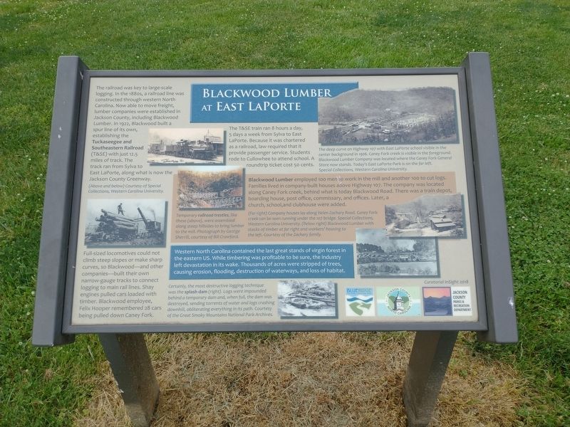
Blackwood Lumber at East LaPorte
Full-sized locomotives could not climb steep slopes or make sharp curves, so Blackwood—and other companies—built their own narrow-gauge tracks to connect logging to main rail lines. Shay engines pulled cars loaded with timber. Blackwood employee, Felix Hooper remembered 28 cars being pulled down Caney Fork.
The T&SE train ran 8 hours a day, 5 days a week from Sylva to East LaPorte. Because it was chartered as a railroad, law required that it provide passenger service. Students rode to Cullowhee to attend school. A roundtrip ticket cost 50 cents.
(sidebar)
Blackwood Lumber employeed 100 men to work in the mill and another 100 to cut logs. Families lived in company-built houses above highway 107. The company was located along Caney Fork creek, behind what is today Blackwood Road. There was a train depot, boarding house, post office, commissary, and offices. Later, a church, school, and clubhouse were added.
Western North Carolina contained the last great stands of virgin forest in the eastern U.S. While timbering was profitable to be sure, the industry left devastation in its wake. Thousands of acres were stripped of trees, causing erosion, flooding, destruction of waterways, and loss of habitat.
(captions)
(Above and below) Courtesy of Special Collections, Western Carolina University
The deep curve on Highway 107 with East LaPorte school visible in the center background in 1926. Caney Fork creek is visible in the foreground. Blackwood Lumber Company was located where the Caney Fork General Store now stands. Today’s East LaPorte Park is on the far left. Special Collections, Western Carolina University.
Temporary railroad trestles, like these (above) were assembled along steep hillsides to bring lumber to the mill. Photograph by George Sherrill, courtesy of Bill Crawford.
(Far right) Company houses lay along Helen Zachary Road. Caney Fork creek can be seen running under the 107 bridge. Special Collections, Western Carolina University. (Below right) Blackwood Lumber with stacks of timber at far right and workers’ housing to the left. Courtesy of the Zachary family.
Certainly, the most destructive logging technique was the splash dam (right). Logs were impounded behind a temporary dam and, when full, the dam was destroyed, sending torrents of water and logs crashing downhill, obliterating everything in its path. Courtesy of the Great Smoky Mountains National Park Archives.
Erected 2018 by Jackson County Parks & Recreation Department.
Topics. This historical marker is listed in these topic lists: Horticulture & Forestry • Industry & Commerce • Railroads & Streetcars. A significant historical year for this entry is 1922.
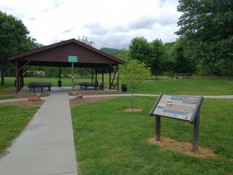
Location. 35° 17.879′ N, 83° 8.827′ W. Marker is in East LaPort, North Carolina, in Jackson County. Marker can be reached from State Highway 107 south of Helen Zachary Road (County Highway 1735), on the right when traveling south. Marker located within the East LaPort River Access Park. Touch for map. Marker is in this post office area: Cullowhee NC 28723, United States of America. Touch for directions.
Other nearby markers. At least 8 other markers are within 3 miles of this marker, measured as the crow flies. Judaculla Rock (about 700 feet away, measured in a direct line); John R. Brinkley (approx. half a mile away); Aunt Sally (approx. half a mile away); Who is Judaculla? (approx. 2.1 miles away); Judaculla Rock: A Cherokee Cultural Heritage Site (approx. 2.1 miles away); What do these markings tell us? (approx. 2.1 miles away); Judaculla Rock Petroglyphs (approx. 2.1 miles away); Robert L. Madison (approx. 2.4 miles away). Touch for a list and map of all markers in East LaPort.
Also see . . . North Carolina Railroads - Tuckaseegee & Southeastern Railway. (Submitted on May 16, 2022, by Tom Bosse of Jefferson City, Tennessee.)
Credits. This page was last revised on May 16, 2022. It was originally submitted on May 16, 2022, by Tom Bosse of Jefferson City, Tennessee. This page has been viewed 440 times since then and 85 times this year. Photos: 1, 2. submitted on May 16, 2022, by Tom Bosse of Jefferson City, Tennessee. • Bernard Fisher was the editor who published this page.

