Scary in Putnam County, West Virginia — The American South (Appalachia)
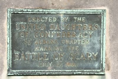
Battle of Scary
United Daughters
of Confederacy
St. Albans Chapter
Marking the
Battle of Scary
July 17, 1861
Erected by United Daughters of Confederacy.
Topics and series. This historical marker is listed in this topic list: War, US Civil. In addition, it is included in the United Daughters of the Confederacy series list. A significant historical month for this entry is July 1831.
Location. 38° 25.965′ N, 81° 51.178′ W. Marker is in Scary, West Virginia, in Putnam County. Marker is on Winfield Road (U.S. 35) half a mile south of Interstate 64, on the left when traveling south. Touch for map. Marker is in this post office area: Scott Depot WV 25560, United States of America. Touch for directions.
Other nearby markers. At least 8 other markers are within one mile of this marker, measured as the crow flies. A different marker also named Battle of Scary (about 400 feet away, measured in a direct line); Putnam County / Kanawha County (approx. one mile away); Lou Burdette (approx. one mile away); Kathy Mattea (approx. one mile away); Larry Barnett (approx. one mile away); Co. B 142nd Infantry 36th Division (approx. one mile away); a different marker also named Co. B 142nd Infantry 36th Division (approx. one mile away); a different marker also named Co. B 142nd Infantry 36th Division (approx. one mile away).
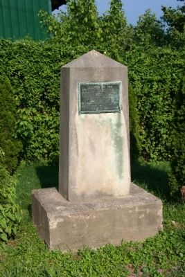
More about this marker. The historical marker is situated on the east side of Winfield Road and can be found on the northeast side of the bridge that takes Winfield Road across Scary Creek.
Credits. This page was last revised on May 20, 2022. It was originally submitted on October 8, 2009, by Dale K. Benington of Toledo, Ohio. This page has been viewed 1,898 times since then and 49 times this year. Last updated on May 16, 2022, by Darryl R Smith of Cincinnati, Ohio. Photos: 1, 2, 3. submitted on October 8, 2009, by Dale K. Benington of Toledo, Ohio. • Bernard Fisher was the editor who published this page.


