
Forest in Bedford County, Virginia — The American South (Mid-Atlantic)
Mounds Made of Ideas and Sweat
Photographed by Bernard Fisher, May 17, 2022
1. Mounds Made of Ideas and Sweat Marker
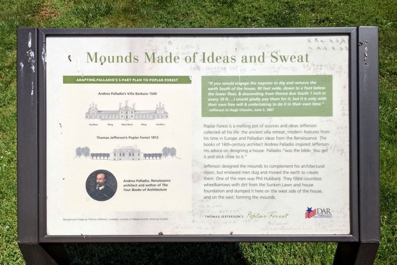
—Jefferson to Hugh Chisolm, June 5, 1807
Poplar Forest is a melting pot of sources and ideas Jefferson collected all his life: the ancient villa retreat, modern features from his time in Europe and Palladian ideas from the Renaissance. The books of 16th-century architect Andrea Palladio inspired Jefferson. His advice on designing a house: Palladio "was the bible. You get it and stick close to it."
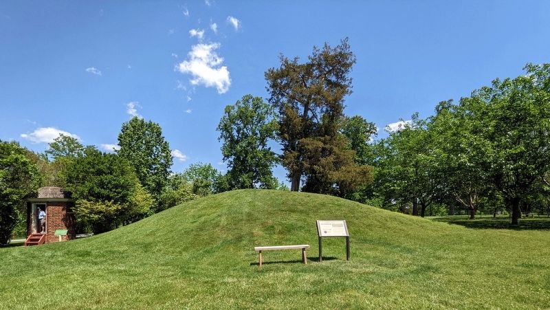
Jefferson designed the mounds to complement his architectural vision, but enslaved men dug and moved the earth to create them. One of the men was Phil Hubbard. They filled countless wheelbarrows with dirt from the Sunken Lawn and house foundation and dumped it here on the west side of the house, and on the east, forming the mounds.
(captions)
Adapting Palladio's 5-Part Plan To Poplar Forest
Andrea Palladio's Villa Barbaro 1549
Thomas Jefferson's Poplar Forest 1812
Andrea Palladio, Renaissance architect and author of The Four Books of Architecture
Background image by Thomas Jefferson, undated; courtesy of Massachusetts Historical Society
Erected by Thomas
this page online
Topics and series. This historical marker is listed in these topic lists: African Americans • Architecture. In addition, it is included in the Daughters of the American Revolution (DAR) series list. A significant historical year for this entry is 1807.
Location. 37° 20.869′ N, 79° 15.904′ W. Marker is in Forest, Virginia, in Bedford County. It can be reached from the intersection of Poplar Forest Drive and Foxhall Drive, on the left when traveling east. Touch for map. Marker is at or near this postal address: 1542 Bateman Bridge Road, Forest VA 24551, United States of America. Touch for directions.

Regionally, this marker is in Southwest Virginia. It is also in the American South and specifically in the Upper South. Globally, it is in North America, the Western Hemisphere, the Western World, and the Anglosphere. Historically, it finds itself in what was once the territory of the Mississippian Culture, one of the original Thirteen Colonies, one of the Confederate States of America, and the Antebellum South.
Other nearby markers. At least 8 other markers
Photographed by Bernard Fisher, May 17, 2022
2. Mounds Made of Ideas and Sweat Marker
Other markers no longer nearby. Why build the mounds? (was here, next to this marker but has been replaced with another marker now near it); What happened to Poplar Forest after Jefferson's death? (was within shouting distance of this marker but has been replaced with another marker now near it); Commemorating Lewis and Clark (was within shouting distance of this marker but has been replaced with another marker now near it); Why is the lawn sunken? (was about 300 feet away, measured in a direct line but has been replaced with another marker now near it); How was the landscape partitioned? (was about 400 feet away but has been replaced with another marker now near it).
Related marker. Click here for another marker that is related to this marker. Old Marker At This Location titled "Why build the mounds?".
Also see . . . Thomas Jefferson’s Poplar Forest. (Submitted on May 18, 2022.)
Credits. This page was last revised on May 19, 2022. It was originally submitted on May 18, 2022, by Bernard Fisher of Richmond, Virginia. This page has been viewed 284 times since then and 15 times this year. Photos: 1, 2. submitted on May 18, 2022, by Bernard Fisher of Richmond, Virginia.
