Lamond Riggs in Northeast Washington in Washington, District of Columbia — The American Northeast (Mid-Atlantic)
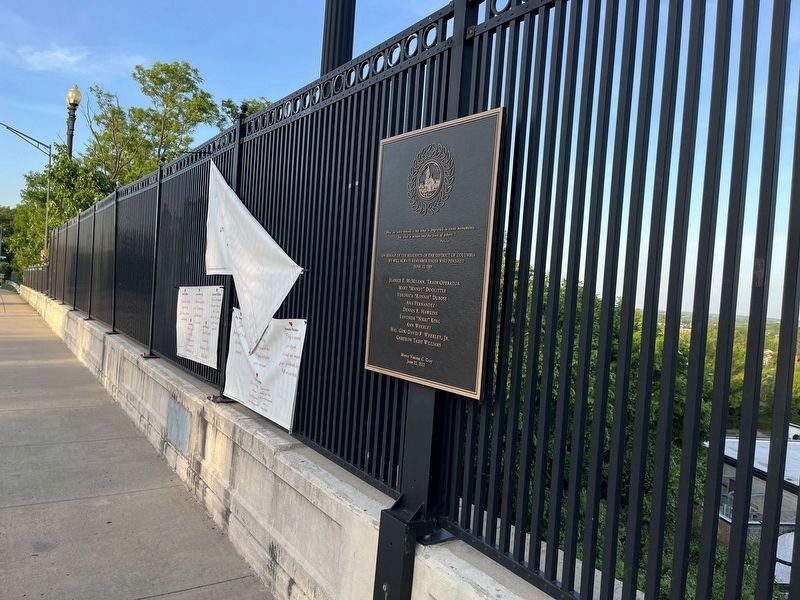
June 22, 2009 Memorial
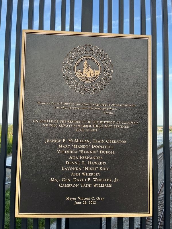
"What we leave behind is not what is engraved in stone monuments, but what is woven into the lives of others."
- Pericles
On behalf of the residents of the District of Columbia we well always remember those who perished June 22, 2009
Jeanice E. McMillan, Train Operator • Mary "Mandy" Doolittle • Veronica "Ronnie" Dubose • Ana Fernandez • Dennis R. Hawkins • Lavonda "Nikki" King • Ann Wherley • Maj. Gen. David F. Wherley, Jr. • Cameron Taihi Williams
Erected 2012 by The Government of the District of Columbia, Mayor Vincent C. Gray.
Topics. This historical marker and memorial is listed in these topic lists: Disasters • Railroads & Streetcars. A significant historical date for this entry is June 22, 2009.
Location. 38° 57.638′ N, 77° 0.368′ W. Marker is in Northeast Washington in Washington, District of Columbia. It is in Lamond Riggs. Marker is on New Hampshire Avenue Northeast, 0.1 miles north of South Dakota Avenue Northeast. Touch for map. Marker is in this post office area: Washington DC 20011, United States of America. Touch for directions.
Other nearby markers. At least 8 other markers are within walking distance of this marker. Civil War Defenses of Washington (about 400 feet away, measured in a direct line); Legacy Memorial Park (about 400 feet away); The Washington Animal Rescue League (about 700 feet away); Welcome to The Lamond Community (approx. 0.3 miles away); Fort Slocum (approx. 0.4 miles away); WOOK-TV Building (approx. 0.4 miles away); Original Federal Boundary Stone, District of Columbia, Northeast 3 (approx. 0.4 miles away in Maryland); Marlon Francisco Morales (approx. half a mile away). Touch for a list and map of all markers in Northeast Washington.
Also see . . . June 2009 Washington Metro train collision. Wikipedia article. There is a section of the article about the three memorials for the Red Line crash in Upper Northeast. (Submitted on May 19, 2022, by Devry Becker Jones of Washington, District of Columbia.)

Photographed By Devry Becker Jones (CC0), May 19, 2022
2. June 22, 2009 Memorial
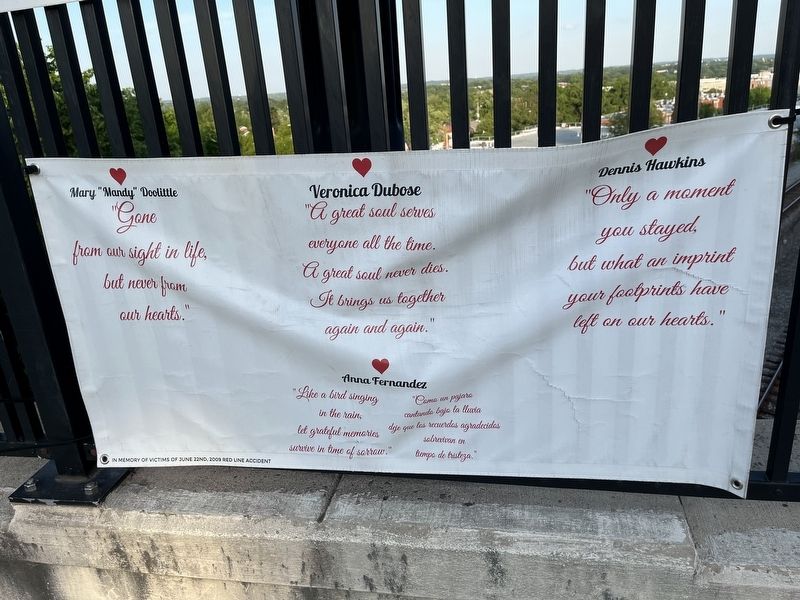
The memorial also features some banners along the Langley Bridge.

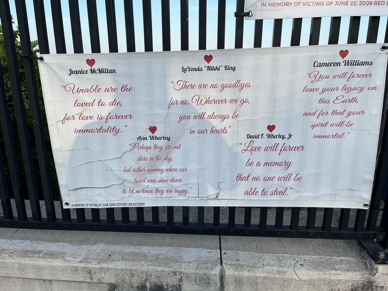
Photographed By Devry Becker Jones (CC0), May 19, 2022
4. Another one of the banners along Langley Bridge
Credits. This page was last revised on January 30, 2023. It was originally submitted on May 19, 2022, by Devry Becker Jones of Washington, District of Columbia. This page has been viewed 83 times since then and 6 times this year. Photos: 1, 2, 3, 4. submitted on May 19, 2022, by Devry Becker Jones of Washington, District of Columbia.

