Great Falls in Fairfax County, Virginia — The American South (Mid-Atlantic)
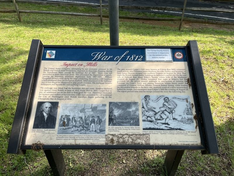
War of 1812
Impact on Mills
The United States Congress, attempting to use economic pressure to lift British and French trade restrictions, imposed on American shipping during the Napoleonic Wars, passed the Embargo Act of 1807. Ships were not permitted to leave American ports. This prevented the exportation of goods, causing an American economic depression from 1807-1809. William Sheppard owned a mill along the road connecting Alexandria with Leesburg which produced flour for European markets. After enactment of the Embargo Act, it was illegal for Sheppard to ship goods overseas. His mortgage became delinquent and he sold the mill to Philip Carper.
The embargo was lifted, but the hostilities did not cease. America declared war against Great Britain in June of 1812. From 1813 to 1815, Carper had to pay an additional tax on his mill to help fund the war. Hardships increased for farmers and millers at harvest time when men answered the call to defend the City of Washington once British warships began gathering in the Chesapeake Bay in August of 1814.
The area around Carper's Mill (now known as Colvin Run Mill) witnessed much activity after President James Madison, his wife, Dolley, and Secretary of State James Monroe escaped into northern Virginia on August 24, 1814. That night the British burned public buildings in America's capital city. On the east side of Difficult Run stood Wiley's Tavern, where both of the Madisons stopped on August 25. Dolley remained that night at Wiley's but the president left the tavern around midnight in anticipation of crossing the Potomac via Conn's Ferry and joining American militia forces under the command of General William Winder. General Robert Young, while leading his Alexandria brigade to the ferry site, received word of a slave insurrection, halted his troops, and encamped near Carper's Mill the evening of August 26. The report proved false and his troops crossed the river the following day.
[Captions:]
James Madison, fourth president of the United States.
An 1814 political cartoon published by S.W. Forbes in London poking fun at President James Madison and Secretary of War John Armstrong fleeing America's capital city with papers before the British set it ablaze.
An 1876 engraving by Richard Miller Devens depicting the British burning the United States Capitol building.
Political cartoon of President Thomas Jefferson's Embargo Act of 1807 drawn by Alexander Anderson. "Ograbme" is embargo spelled backwards.
Erected 2014 by Fairfax County History Commission.
Topics and series. This historical marker is listed in these topic lists: Government & Politics
Location. 38° 58.21′ N, 77° 17.637′ W. Marker is in Great Falls, Virginia, in Fairfax County. Marker is on Colvin Run Road (Virginia Route 743) east of Robindale Drive, on the right when traveling east. Touch for map. Marker is at or near this postal address: 10017 Colvin Run Rd, Great Falls VA 22066, United States of America. Touch for directions.
Other nearby markers. At least 8 other markers are within one mile of this marker, measured as the crow flies. Old Road To The West (here, next to this marker); Colvin Run Mill (within shouting distance of this marker); Outbuildings (about 400 feet away, measured in a direct line); Ghost Lines (about 400 feet away); The Miller's House (about 500 feet away); Formal Garden (about 500 feet away); a different marker also named Colvin Run Mill (about 600 feet away); In Memory of Mack S. "Jack" Crippen, Jr. (approx. one mile away). Touch for a list and map of all markers in Great Falls.
Credits. This page was last revised on May 21, 2022. It was originally submitted on May 21, 2022, by Devry Becker Jones of Washington, District of Columbia. This page has been viewed 173 times since then and 18 times this year. Photos: 1, 2. submitted on May 21, 2022, by Devry Becker Jones of Washington, District of Columbia.

