Sault Ste. Marie in Algoma District, Ontario — Central Canada (North America)
Post Office
1902
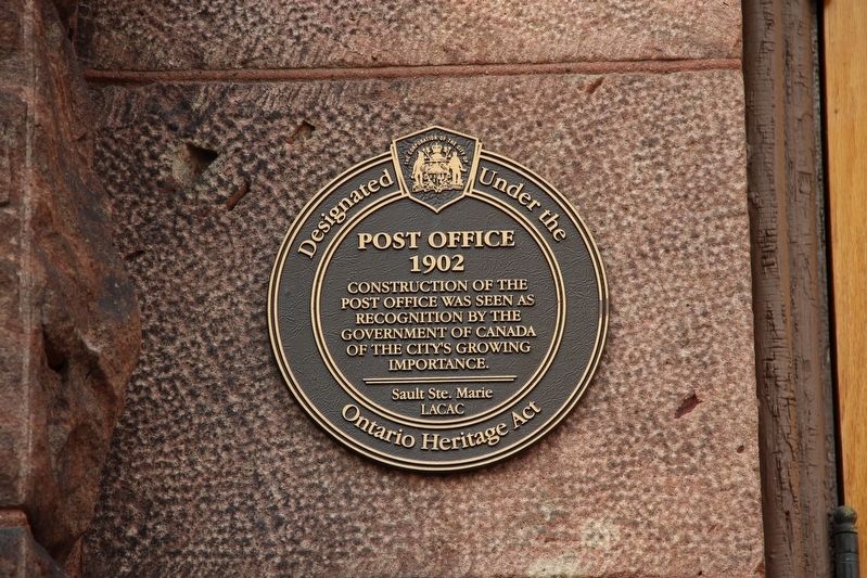
post office was seen as
recognition by the
Government of Canada
of the city's growing
importance.
Sault Ste. Marie
LACAC
Designated under the
Ontario Heritage Act
Erected by Sault Ste. Marie Local Architectural Conservation Advisory Committee.
Topics. This historical marker is listed in these topic lists: Architecture • Communications. A significant historical year for this entry is 1902.
Location. 46° 30.481′ N, 84° 19.681′ W. Marker is in Sault Ste. Marie, Ontario, in Algoma District. It is at the intersection of Queen Street East and East Street, on the right when traveling north on Queen Street East. Touch for map. Marker is at or near this postal address: 690 Queen St E, Sault Ste Marie ON P6A 2A4, Canada. Touch for directions.

Regionally, this marker is in the Sault Ste. Marie and Algoma Area and in Northern Ontario. It is also in Central Canada. Globally, it is in North America, in the Great North Woods, on the Great Lakes, on Lake Superior’s North Shore, in the Western Hemisphere, in the Western World, and in the Anglosphere. Historically, it finds itself
this page online
Other nearby markers. At least 8 other markers are within walking distance of this marker: Precious Blood Cathedral (about 150 meters away, measured in a direct line); City of Sault Ste. Marie 100th Anniversary Flower Garden and Commemorative Plaque (approx. 0.3 kilometers away); Ermatinger Old Stone House (approx. 0.3 kilometers away); Clergue Blockhouse (approx. 0.3 kilometers away); Herbs in the 19th Century (approx. 0.3 kilometers away); Ermatinger House (approx. 0.3 kilometers away); The Three Sisters Garden (approx. 0.4 kilometers away); Blossoms and Berries (approx. 0.4 kilometers away). Touch for a list and map of all markers in Sault Ste. Marie.
Also see . . .
1. Old Post Office (1902-1907) (PDF). Excerpts from contemporary newspaper articles help tell the history of the iconic building. (City of Sault Ste. Marie) (Submitted on May 22, 2022, by Duane and Tracy Marsteller of Murfreesboro, Tennessee.)
2. Old Post Office. Canadian Register of Historic Places entry on the building,
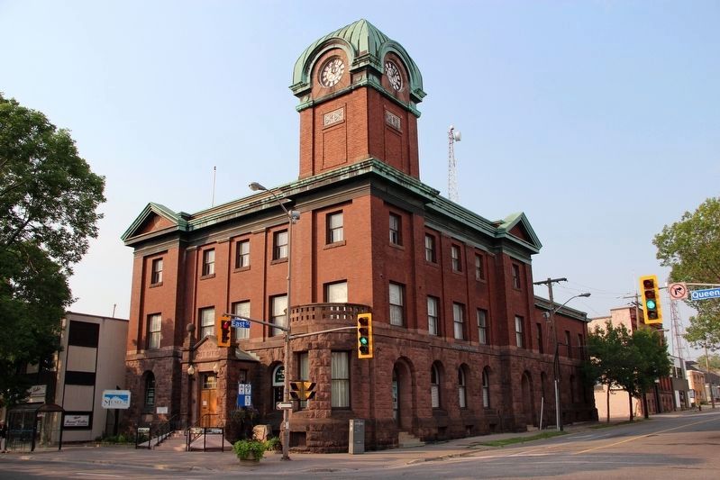
cmh2315fl via Flickr (CC BY-NC 2.0), June 28, 2012
2. Post Office Marker
Marker is left of the entrance.
Credits. This page was last revised on May 22, 2022. It was originally submitted on May 22, 2022, by Duane and Tracy Marsteller of Murfreesboro, Tennessee. This page has been viewed 326 times since then and 23 times this year. Photos: 1, 2. submitted on May 22, 2022, by Duane and Tracy Marsteller of Murfreesboro, Tennessee.
