Kimmswick in Jefferson County, Missouri — The American Midwest (Upper Plains)
Windsor Harbor Road Bridge
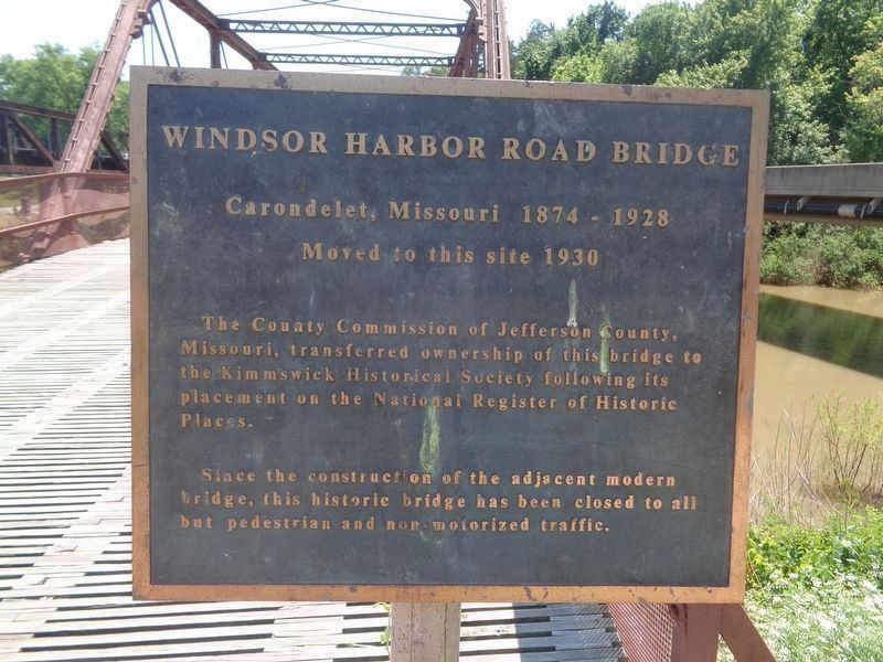
Photographed by Jason Voigt, June 13, 2024
1. Windsor Harbor Road Bridge Marker
National Register of Historic Places Inventory—Nomination Form
Click for more information.
Click for more information.
Moved to this site 1930
The County Commission of Jefferson County, Missouri, transferred ownership of this bridge to the Kimmswick Historical Society following its placement on the National Register of Historic Places.
Since the construction of the adjacent modern bridge, this historic bridge has been closed to all but pedestrian and non-motorized traffic.
Topics. This historical marker is listed in this topic list: Bridges & Viaducts. A significant historical year for this entry is 1930.
Location. 38° 21.853′ N, 90° 21.75′ W. Marker is in Kimmswick, Missouri, in Jefferson County. It can be reached from the intersection of Mississippi Street and Windsor Harbor Road, on the right when traveling east. Marker is at the north end of the bridge. Touch for map. Marker is in this post office area: Imperial MO 63052, United States of America. Touch for directions.

Regionally, this marker is in the Missouri River Corridor and in Greater St. Louis. It is also in the American Midwest, in the Lewis & Clark Corridor, in the Corn Belt, and in the Great River Road Region. Globally, it is in North
this page online
Other nearby markers. At least 8 other markers are within 2 miles of this marker, measured as the crow flies: Kimmswick Historic Flooding (a few steps from this marker); El Camino Real (approx. 0.3 miles away); Bring Us Home (approx. 1.1 miles away); Flame of Freedom (approx. 1.1 miles away); Excavating the Bones (approx. 1½ miles away); Kimmswick Bone Bed (approx. 1½ miles away); Quarry Operations (approx. 1½ miles away); Welcome to Sulphur Springs Landing (approx. 2 miles away). Touch for a list and map of all markers in Kimmswick.
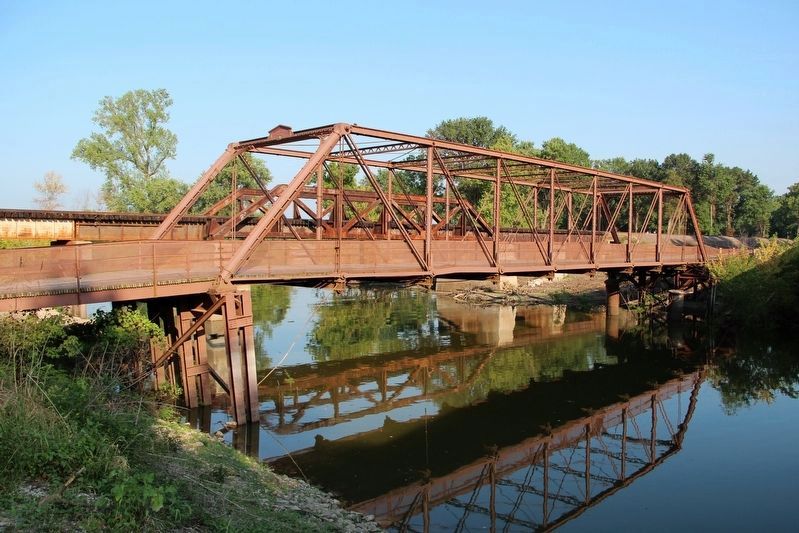
Regarding Windsor Harbor Road Bridge. Excerpt from the bridge's National Register nomination:
When the city of Carondelet with a population of 5,387 was incorporated by the city of St. Louis in 1870, the bustling farm-to-market traffic crossed the River des Peres at the southern boundary of the expanded city limits on a covered toll bridge. Ordinances were passed in the summers of1874 and 1875 to fund the construction of a new wrought iron span. The cost was to be shared equally by the city of St. Louis and St. Louis County. The city appropriated $6,500 from general revenue for its share and the Keystone Bridge Company won the construction contract.…
In 1928, after fifty-three years of service, the bridge was moved to a point just west of its original location while a new concrete and steel viaduct was under construction. Upon completion of the new span — noted by a local poet — the bridge was dismantled and re-erected in 1930 at Kimmswick in Jefferson County. The City of St. Louis donated the bridge; the County Court of Jefferson County paid for dismantling, moving and re-erection except for iron piling and driving which was paid for by the County. …
Also see . . . Windsor Harbor Road Bridge on Wikipedia. (Submitted on June 13, 2024, by Jason Voigt of Glen Carbon, Illinois.)
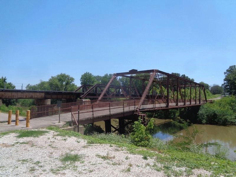
Photographed by Jason Voigt, June 13, 2024
3. Windsor Harbor Road Bridge Marker

Photographed by Jason Voigt, June 13, 2024
4. Windsor Harbor Road Bridge Marker
Credits. This page was last revised on June 13, 2024. It was originally submitted on May 22, 2022, by Duane and Tracy Marsteller of Murfreesboro, Tennessee. This page has been viewed 593 times since then and 35 times this year. Photos: 1. submitted on June 13, 2024, by Jason Voigt of Glen Carbon, Illinois. 2. submitted on May 22, 2022, by Duane and Tracy Marsteller of Murfreesboro, Tennessee. 3, 4. submitted on June 13, 2024, by Jason Voigt of Glen Carbon, Illinois.
