Craigellachie in Columbia-Shuswap, British Columbia — Canada’s West Coast (North America)
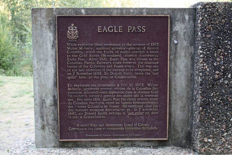
Eagle Pass
[Francais] En explorant ces montagnes à l'été de 1865, Walter Moberly, arpenteur général adjoint de la Colombie-Britannique, découvrit cette dépression dans le chaînon Gold (Monashees), lorsqu'il aperçut des aigles qui la traversaient. Peu après 1881, Eagle Pass fut choisi comme route du Canadien Pacifique, entre les bassins hydrographiques des fleuves Columbia et Fraser. On terminait ainsi l'un des derniers tronçons ferroviaires et, le 7 novembre 1885, sir Donald Smith enfonça le “last spike” ici, dans le col, à Craigellachie.
Erected by Historic Sites and Monuments Board of Canada/Commission des lieux et monuments historiques du Canada.
Topics and series. This historical marker is listed in these topic lists: Natural Features • Railroads & Streetcars. In addition, it is included in the Canada, Historic Sites and Monuments Board series list. A significant historical date for this entry is November 7, 1885.
Location. 50° 58.527′ N, 118° 43.427′ W. Marker is in Craigellachie, British Columbia, in Columbia-Shuswap. Marker can be reached from Trans-Canada Highway (Provincial Highway 1) 0.8 kilometers north of Lybarger Road, on the right when traveling north. Marker is in The Last Spike historic site. Touch for map. Marker is in this post office area: Craigellachie BC V0E 2J0, Canada. Touch for directions.
Other nearby markers. At least 1 other marker is within walking distance of this marker. The Last Spike (a few steps from this marker).
Credits. This page was last revised on May 25, 2022. It was originally submitted on May 25, 2022, by Duane and Tracy Marsteller of Murfreesboro, Tennessee. This page has been viewed 94 times since then and 12 times this year. Photos: 1, 2. submitted on May 25, 2022, by Duane and Tracy Marsteller of Murfreesboro, Tennessee.

