
Central Vancouver in Metro Vancouver, British Columbia — Canada’s West Coast (North America)
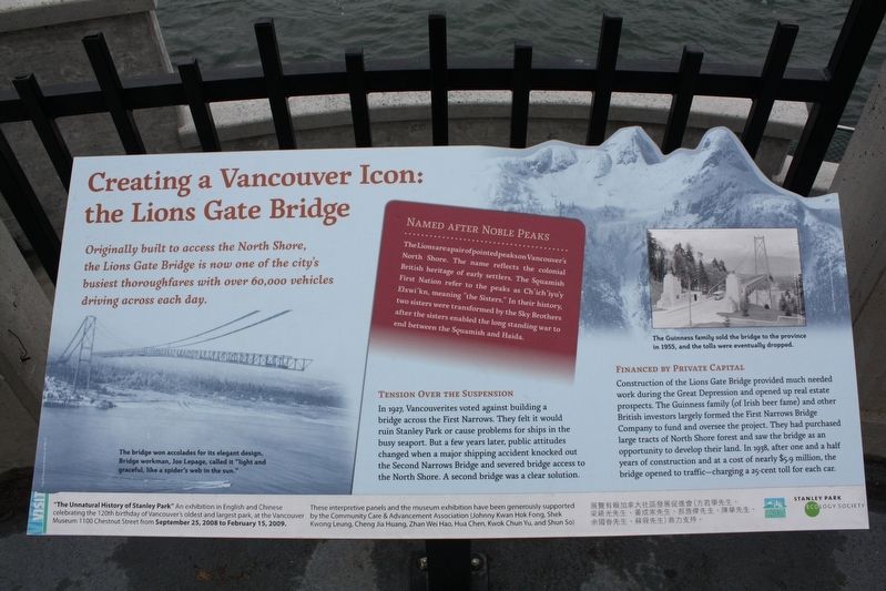
Creating a Vancouver Icon: the Lions Gate Bridge
cmh2315fl via Flickr (CC BY-NC 2.0), August 8, 2010
1. Creating a Vancouver Icon: the Lions Gate Bridge Marker
Originally built to access the North Shore, the Lions Gate Bridge is now one of the city's busiest thoroughfares with over 60,000 vehicles driving across each day.
Tension over the Suspension
In 1927, Vancouverites voted against building a bridge across the First Narrows. They felt it would ruin Stanley Park or cause problems for ships in the busy seaport. But a few years later, public attitudes changed when a major shipping accident knocked out the Second Narrows Bridge and severed bridge access to the North Shore. A second bridge was a clear solution.
Financed by Private Capital
Construction of the Lions Gate Bridge provided much needed work during the Great Depression and opened up real estate prospects. The Guinness family (of Irish beer fame) and other British investors largely formed the First Narrows Bridge Company to fund and oversee the project. They had purchased large tracts of North Shore forest and saw the bridge as an opportunity to develop their land. In 1938, after one and a half years of construction and at a cost of nearly $5.9 million, the bridge opened to traffic - charging a 25-cent toll for each
this page online
[Sidebar]
Named After Noble Peaks
The Lions are a pair of pointed peaks on Vancouver's North Shore. The name reflects the colonial British heritage of early settlers. The Squamish First Nation refer to the peaks as Ch'ich'iyu'y Elxwi'kn, meaning “the Sisters.” In their history, two sisters were transformed by the Sky Brothers after the sisters enabled the long standing war to end between the Squamish and Haida.
Captions
(Left) The bridge won accolades for its elegant design. Bridge workman, Joe Lepage, called it “light and graceful, like a spider's web in the sun.”
(Right) The Guinness family sold the bridge to the province in 1955, and the tolls were eventually dropped.
Erected by Vancouver Parks and Recreation • Stanley Park Ecology Society.
Topics. This historical marker is listed in these topic lists: Bridges & Viaducts • Indigenous Peoples and Communities • Industry & Commerce. A significant historical year for this entry is 1938.
Location. Marker has been reported missing. It was located near 49° 18.052′ N, 123° 7.027′ W. Marker was in Vancouver, British Columbia, in Metro Vancouver. It was in Central
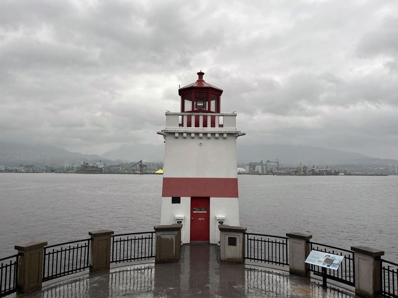
Photographed by Adam Margolis, October 9, 2023
2. Creating a Vancouver Icon: the Lions Gate Bridge Marker (Missing)
The marker should be located on the left, but it was missing as of 9 October 2023.

Regionally, this marker was on British Columbia’s Lower Mainland and in Coast & Mountains. Globally, it was in North America, in the Cascade Range, in the Inside Passage, on the Ring of Fire, in the Pacific Rim, in the Western Hemisphere, in the Western World, and in the Anglosphere. Historically, it found itself in what was once a British colony.
Other nearby markers. At least 8 other markers are within walking distance of this location: Beacon of Maritime Safety (here, next to this marker); Chehalis Cross (about 210 meters away, measured in a direct line); Nine O'Clock Gun (approx. 0.3 kilometers away); Harry Winston Jerome (approx. 0.3 kilometers away); Beaver Crest Pole (approx. 0.3 kilometers away); Oscar Maltipi Pole (approx. 0.3 kilometers away); Hallelujah Point (approx. 0.3 kilometers away); Sky Chief Pole (approx. 0.3 kilometers away). Touch for a list and map
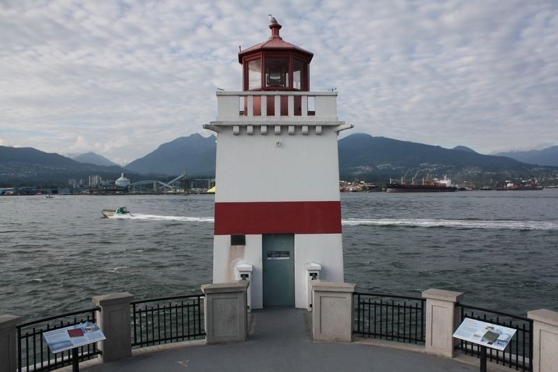
cmh2315fl via Flickr (CC BY-NC 2.0), August 10, 2010
3. Creating a Vancouver Icon: the Lions Gate Bridge Marker
Featured marker is on the left.
Also see . . . Lions Gate Bridge. Places That Matter website entry:
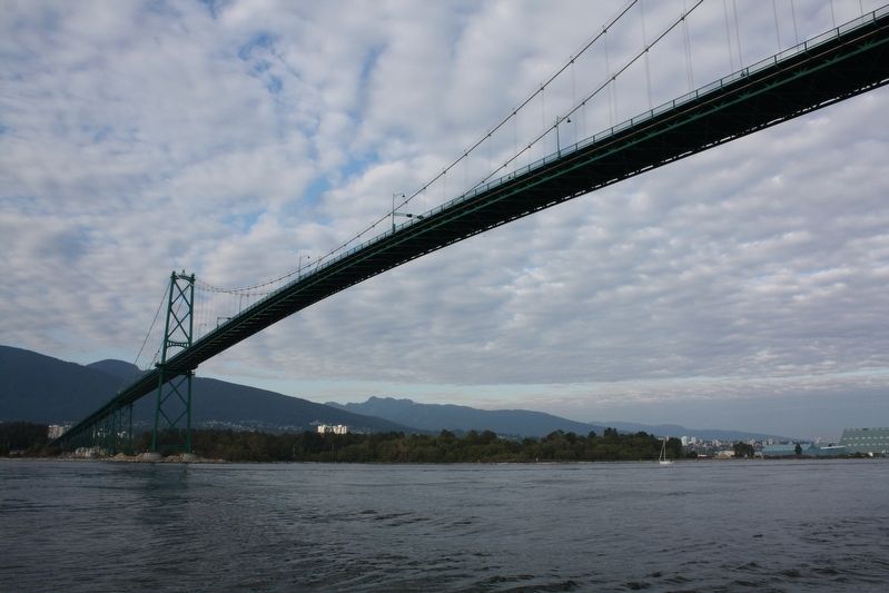
The most beautiful bridge north of San Francisco’s Golden Gate, Lions Gate Bridge brought Vancouver into the automobile age and heralded the era of auto-dependent suburbs when it opened in 1938. (Vancouver Heritage Foundation) (Submitted on May 25, 2022, by Duane and Tracy Marsteller of Murfreesboro, Tennessee.)
Credits. This page was last revised on December 30, 2023. It was originally submitted on May 25, 2022, by Duane and Tracy Marsteller of Murfreesboro, Tennessee. This page has been viewed 278 times since then and 20 times this year. Photos: 1. submitted on May 25, 2022, by Duane and Tracy Marsteller of Murfreesboro, Tennessee. 2. submitted on November 12, 2023, by Adam Margolis of Mission Viejo, California. 3. submitted on May 26, 2022, by Duane and Tracy Marsteller of Murfreesboro, Tennessee. 4. submitted on May 25, 2022, by Duane and Tracy Marsteller of Murfreesboro, Tennessee.
