Central Vancouver in Metro Vancouver, British Columbia — Canada’s West Coast (North America)
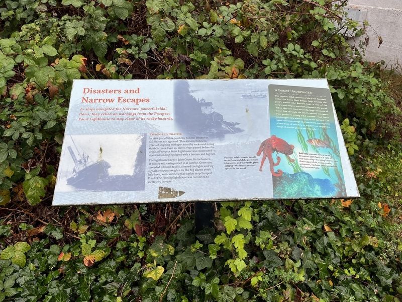
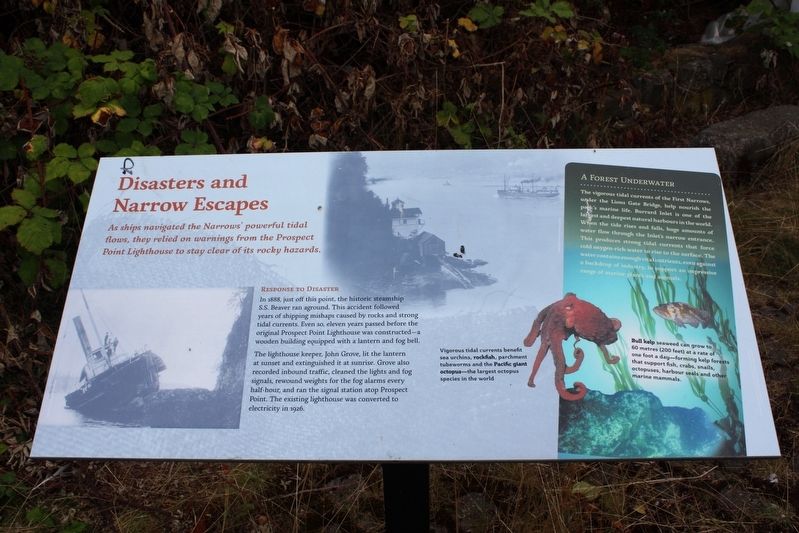
Disasters and Narrow Escapes
As ships navigated the Narrows' powerful tidal flows, they relied on warnings from the Prospect Point Lighthouse to stay clear of its rocky hazards.
Response to Disaster
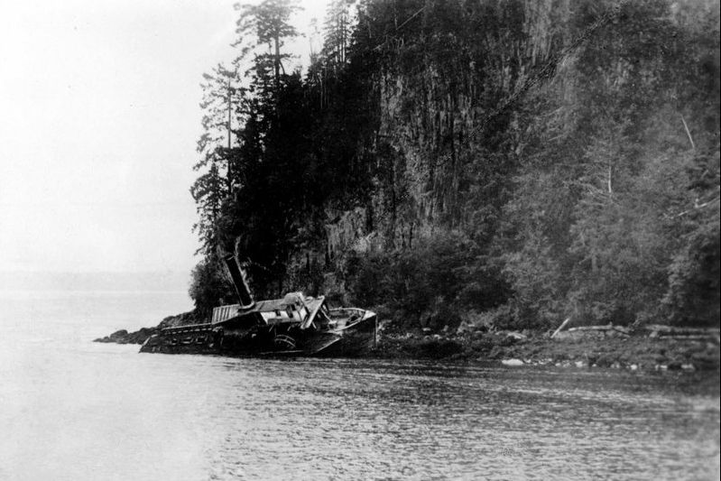
In 1888, just off this point, the historic steamship S.S. Beaver ran aground. This accident followed years of shipping mishaps caused by rocks and strong tidal currents. Even so, eleven years passed before the original Prospect Point Lighthouse was constructed – a wooden building equipped with a lantern and fog bell.
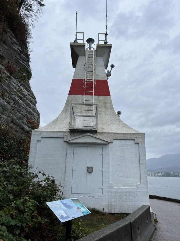
The lighthouse keeper, John Grove, lit the lantern at sunset and extinguished it at sunrise. Grove also recorded inbound traffic, cleaned the lights and fog signals, rewound weights for the fog alarms every half-hour, and ran the signal station atop Prospect Point. The existing lighthouse was converted to electricity in 1926.
A Forest Underwater
The vigorous tidal currents of the First Narrows, under the Lions Gate Bridge, help nourish the park's marine life. Burrard Inlet is one of the largest and deepest natural harbours in the world. When the tide rises and falls, huge amounts of water flow through the Inlet's narrow entrance. This produces strong tidal currents that force cold oxygen-rich water to rise to the surface. The water contains enough vital nutrients, even against a backdrop of industry, to support an impressive range of marine plants and animals.
Captions
• Vigorous tidal currents benefit sea urchins, rockfish, parchment tubeworms and the Pacific giant octopus – the largest octopus species in the world.
• Bull kelp seaweed can grow to 60 metres (200 feet) at a rate of one foot a day – forming kelp forests that support fish, crabs, snails, octopuses, harbour seals and other marine mammals.
Topics and series. This historical marker is listed in these topic lists: Communications • Disasters • Waterways & Vessels. In addition, it is included in the Lighthouses series list. A significant historical year for this entry is 1888.
Location. 49° 18.841′ N, 123° 8.479′ W. Marker is in Vancouver, British Columbia, in Metro Vancouver. It is in Central Vancouver. Marker can be reached from Stanley Park Drive, on the right when traveling west. The marker is on the Stanley Park Seawall Path, next to Prospect Point Lighthouse. Touch for map. Marker is in this post office area: Vancouver BC V6G 3E2, Canada. Touch for directions.
Other nearby markers. At least 8 other markers are within 2 kilometers of this marker, measured as the crow flies. Beaver (within shouting distance of this marker); Welcome to Lowden's Lookout (about 90 meters away, measured in a direct line); Windstorm of December 2006 (about 150 meters away); The Lions' Gate Bridge / Le pont Lions' Gate
Also see . . . Steam that built Vancouver: The tale of the S.S. Beaver. Vancouver is Awesome website entry:
Vancouver's most famous shipwreck (Submitted on August 30, 2022, by Larry Gertner of New York, New York.)
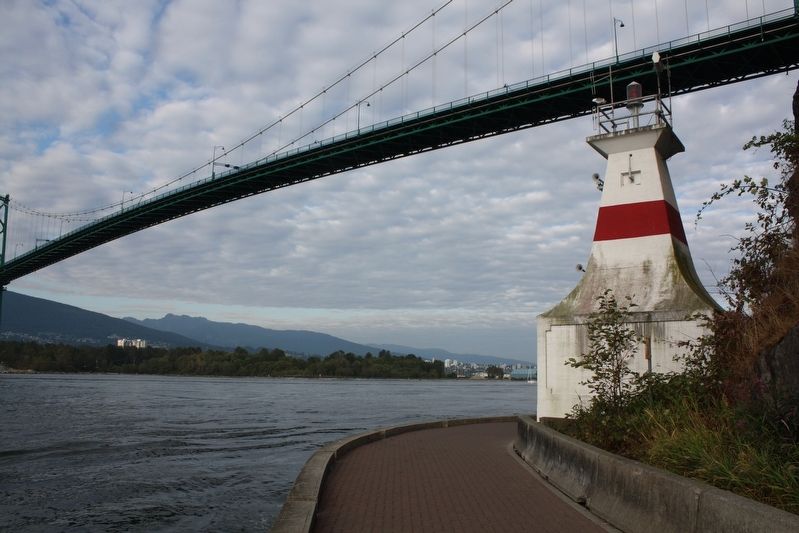
cmh2315fl via Flickr (CC BY-NC 2.0), August 10, 2010
4. Prospect Point Lighthouse and Lions Gate Bridge
Credits. This page was last revised on December 30, 2023. It was originally submitted on May 26, 2022, by Duane and Tracy Marsteller of Murfreesboro, Tennessee. This page has been viewed 75 times since then and 5 times this year. Photos: 1. submitted on November 12, 2023, by Adam Margolis of Mission Viejo, California. 2. submitted on May 26, 2022, by Duane and Tracy Marsteller of Murfreesboro, Tennessee. 3. submitted on November 12, 2023, by Adam Margolis of Mission Viejo, California. 4. submitted on May 26, 2022, by Duane and Tracy Marsteller of Murfreesboro, Tennessee. 5. submitted on August 30, 2022, by Larry Gertner of New York, New York.
