Mackinaw City in Cheboygan County, Michigan — The American Midwest (Great Lakes)
Island-Hopping the Straits
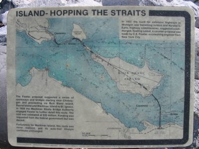
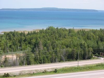
The Fowler proposal suggested a series of causeways and bridges starting near Cheboygen and proceeding via Bois Blanc Island, Round Island and Mackinac Island to St. Ignace. In 1934 the Mackinac Straits Bridge Authority engaged Fowler to further detail this route. The cost was estimated at $35 million. Funding was requested from the federal government but was denied.
Fortunately for Mackinac Island, this route was never realized, and its auto-free lifestyle continues unchanged.
Topics. This historical marker is listed in these topic lists: Bridges & Viaducts • Landmarks. A significant historical year for this entry is 1920.
Location. 45° 47.022′ N, 84° 43.364′ W. Marker is in Mackinaw City, Michigan, in Cheboygan County. Marker can be reached from North Huron Avenue, on the right when traveling north. Near East Jamet Street and the Lake Huron shore, east of Mackinac Bridge (Interstate 75). Touch for map. Marker is in this post office area: Mackinaw City MI 49701, United States of America. Touch for directions.
Other nearby markers. At least 8 other markers are within walking distance of this marker. Our weather (within shouting distance of this marker); A Bridge for Mackinac (within shouting distance of this marker); John L. (Jack) Staffan • Chief Wawatam (within shouting distance of this marker); Lake Level Research on the Great Lakes (within shouting distance of this marker); Mackinaw Boat - Mackinaw Coat (within shouting distance of this marker); Historic Timeline (within shouting distance of this marker); Chief Wawatam (within shouting distance of this marker); a different marker also named Chief Wawatam (within shouting distance of this marker). Touch for a list and map of all markers in Mackinaw City.
Regarding Island-Hopping the Straits. Mackinaw City is the only entity spelled with “aw.” Mackinac Island, Mackinac County, the Straits of Mackinac and the Mackinac Bridge are all spelled with the French “ac,” but are pronounced “aw.”
Also see . . . Straights of Mackinac. History of the present bridge, on the Michigan Department of Transportation website. (Submitted on June 28, 2007.)
Additional keywords. Straits
of Mackinac
Mackinac Bridge
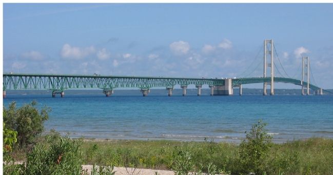
Photographed By Keith L, August 9, 2006
7. Mackinac Bridge Crossing the Straights of Mackinac
This bridge that avoided Mackinac Island carries Interstate 75 connecting the southern and northern peninsulas that form the State of Michigan. The Straights of Mackinac connect Lake Michigan to the west from Lake Huron to the east.
Credits. This page was last revised on June 16, 2016. It was originally submitted on June 28, 2007, by Keith L of Wisconsin Rapids, Wisconsin. This page has been viewed 2,331 times since then and 9 times this year. Last updated on August 5, 2007, by Keith L of Wisconsin Rapids, Wisconsin. Photos: 1. submitted on June 28, 2007, by Keith L of Wisconsin Rapids, Wisconsin. 2, 3, 4, 5, 6. submitted on August 5, 2007, by Keith L of Wisconsin Rapids, Wisconsin. 7. submitted on June 28, 2007, by Keith L of Wisconsin Rapids, Wisconsin. • J. J. Prats was the editor who published this page.
