Fryeburg in Oxford County, Maine — The American Northeast (New England)
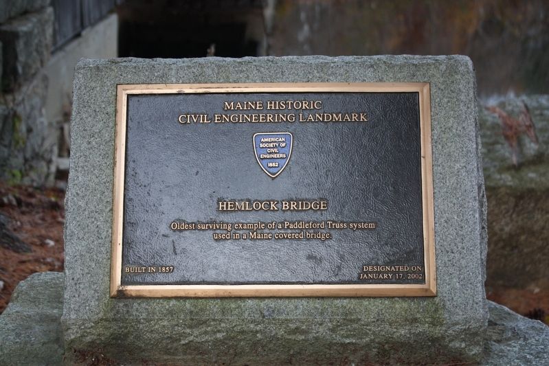
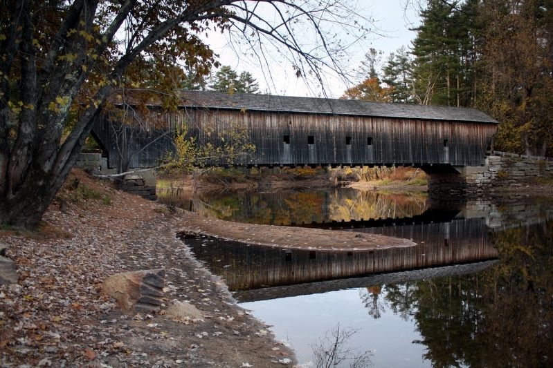
Hemlock Bridge
Maine Historic Civil Engineering Landmark
used in a Maine covered bridge.
Built in 1857 — Designated on January 17, 2002
Erected by American Society of Civil Engineers.
Topics and series. This historical marker is listed in this topic list: Bridges & Viaducts. In addition, it is included in the Covered Bridges series list. A significant historical year for this entry is 1857.
Location. 44° 4.753′ N, 70° 54.214′ W. Marker is in Fryeburg, Maine, in Oxford County. Marker is on Hemlock Bridge Road, 1.1 miles south of Frog Alley, on the right when traveling east. Location and GPS coordinates are approximate. Touch for map. Marker is in this post office area: Fryeburg ME 04037, United States of America. Touch for directions.
Other nearby markers. At least 4 other markers are within 14 miles of this marker, measured as the crow flies. John Stevens (approx. 5.8 miles away); Bridgton's Sons Civil War Memorial (approx. 9.6 miles away); Webb House, circa 1830 (approx. 9.8 miles away); Brickett Place (approx. 13.9 miles away).
Regarding Hemlock Bridge. Excerpt from the bridge's National Register of Historic Places nomination:
Seven wooden covered bridges once enabled the traveler in Fryeburg, Maine to cross the Saco River. Today only one, the Old Hemlock Bridge remains. It has been repaired and preserved by the state, but it would never have been constructed in the first place, if Benjamin Wiley and fellow lumbermen and formers of North Fryeburg had not changed the course of the Saco River 150 years ago.
… Spring floods not only inundated fields but also washed away and scattered logs that lumbermen had piled on the river banks. Tired of being plagued by a river that didn't go where it should go, Wiley and his neighbors petitioned the Massachusetts Legislature in 1815 and secured a charter giving them permission to dig a canal that would alter the river's course.
In 1816 they made their first cut and diverted the river into a series of small ponds. From these it rejoined the south flow of the original loop. The canal was narrow when first dug, but freshets soon widened the channel. Before the canal was dug there were five covered bridges in Fryeburg. After the canal was dug two more bridges were built, and one of these was the Old Hemlock Bridge.
Also see . . . Hemlock Bridge (PDF). National Register of Historic Places nomination for the bridge, which was listed in 1970. (National Archives) (Submitted on May 27, 2022, by Duane and Tracy Marsteller of Murfreesboro, Tennessee.)
Credits. This page was last revised on May 27, 2022. It was originally submitted on May 27, 2022, by Duane and Tracy Marsteller of Murfreesboro, Tennessee. This page has been viewed 124 times since then and 16 times this year. Photos: 1, 2. submitted on May 27, 2022, by Duane and Tracy Marsteller of Murfreesboro, Tennessee.
Editor’s want-list for this marker. Wide shot of marker and surrounding area in context. • Confirm GPS coordinates • Can you help?

