Near Modoc in McCormick County, South Carolina — The American South (South Atlantic)
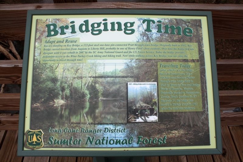
Bridging Time
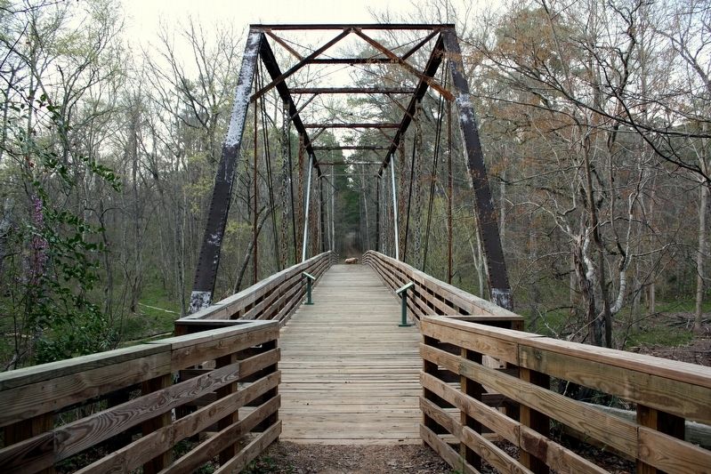
You are standing on Key Bridge, a 122-foot steel one-lane pin-connected Pratt through-truss bridge. Originally built in 1912, Key Bridge carried travelers from Augusta to Liberty Hill, probably in one of Henry Ford's first creations. Over time the bridge fell into disrepair until it was rebuilt in 2007 by the SC Army National Guard and the US Forest Service. Today the bridge provides pedestrian access to the Wine-Turkey Creek biking and hiking trail. Now while walking across Key Bridge, you can enjoy the opportunity to travel through time!
Traveling Today
Today vehicles use the bridge that is in front of you. It is a 150-foot steel two-lane Parker through-truss bridge built in 1925 by Roanoke Iron and Bridge Works of Roanoke, Virginia. Originally located in Georgetown County, South Carolina on US Highway 17, the bridge was moved to Turkey Creek in 1961 when the road was realigned.
Caption (inset photo) 2005 - Hiking bridge under re-construction
Erected by U.S. Forest Service.
Topics. This historical marker is listed in this topic list: Bridges & Viaducts. A significant historical year for this entry is 1912.
Location. 33° 47.675′ N, 82° 8.72′ W. Marker is near Modoc, South Carolina, in McCormick County. Marker can be reached from Key Road, 1˝ miles north of Turkey Road, on the left when traveling north. Marker is on the bridge. The bridge is on the Wine-Turkey Creek trail, north of the southern trailhead, in Sumter National Forest. Touch for map. Marker is in this post office area: Modoc SC 29838, United States of America. Touch for directions.
Other nearby markers. At least 8 other markers are within 12 miles of this marker, measured as the crow flies. A different marker also named Bridging Time (a few steps from this marker); Bethany Church (approx. 9.3 miles away); J. Strom Thurmond Dam (approx. 9˝ miles away); Thurmond Dam and Lake / McCormick County (approx. 9˝ miles away); Purpose of the Dam (approx. 9.8 miles away); McCormick Train Station (approx. 11.7 miles away); McCormick County Confederate Monument (approx. 11.7 miles away); McCormick County Veterans Monument (approx. 11.7 miles away).

cmh2315fl via Flickr (CC BY-NC 2.0), March 23, 2009
2. Bridging Time Marker
Featured marker is on the right.
Credits. This page was last revised on May 28, 2022. It was originally submitted on May 28, 2022, by Duane and Tracy Marsteller of Murfreesboro, Tennessee. This page has been viewed 174 times since then and 12 times this year. Photos: 1, 2. submitted on May 28, 2022, by Duane and Tracy Marsteller of Murfreesboro, Tennessee.
