Trap Pond State Park near Whaleys Crossroads in Sussex County, Delaware — The American Northeast (Mid-Atlantic)
Hidden Forests
Much of the Great Cypress Swamp was destroyed by fire, mostly for the sake of shingles.
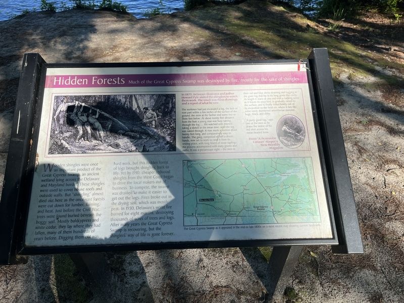
In 1879, Delaware illustrator an other Howard Pyle visited the shingles to watch them at work. The result was these drawings and a report of what he saw.
The workmen had just excavated a log, the butt or root part within a few inches of the surface of the ground, the stem at the farther end some two or three feet below. At about twenty feet distance from the butt a young man was busy sawing through the log.... We watched with interest, taking a sketch in the mean time, until the log was sawed through. It was now made a section about twenty feet long, and comparatively easy to handle. The gang, composed of half a dozen hands, now set to work to raise it from its resting-place, with long levers of stout saplings, the process accompanied with many grunts and oaths. It was a picturesque sight — the men in their red and blue shirts straining and tugging at the giant log that lay in its long grave-like cavity. At length it starts at one end with a sucking noise as it leaves its oozy bed, is gradually raised to the surface, and is finally rolled bodily out of its excavation to the fresh air, where it lies like some newlydisinterred antediluvian monster, huge, black, and slimy.
Click or scan to see
this page online
"A purty good log," says one of the men as he draws the sleeve of his red shirt across his sweat-beaded brow.
From "A Peninsular Canaan" Harper's New Monthly Magazine
Wooden shingles were once an important product of the Great Cypress Swamp, an ancient wetland lying across the Delaware and Maryland border. These shingles were used to cover house roofs and outside walls. But "shingling" almost died out here as the once-vast forests were cut down for lumber, farming, and heat. Just before the Civil War, trees were found buried beneath the boggy soil. Mostly baldcypress and white cedar, they lay where they had fallen, many of them hundreds of years before. Digging them out was hard work, but this hidden forest of logs brought shingling back to life. Yet by 1910, cheaper redwood shingles from the West Coast began to drive the local makers out of business. To compete, the swamp was drained to make it easier to get out the logs. Fires broke out in the drying soil, which was mostly peat. In 1930, Delaware's worst fire burned for eight months, destroying thousands of acres of

Erected by Delaware State Parks.
Topics and series. This historical marker is listed in these topic lists: Horticulture & Forestry • Industry & Commerce • Natural Resources. In addition, it is included in the Delaware State Parks series list. A significant historical year for this entry is 1879.
Location. 38° 31.514′ N, 75° 28.397′ W. Marker is near Whaleys Crossroads, Delaware, in Sussex County. It is in Trap Pond State Park. It can be reached from Island Trail 0.8 miles south of County Road 450, on the right when traveling east. Touch for map. Marker is in this post office area: Laurel DE 19956, United States of America. Touch for directions.

Regionally, this marker is in the American Mid-Atlantic, on the Delmarva Peninsula, and on the Eastern Seaboard. Globally, it is in the North Atlantic Region, North America, the Western Hemisphere, the Western World, and the Anglosphere. Historically, it finds itself in what was once New Netherland, one of the original Thirteen Colonies, and the Antebellum South.
Other nearby markers. At least 8 other markers are within 3 miles of this marker, measured as the crow flies: Jason Beach (about 500 feet away, measured in a direct line); Senator Robert "Bob" Venables (approx. 0.3 miles away); Welcome to Trap Pond State Park (approx. 0.4 miles away); Historic Mills of the Trap Pond Area (approx. half a mile away); The Old Country Church (approx. 1.2 miles away); The Bethesda Church Lives On (approx. 1.2 miles away); Ted Harvey: Innovator for Preservation (approx. 2 miles away); Trinity Methodist Church (approx. 2.2 miles away).
Credits. This page was last revised on September 18, 2023. It was originally submitted on May 29, 2022, by Devry Becker Jones of Washington, District of Columbia. This page has been viewed 295 times since then and 36 times this year. Photos: 1, 2. submitted on May 29, 2022, by Devry Becker Jones of Washington, District of Columbia.
