Near Sioux Falls in Minnehaha County, South Dakota — The American Midwest (Upper Plains)
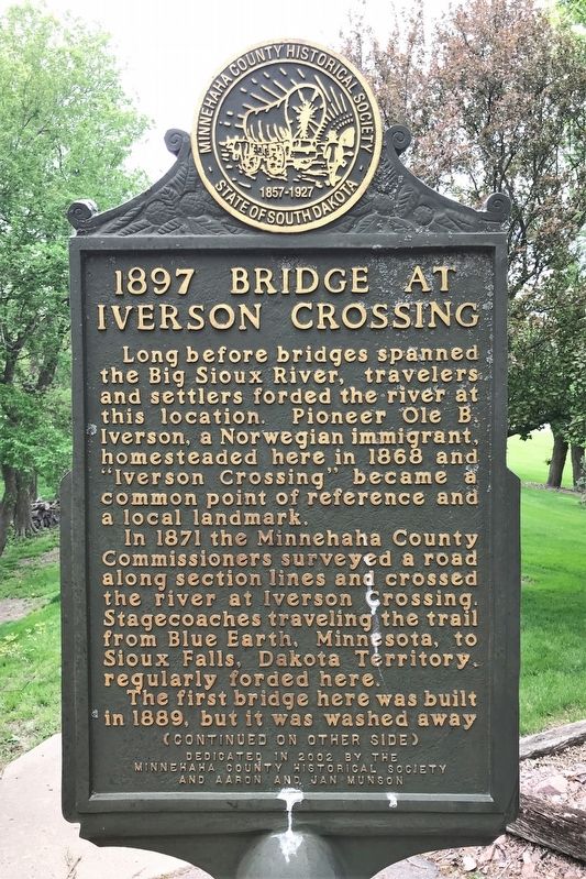
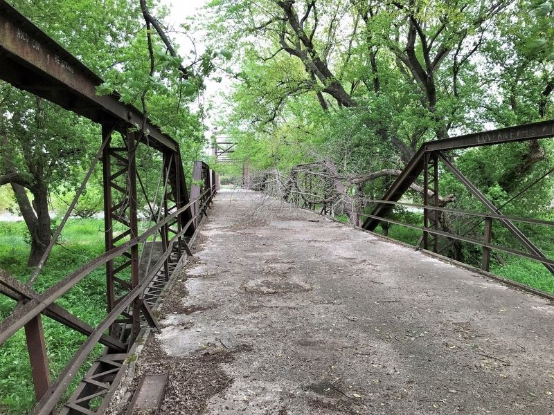
1897 Bridge at Iverson Crossing
In 1871 the Minnehaha County Commissioners surveyed a road along section lines and crossed the river at Iverson Crossing. Stagecoaches traveling the trail from Blue Earth, Minnesota, to Sioux Falls, Dakota Territory, regularly forded here.
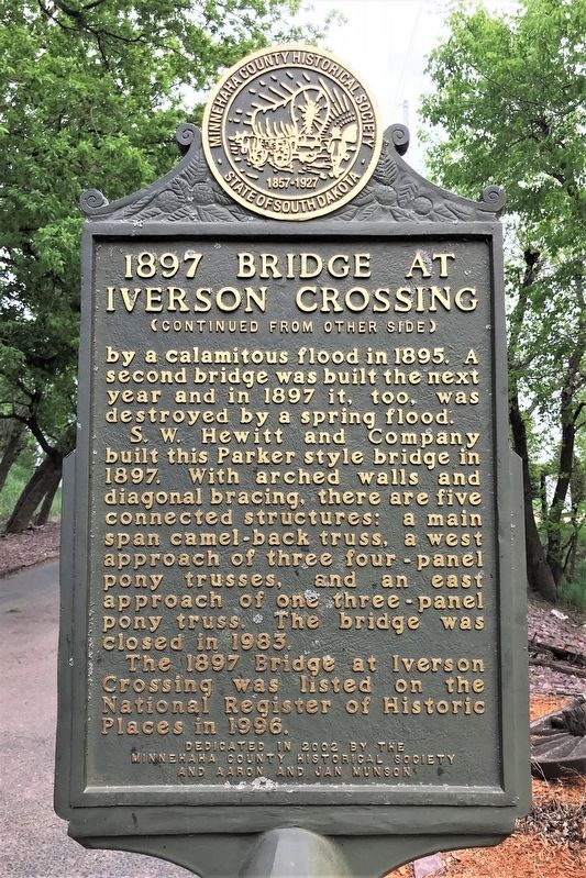
The first bridge here was built in 1889, but it was washed away by a calamitous flood in 1895. A second bridge was built the next year and in 1897 it, too, was destroyed by a spring flood.
S. W. Hewitt and Company built this Parker style bridge in 1897. With arched walls and diagonal bracing, there are five connected structures: a main span camel-back truss, a west approach of three four-panel pony trusses, and an east approach of one three-panel pony truss. The bridge was closed in 1983.
The 1897 Bridge at Iverson Crossing was listed on the National Register of Historic Places in 1996.
Erected 2002 by the Minnehaha County Historical Society and Aaron and Jan Munson.
Topics. This historical marker is listed in these topic lists: Architecture • Bridges & Viaducts • Settlements & Settlers • Waterways & Vessels. A significant historical year for this entry is 1868.
Location. 43° 31.76′ N, 96° 35.964′ W. Marker is near Sioux Falls, South Dakota, in Minnehaha County. Marker is on Iverson Crossing Road, 0.4 miles west of 481st Avenue (State Highway 11), on the left when traveling west. Touch for map. Marker is at or near this postal address: 48054 Iverson Crossing Rd, Brandon SD 57005, United States of America. Touch for directions.
Other nearby markers. At least 8 other markers are within walking distance of this marker. evolve (approx. 0.4 miles away); cultivate (approx. 0.4 miles away); foliate (approx. 0.4 miles away); germinate (approx. 0.4 miles away); Stonecutter John Elm (approx. 0.4 miles away); vegetate (approx. 0.4 miles away); Sprout (approx. 0.4 miles away); Disperse (approx. 0.4 miles away). Touch for a list and map of all markers in Sioux Falls.
Credits. This page was last revised on May 30, 2022. It was originally submitted on May 30, 2022. This page has been viewed 730 times since then and 58 times this year. Photos: 1, 2, 3, 4, 5. submitted on May 30, 2022.
