Scranton in Lackawanna County, Pennsylvania — The American Northeast (Mid-Atlantic)
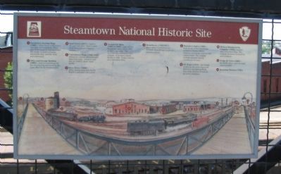
Steamtown National Historic Site
Inscription.
(1) Locomotive Erecting Shop (1909) - where heavy maintenance was done on locomotives. More than 70 locomotives were built here. The facility included a foundry, blacksmith shop, machine shop, and a laboratory.
(2) Office and Storage Building (1909) - used as a warehouse for the erecting ship and served as the main office for the Scranton yard.
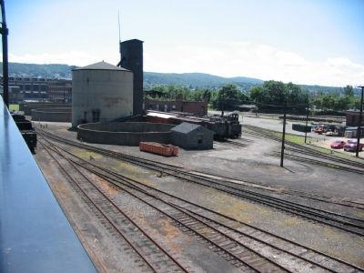
(3) Sand Tower (1917) - used to dry and store sand. Sand is used on all locomotives to improve traction.
(4) Containment Rings (1944-1950) - reinforced concrete place around diesel fuel tanks. Scranton yard was the DL&W's diesel repair facility.
(5) Store House (1900) - where mining equipment for the DL&W's coal mines was stored.
(6) Locomotive Shop (1865 to 1949) - part of first locomotive shop built in 1865 is still in use today. The structure has undergone many changes. It became a diesel facility in 1949. Today it serves as a restoration shop.
(7) Roundhouse (1902/1937) - where steam locomotives are serviced. Roundhouse is open to museum visitors.
(8) Museum Complex (1995) - built on site of the roundhouse includes a theater, history museum, technology museum and visitor center. The complex includes restored historic roundhouse sections.
(9) Oil House (1912) - the storage facility for the yard's fammable lubricants and lighting fluids. Part of the oil house is used as the park's bookstore.
(10) Dickson Manufacturing Company (1876) - machine shop and pattern shop. The company produced locomotives and machinery.
(11) Bridge 60 Tower (1953) - the facility where yard switching was controlled.
(12) Excursion Platform (1995)
Erected by Steamtown Nataionl Historic Site - National Park Service.
Topics. This historical marker is listed in this topic list: Railroads & Streetcars. A significant historical year for this entry is 1865.
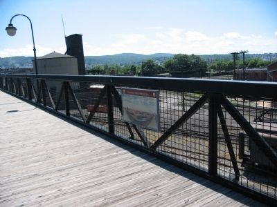
Location. 41° 24.439′ N, 75° 40.175′ W. Marker is in Scranton, Pennsylvania, in Lackawanna County. Marker can be reached from Lacawanna Avenue, on the right when traveling east. Located on an foot bridge connecting Steamtown National Historic Site with "the Mall at Steamtown.". Touch for map. Marker is in this post office area: Scranton PA 18503, United States of America. Touch for directions.
Other nearby markers. At least 8 other markers are within walking distance of this marker. Norwood & St. Lawrence #210 (about 300 feet away, measured in a direct line); 1902 Roundhouse Section (about 300 feet away); E.J. Lavino & Company #3 (about 400 feet away); Long Island Railroad #193 Rotary Snow Plow (about 400 feet away); DL&W Coal Hoppers (about 400 feet away); Claremont & Concord Snow Plow #60 (about 400 feet away); New Haven Trap Rock Company #43 (about 400 feet away); Turntable (about 400 feet away). Touch for a list and map of all markers in Scranton.
Also see . . . Steamtown National Historic Site. National Park Service site. (Submitted on June 13, 2009, by Craig Swain of Leesburg, Virginia.)
Photographed By Craig Swain, July 25, 2008
3. Locomotive Erecting Shop
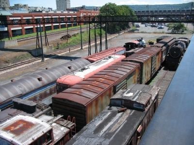
Looking at the extension of the foot bridge connecting to the mall. Below in the foreground are portions of the park's collection of cars and locomotives. The site of the Locomotive Erecting Shop is in the distant right, beyond the footbridge. The building, or at least a building on that site, is still in use today for non-railway related work.
Photographed By Craig Swain, July 25, 2008
4. Storage Buildings, Sand Tower and Containment Rings
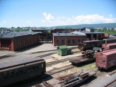
Looking east from the foot bridge. The sand tower and containment rings are in the center of view. Behind it is part of the office and storage facility. The storage building to the right of the sand tower is no longer used.
Photographed By Craig Swain, July 25, 2008
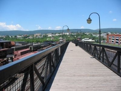
6. Looking West on the Bridge
The oil house stands to the far left, just beyond the roundhouse. Dickson Manufacturing buildings are somewhat obscured by the trees just left of distant center. Looking directly down the footbridge, just to the right is the Bridge 60 Tower and the Excursion Platform.
Credits. This page was last revised on June 16, 2016. It was originally submitted on June 13, 2009, by Craig Swain of Leesburg, Virginia. This page has been viewed 1,345 times since then and 59 times this year. Photos: 1, 2, 3, 4, 5, 6. submitted on June 13, 2009, by Craig Swain of Leesburg, Virginia.
