Ashland in Hanover County, Virginia — The American South (Mid-Atlantic)
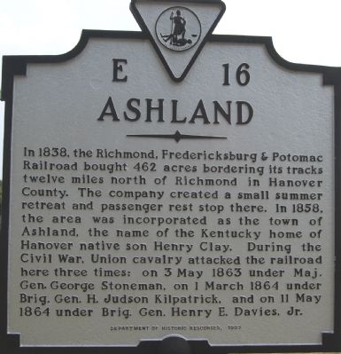
Ashland
Photographed by Dawn Bowen, August 4, 2007
1. Ashland Marker
Erected 1997 by Department of Historic Resources. (Marker Number E-16.)
Topics and series. This historical marker is listed in these topic lists: Railroads & Streetcars • Settlements & Settlers. In addition, it is included in the Virginia Department of Historic Resources (DHR) series list. A significant historical date for this entry is March 1, 1864.
Location. 37° 45.64′ N, 77° 28.285′ W. Marker is in Ashland, Virginia, in Hanover County. It is on Washington Highway (U.S. 1) 0.2 miles north of England Street (Virginia Route 54). Touch for map. Marker
this page online

Regionally, this marker is in Virginia’s Piedmont, in Central Virginia, and in the Richmond Metropolitan Area. It is also in the American South, specifically in the Upper South, and on the Eastern Seaboard. Globally, it is in the North Atlantic Region, North America, the Western Hemisphere, the Western World, and the Anglosphere. Historically, it finds itself in what was once the territory of the Mississippian Culture, one of the original Thirteen Colonies, one of the Confederate States of America, and the Antebellum South.
Other nearby markers. At least 8 other markers are within walking distance of this marker: Henry at Hanover Courthouse (within shouting distance of this marker); Randolph-Macon College (within shouting distance of this marker); Precision Braking, Higher Speeds... (approx. ¼ mile away); a different marker also named Randolph-Macon College (approx. ¼ mile away); All Eyes on the Track - Engineers and Signals (approx. ¼ mile away); Janney Coupler Improves Safety for Railroad Workers (approx. 0.3 miles
Photographed by Dawn Bowen, August 4, 2007
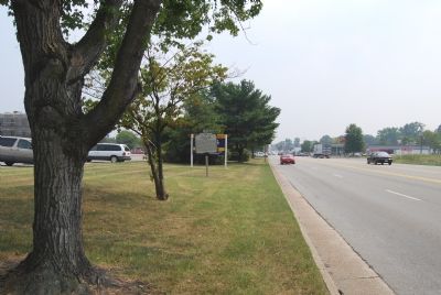
2. Marker along Route 1
Photographed by Dawn Bowen, August 4, 2007
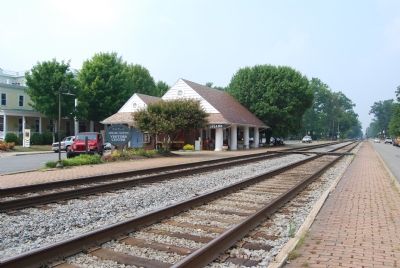
3. Ashland Railroad Station
Photographed by Dawn Bowen, August 4, 2007
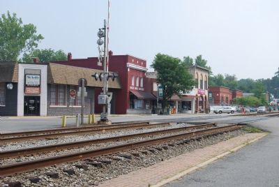
4. Businesses along railroad tracks
Credits. This page was last revised on June 16, 2016. It was originally submitted on August 5, 2007, by Dawn Bowen of Fredericksburg, Virginia. This page has been viewed 1,920 times since then and 50 times this year. Photos: 1, 2, 3, 4. submitted on August 5, 2007, by Dawn Bowen of Fredericksburg, Virginia. • J. J. Prats was the editor who published this page.
