Downtown Kansas City in Jackson County, Missouri — The American Midwest (Upper Plains)
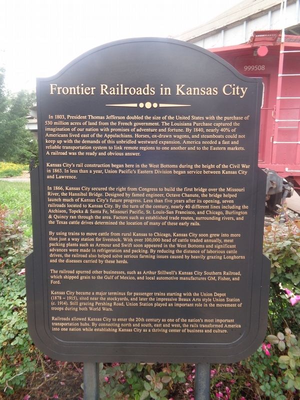
Frontier Railroads in Kansas City
Kansas City's rail construction began here in the West Bottoms during the height of the Civil War in 1863. In less than a year, Union Pacific's Eastern Division began service between Kansas City and Lawrence.
In 1866, Kansas City secured the right from Congress to build the first bridge over the Missouri River, the Hannibal Bridge. Designed by famed engineer, Octave Chanute, the bridge helped launch much of Kansas City's future progress. Less than five years after its opening, seven railroads located to Kansas City. By the turn of the century, nearly 40 different lines including the Atchison, Topeka & Santa Fe, Missouri Pacific, St. Louis-San Francisco, and Chicago, Burlington & Quincy ran through the area. Factors such as established trade routes, surrounding rivers, and the Texas cattle drives determined the location of many of these early rails.
By using trains to move cattle from rural Kansas to Chicago, Kansas City soon grew into more than just a way station for livestock. With over 100,000 head of cattle traded annually, meat packing plants such as Armour and Swift soon appeared in the West Bottoms and significant advances were made in refrigeration and packing. By reducing the distance of laborious cattle drives, the railroad also helped solve serious farming issues caused by heavily grazing Longhorns and the diseases carried by these herds.
The railroad spurred other businesses, such as Arthur Stillwell's Kansas City Southern Railroad, which shipped grain to the Gulf of Mexico, and local automotive manufactures GM, Fisher and Ford.
Kansas City became a major terminus for passenger trains starting with the Union Depot (1878-1915), sited near the stockyards, and later the impressive Beaux Arts style Union Station (c. 1914). Still gracing Pershing Road, Union Station played an important role in the movement of troops during both World Wars.
Railroads allowed Kansas City to enter the 20th century as one of the nation's most important transportation hubs. By connecting north and south, east and west, the rails transformed America into one nation while establishing Kansas City as a thriving center of business and culture.
Topics. This historical marker is listed in these topic lists: Agriculture • Industry & Commerce • Railroads & Streetcars. A significant historical year for this entry is 1803.
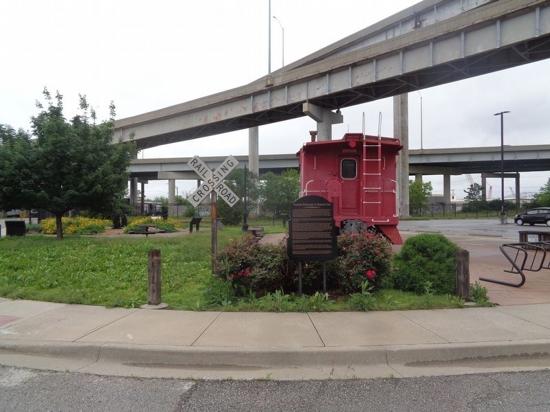
Location. 39° 6.365′ N, 94° 35.682′ W. Marker is in Kansas City, Missouri, in Jackson County. It is in Downtown Kansas City. Marker is at the intersection of West 8th Street and Madison Avenue, on the right when traveling west on West 8th Street. Marker is located at Train Park. Touch for map. Marker is at or near this postal address: 931 W 8th St, Kansas City MO 64101, United States of America. Touch for directions.
Other nearby markers. At least 8 other markers are within walking distance of this marker. Darby Trotter Spirit Mall (here, next to this marker); Ed Hogan (within shouting distance of this marker); Slavery in Kansas City (within shouting distance of this marker); Etienne Veniard - Sieur de Bourgemont (about 800 feet away, measured in a direct line); Lewis and Clark Expedition Across Missouri (about 800 feet away); The French and the Lewis & Clark Expedition (approx. 0.2 miles away); James Pendergast (approx. 0.2 miles away); Lewis and Clark (approx. 0.2 miles away). Touch for a list and map of all markers in Kansas City.
Credits. This page was last revised on February 10, 2023. It was originally submitted on June 4, 2022, by Jason Voigt of Glen Carbon, Illinois. This page has been viewed 618 times since then and 20 times this year. Photos: 1, 2. submitted on June 4, 2022, by Jason Voigt of Glen Carbon, Illinois.

