Marker Logo
THE HISTORICAL
MARKER DATABASE
“Bite-Size Bits of Local, National, and Global History”
Slocomb in Geneva County, Alabama — The American South (East South Central)
 

"Old Town Slocomb"
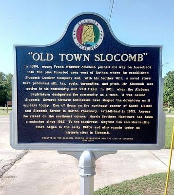
 
 
"Old Town Slocomb" Marker image. Click for full size.
Photographed by James L.Whitman, June 4, 2022
1. "Old Town Slocomb" Marker
Inscription. In 1884, young Frank Wheeler Slocomb pushed his way on horseback into the pine forested area west of Dothan where he established Slocomb Lumber Company and, with his brother Will, a naval store that produced sill, tar, rosin, turpentine, and pitch. Mr. Slocomb was active in his community and well liked. in 1901, when the Alabama Legislature designated the community as a town, it was named Slocomb. Several historic businesses have shaped the downtown as it appears today. One of these on the northeast corner of South Dalton and Slocomb Street is Dalton Pharmacy. established in 1903. Across the street on the southeast corner, Harris Brothers Hardware has been a mainstay since 1925. To the southwest, Segrest Gin and Mercantile Store began in the early 1940s and also remain today as historic sites in Slocomb.
 
Erected 2010 by by the Alabama Tourism Department and the City of Slocomb.
 
Topics and series. This historical marker is listed in these topic lists: Industry & CommerceSettlements & Settlers. In addition, it is included in the Alabama Tourism Department series list. A significant historical year for this entry is 1884.
 
Location. 31° 6.367′ N,
Paid Advertisement
Click or scan to see
this page online
85° 35.625′ W. Marker is in Slocomb, Alabama, in Geneva County. It is on South Dalton Street south of Slocomb Street, on the right when traveling south. Touch for map. Marker is at or near this postal address: 162 S Dalton St, Slocomb AL 36375, United States of America. Touch for directions.

Regionally, this marker is in the American South, specifically in the Deep South, and in the Wiregrass. Globally, it is in North America, a Gulf of Mexico state, the Western Hemisphere, the Western World, and the Anglosphere. Historically, it finds itself in what was once the territory of the Mississippian Culture, one of the Confederate States of America, and the Antebellum South.

Other nearby markers. At least 8 other markers are within 11 miles of this marker, measured as the crow flies: Countyline Missionary Baptist Church (approx. 0.6 miles away); a different marker also named Countyline Missionary Baptist Church (approx. 0.6 miles away); Aus-Kel Springs (approx. 1.4 miles away); Pleasant Hill Baptist Church Cemetery (approx. 1.4 miles away); Earliest Church In Hartford (approx. 4.6 miles away); Town of Taylor, Alabama
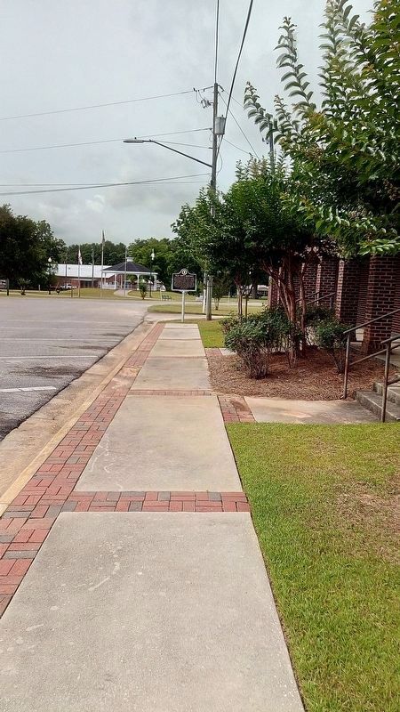
"Old Town Slocomb" Marker in far background. image. Click for full size.
Photographed by James L.Whitman, June 4, 2022
2. "Old Town Slocomb" Marker in far background.
(approx. 8.3 miles away); Big Creek United Methodist Church / Joseph Watford Revolutionary War Veteran (approx. 9.8 miles away); Boyhood Home of Rev. Bob Jones (approx. 11 miles away). Touch for a list and map of all markers in Slocomb.
 
 
Credits. This page was last revised on June 6, 2022. It was originally submitted on June 5, 2022, by James L.Whitman of Eufaula, Alabama. This page has been viewed 1,686 times since then and 125 times this year. Photos:   1, 2. submitted on June 5, 2022, by James L.Whitman of Eufaula, Alabama. • Mark Hilton was the editor who published this page.

m=199311

CeraNet Cloud Computing sponsors the Historical Marker Database.
This website earns income from purchases you make after using our links to Amazon.com. We appreciate your support.
Paid Advertisement
Aug. 7, 2026
