Near Spotsylvania Courthouse in Spotsylvania County, Virginia — The American South (Mid-Atlantic)
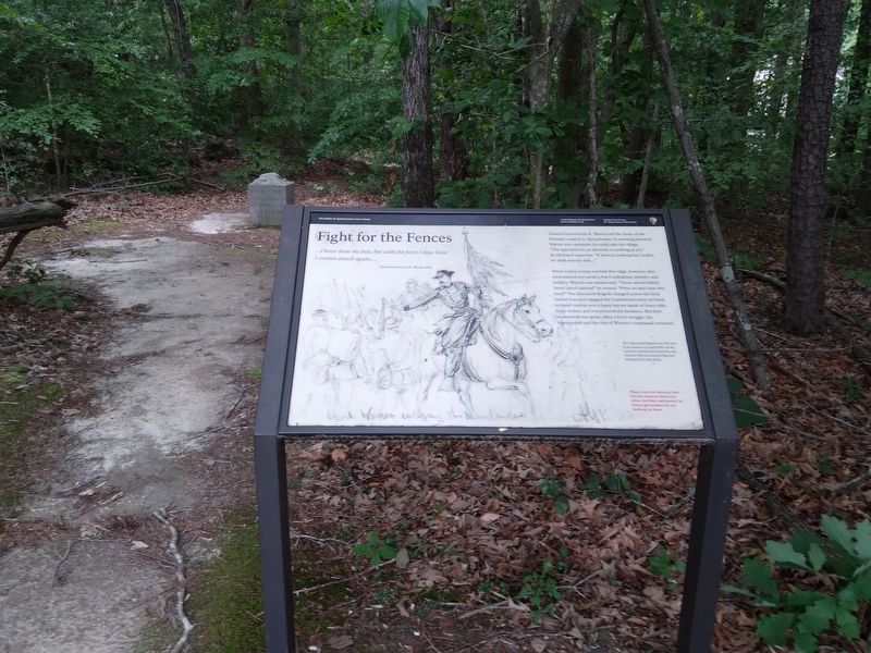
Fight for the Fences
The Battle of Spotsylvania Court House
— Fredericksburg and Spotsylvania National Military Park —
General Gouverneur K. Warren le the Army of the Potomac’s march to Spotsylvania. As morning dawned, Warren was optimistic he could take the village. “The oposition to us amounts to nothing as yet,” he informed superiors. “If there is nothing but cavalry, we shall scarcely halt…”
When Union troops reached this ridge, however, they encountered not cavalry, but Confederate infantry and artillery. Warren was undeterred. “Never mind bullets! Neber mind cannon!” he roared, “Press on and clear this road!” The Maryland Brigade charged across the field behind you and engaged the Confederates here in hand-to-hand combat over a hasty barrier made of fence rails, loose timber, and even household furniture. But their momentum was spent. After a brief struggle, the Marylanders and the rest of Warren’s command retreated.
(captoin)
The Maryland Brigade lost 189 men in its assault on Laurel Hill. As the survivors streamed toward the rear, General Warren seized a flag and attempted to rally them.
Erected by National Park Service, U.S. Department of the Interior.
Topics. This historical marker is listed in this topic list: War, US Civil. A significant historical date for this entry is May 8, 1864.
Location. 38° 12.707′ N, 77° 36.921′ W. Marker is near Spotsylvania Courthouse, Virginia, in Spotsylvania County. Marker can be reached from Pritchett Road (County Route 685) 0.1 miles west of Old Blockhouse Lane (County Route 648), on the right when traveling west. Marker is on the Laurel Hill Trail slighty north of the Maryland Brigade monument (seen in background). Touch for map. Marker is in this post office area: Spotsylvania VA 22553, United States of America. Touch for directions.
Other nearby markers. At least 8 other markers are within walking distance of this marker. Maryland Monument (a few steps from this marker); The Spindle House (approx. 0.2 miles away); a different marker also named Spindle House (approx. 0.2 miles away); Warren's Line (approx. 0.3 miles away); Spotsylvania Campaign (approx. 0.4 miles away); The Race for Spotsylvania Court House (approx. 0.4 miles away); Laurel Hill (approx. 0.4 miles away); The Death of Sedgwick (approx. 0.4 miles away). Touch for a list and map of all markers in Spotsylvania Courthouse.
Also see . . . Fredericksburg & Spotsylvania National Military Park. National Park Service (Submitted on June 6, 2022.)
Credits. This page was last revised on June 6, 2022. It was originally submitted on June 6, 2022, by Mike McKeown of Baltimore, Maryland. This page has been viewed 150 times since then and 14 times this year. Photo 1. submitted on June 6, 2022, by Mike McKeown of Baltimore, Maryland. • Bernard Fisher was the editor who published this page.
