Myrtle Beach in Horry County, South Carolina — The American South (South Atlantic)
The Ark Sand Ridge
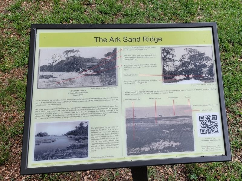
by Louise Chestnut Squires
August 1980
This place was an unspoiled wilderness. Deer were plentiful. My dad could go out with one of his hound dogs and in a short time return with a deer. He and my brothers could go out in the afternoon and bag a couple dozen quail or doves, whatever our appetite called for. In the Fall I've followed my dad up and down to the lakes nestled behind the sand dunes and, lying flat on my belly, look over the top and see hundreds of wild ducks swimming around unaware of danger. We would carry home as many as we needed."
The photograph on the left was taken in the 1950s. It is the area between 6th and 7th Avenues South in Surfside Beach. It shows a lake located behind the inner-most sand ridge. In the distance you can see the sand ridge. Behind that ridge the land dropped down to the washed-out area. Beyond that lay the ocean dunes and then the strand.
Photo courtesy of Jack Thompson
( photo captions )
— Entrance to the Shady Side Inn grounds as seen from the ocean side, around 1925.
— Inner-most sand ridge that extended from Lakewood Family Campground to the area now called Garden City.
— Washed-out area that extended from the inner-most sand ridge to the ocean front dunes.
— The Shady Side Inn
— Inner-most sand ridge as seen from behind the sand ridge at the Shady Side Inn.
Below is an early photograph of the view from the inner-most sand ridge looking towards the ocean. In the photo you can see the large washed-out area between the inner sand ridge and the ocean dunes.
Photo courtesy of Robert Michael Squires
( photo captions )
— Innermost sand ridge
— Washed-out area
— Ocean dunes
— Horizon
— Atlantic Ocean
Erected 2021 by Surfside Beach Historical Society.
Topics. This historical marker is listed in this topic list: Environment. A significant historical month for this entry is August 1980.
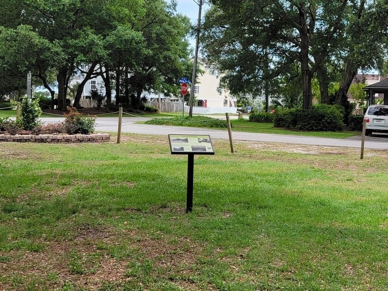
Location. 33° 36.324′ N, 78° 58.578′ W. Marker is in Myrtle Beach, South Carolina, in Horry County. Marker is at the intersection of 3rd Avenue South and South Willow Drive, on the right when traveling south on 3rd Avenue South. Touch for map. Marker is in this post office area: Myrtle Beach SC 29575, United States of America. Touch for directions.
Other nearby markers. At least 8 other markers are within 4 miles of this marker, measured as the crow flies. 1838 Ark Land Survey (a few steps from this marker); Ark Plantation (a few steps from this marker); The Ark House and Shady Side Inn (a few steps from this marker); Ark Agriculture (a few steps from this marker); Surfside Beach Veterans Monument (approx. 0.2 miles away); Ark Cemetery (approx. 0.2 miles away); Jack Walker (approx. 3.6 miles away); St. James Rosenwald School (approx. 3.9 miles away). Touch for a list and map of all markers in Myrtle Beach.
Also see . . . Surfside Beach Historical Society. City website entry (Submitted on June 7, 2022, by Michael Herrick of Southbury, Connecticut.)
Credits. This page was last revised on December 15, 2023. It was originally submitted on June 7, 2022, by Michael Herrick of Southbury, Connecticut. This page has been viewed 96 times since then and 5 times this year. Photos: 1, 2. submitted on June 7, 2022, by Michael Herrick of Southbury, Connecticut.

