South Kansas City in Jackson County, Missouri — The American Midwest (Upper Plains)
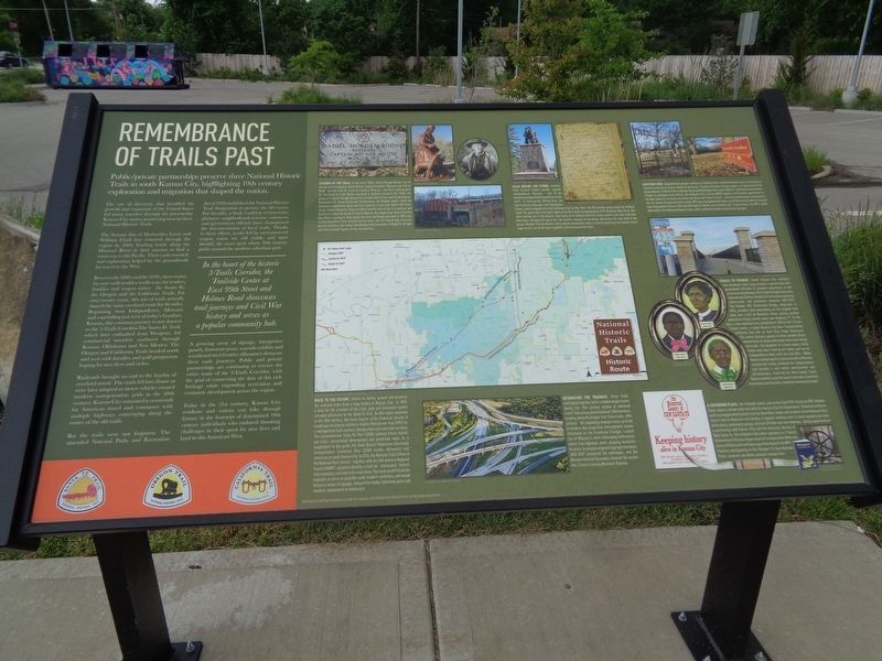
Remembrance of Trails Past
In the heart of the historic 3-Trails Corridor, the Trailside Center at East 99th Street and Holmes Road showcases trail journeys and Civil War history and serves as a popular community hub.
The era of discovery that heralded the growth and expansion of the United States led many travelers through the present-day Kansas City metro, journeying west on three National Historic Trails.
The famous duo of Meriwether Lewis and William Clark first ventured through the region in 1804, heading north along the Missouri River in their mission to find a waterway to the Pacific. Their early research and exploration helped lay the groundwork for travel to the West.
Between the 1820s and the 1870s, three routes became well-trodden trafficways for traders, families and wagon trains: the Santa Fe, the Oregon and the California Trails. For over twenty years, this trio of trails actually shared the same overland route for 46 miles. Beginning near Independence, Missouri and concluding just west of today's Gardner, Kansas, this common journey is now known as the 3-Trails Corridor. The Santa Fe Trail, which later embarked from Westport, led commercial travelers southwest through Kansas, Oklahoma and New Mexico. The Oregon and California Trails headed north and west with families and gold prospectors hoping for new lives and riches.
Railroads brought an end to the heyday of overland travel. The trails fell into disuse or were later adapted as motor vehicles created modern transportation grids in the 20th century. Kansas City remained a crossroads for American travel and commerce with multiple highways converging along the routes of the old trails.
But the trails were not forgotten. The amended National Parks and Recreation Act of 1978 established the National Historic Trail designation to protect the old routes. For decades, a lively coalition of historians, planners, neighborhood activists, volunteers and government officials have championed the documentation of local trails. Thanks to these efforts, swales left by oxen-powered wagon trains are still visible, and signs identify the exact spots where 19th century paths crossed the modern suburban grid.
A growing array of signage, interpretive panels, limestone posts, wayside exhibits and weathered steel frontier silhouettes showcase these early journeys. Public and private partnerships are continuing to retrace the entire route of the 3-Trails Corridor, with the goal of connecting the dots of this rich heritage while expanding recreation and
economic development across the region.
Today in the 21st century, Kansas City residents and visitors can hike through history in the footsteps of determined 19th century individuals who endured daunting challenges in their quest for new lives and land in the American West.
Legends of the Trail. In the early 1800s, Daniel Morgan Boone, one of the six sons of explorer Daniel Boone, helped establish "Boone's Lick Trail or Road" that led from St. Louis to Franklin, Missouri - the first starting point for the Santa Fe Trail. Boone resettled in Jackson County in the 1820s; his grave is in Daniel Morgan Boone park at East 63rd Street and Euclid Avenue. Renowned U.S. Army Scout and frontiersman Jim Bridger led numerous expeditions west and later lived on a farm near Watts Mill Park. Susan Shelby Magoffin became one of the first women and diarists to travel the Santa Fe Trail to Mexico. Her wagon train had to ford the Blue River crossing in 1846 before the first red bridge was built in 1859 near current-day Minor Park. Rebuilt several times, the 'old' Red Bridge remains a popular walkway; the modern Red Bridge features panels of Magoffin, Bridger and other notable figures of the overland era.
Calm Before the Storm. Families from Eastern states usually reached Independence, Missouri - one of the departure and provisioning points for trails west - in early spring. Among them: the Donner-Reed entourage from Springfield, Illinois, which stepped onto the California Trail in May 1846. The 80-member group (majority children under 18) spent their first quiet night at the Hart Grove Campground at 9779 Hickman Mills Drive. But after leaving late in the season, they chose an ill-advised shortcut. Early snows in the Sierra Nevada Mountains stranded the party for five months, leading to starvation and illness for over half of the group. Member Patrick Breen's diary shared eyewitness notes to the ill-fated trip; the Donner Party saga recalls one of the epic tragedies in the history of the trails.
Certified True. Neighborhood groups continue to identify trails-related heirloom assets according to national protocols to ensure historical accuracy. Prominent locales include swales, or depressions from wagon wheels, in Minor Park at Holmes Road and Red Bridge Road, and at 85th St. and Manchester Avenue. Thanks to extensive local efforts, the National Park Service (NPS) signed a certification agreement for the New Santa Fe Cemetery at State Line Road and Santa Fe Trail - once the westernmost graveyard in the U.S. before Kansas became a state. NPS also recognized the three-acre Palestine Cemetery, located near Schumacher Park at 93rd and Old Santa Fe Road, as an historic site. To learn more, the NPS, which administers the National Historic Trails, offers extensive online resources at nps.gov.
Trails to Transit. South Kansas City residents and volunteers have long worked in partnership with government officials to broaden awareness of and access to trail pathways. The 3-Trails Village Community Improvement District funded infrastructure planning, construction and promotion between 2002-2015. The Powder Mill Pedestrian Bridge, dedicated in 2016, provides safe walkability via the original trail route over I-435 at Bannister Road, joining another pedestrian bridge further west over Highway 71. To the east, a new memorial was completed in 2018 at the 3-Trails Transit Center, a major Kansas City Area Transportation Authority bus hub at 9449 Blue Ridge Boulevard. The center features panels of three notable Black women born as slaves who made their mark along the trails. The daughter of a slave owner, Emily Fisher was later freed by her father and ran an Independence hotel until the Civil War. Biddy Mason walked west to California with a Mormon slaveholder family, achieved her independence and became a real estate entrepreneur and philanthropist. Freed by her third owner, Clara Brown cooked to pay her way to Colorado; launched businesses and became a beloved community leader.
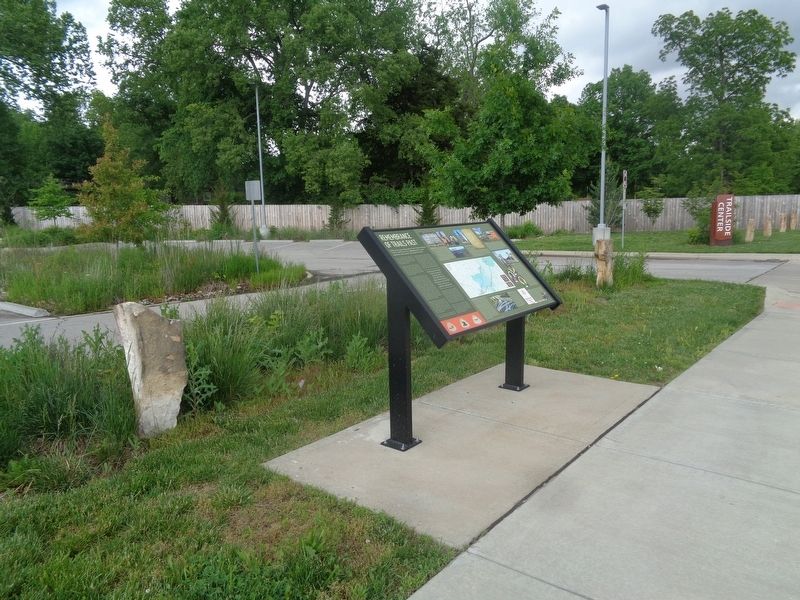
A Gathering Place. The Trailside Center, just across East 99th Street at 9901 Holmes Road, shares a former bank site with the Kansas City Fire Department. Historical artifacts such as a wagon wheel pulled from the Blue River, books and artwork reflect Kansas City's central role in American trail history. A popular meeting room is used regularly by trails enthusiasts, community groups, elected officials and area veterans. Jointly sponsored via a partnership with Kansas City and the Historical Society of New Santa Fe, the volunteer-led center operates as a Tourist Information & Missouri Department of Transportation Welcome Center Affiliate and maintains a partnership with the NPS. Travelers participating in the Passport To Your National Parks program can obtain passport stamps here.
Detangling the Triangle. Three trails converging together led to crowded wagon trains during the 19th century heyday of overland travel. One convoy alone featured 1,000 members heading along the Oregon Trail. Same route, 20th century: the expanding transportation grid led to modern-day congestion. One segment, known informally as the Grandview Triangle, created one of Missouri's most challenging bottlenecks where five highways meet, plaguing motorists for years. A complex engineering project between 2003-2007 unsnarled the exchanges, and the Missouri General Assembly renamed the section the 3-Trails Crossing Memorial Highway.
Back to the Future. Efforts to define, protect and preserve the overland trails have a long history in Kansas City. In 1893, a plan for the creation of the city's park and boulevard system included references to the Santa Fe Trail. As the region expanded in the 20th century, the local chapter of the American Society of Landscape Architects drafted a modern MetroGreen Plan (1991) for a metropolitan trails system, linking urban and rural trail corridors. The comprehensive Trails KC Plan (2008) outlined future shared-use trails, recreational development and protection maps. As a supplement to this guide, the Sixth District Pedestrian Intermodal Transportation Connector Plan (2010) further delineated trail resources in south Kansas City. In 2016, the National Trails Office of the National Park Service together with the Mid-America Regional Council (MARC) agreed to identify a route for "retraceable" historic trail segments, outlined in the map above. The route would follow the originals as close as possible under modern conditions, and would feature a series of signage, interpretive media, limestone posts and markers, monuments or memorials.
Topics and series. This historical marker is listed in these topic lists: African Americans • Bridges & Viaducts • Roads & Vehicles • Settlements & Settlers. In addition, it is included in the California Trail, the Oregon Trail, and the Santa Fe Trail series lists. A significant historical month for this entry is May 1846.
Location. 38° 56.901′ N, 94° 34.916′ W. Marker is in Kansas City, Missouri, in Jackson County. It is in South Kansas City. Marker is on East 99th Street east of Holmes Road, on the right when traveling west. Touch for map. Marker is at or near this postal address: 700 E 99th St, Kansas City MO 64131, United States of America. Touch for directions.
Other nearby markers. At least 8 other markers are within 2 miles of this marker, measured as the crow flies. "The Boy Scout" (approx. 0.4 miles away); Thomas Farmhouse (approx. 0.8 miles away); Frank S. Land Memorial (approx. 1.6 miles away); James Beckwourth (approx. 1.6 miles away); Alexander Majors (approx. 1.6 miles away); Kit Carson (approx. 1.6 miles away); Amache Prowers (approx. 1.7 miles away); Jim Bridger (approx. 1.7 miles away). Touch for a list and map of all markers in Kansas City.
Credits. This page was last revised on February 10, 2023. It was originally submitted on June 8, 2022, by Jason Voigt of Glen Carbon, Illinois. This page has been viewed 626 times since then and 107 times this year. Photos: 1, 2. submitted on June 9, 2022, by Jason Voigt of Glen Carbon, Illinois.

