Jersey Shore in Lycoming County, Pennsylvania — The American Northeast (Mid-Atlantic)
'Let's Go to the Jersey shore!'
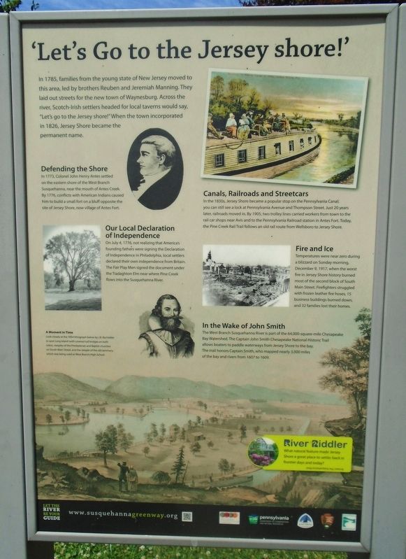
In 1785, families from the young state of New Jersey moved to this area, led by brothers Reuben and Jeremiah Manning. They laid out streets for the new town of Waynesburg. Across the river, Scotch-Irish settlers headed for local taverns would say, "Let's go to the Jersey shore!" When the town incorporated in 1826, Jersey Shore became the permanent name.
Defending the Shore
In 1773, Colonel John Henry Antes settled on the eastern shore of the West Branch Susquehanna, near the mouth of Antes Creek. By 1776, conflicts with American Indians caused him to build a small fort on a bluff opposite the site of Jersey Shore, now village of Antes Fort.
Our Local Declaration of Independence
On July 4, 1776, not realizing that America's founding fathers were signing the Declaration of Independence in Philadelphia, local settlers declared their own independence from Britain. The Fair Play Men signed the document under the Tiadaghton Elm near where Pine Creek flows into the Susquehanna River.
Canals, Railroads and Streetcars
In the 1830s, Jersey Shore became a popular stop on the Pennsylvania Canal; you can still see a lock at Pennsylvania Avenue and Thompson Street. Just 20 years later, railroads moved in. By 1905, two trolley lines carried workers from town to the rail car shops near Avis and to the Pennsylvania Railroad station in Antes Fort. Today, the Pine Creek Rail Trail follows an old rail route from Wellsboro to Jersey Shore.
Fire and Ice
Temperatures were near zero during a blizzard on Sunday morning, December 9, 1917, when the worst fire in Jersey Shore history burned most of the second block of South Main Street. Firefighters struggled with frozen leather fire hoses, 15 business buildings burned down, and 32 families lost their homes.
In the Wake of John Smith
The West Branch Susquehanna River is part of the 64,000-square-mile Chesapeake Bay Watershed. The Captain John Smith Chesapeake National Historic Trail allows boaters to paddle waterways from Jersey Shore to the bay. The trail honors Captain John Smith, who mapped nearly 3,000 miles of the bay and rivers from 1607 to 1609.
A Moment in Time
Look closely at the 1854 lithograph below by J.B. Bachelder to spot Long Island (with covered toll bridges on both sides), steeples of the Presbyterian and Baptist churches on South Main Street, and the steeples of the old seminary, which was being used as West Branch High School.
Erected by Susquehanna Greenway, National Park Service, PA DCNR, and First Community Foundation Partnership of PA.
Topics and series. This historical marker is listed in these topic lists: Disasters • Patriots & Patriotism • Settlements & Settlers • Waterways & Vessels. In addition, it is included in the Captain John Smith Chesapeake National Historic Trail series list. A significant historical year for this entry is 1785.
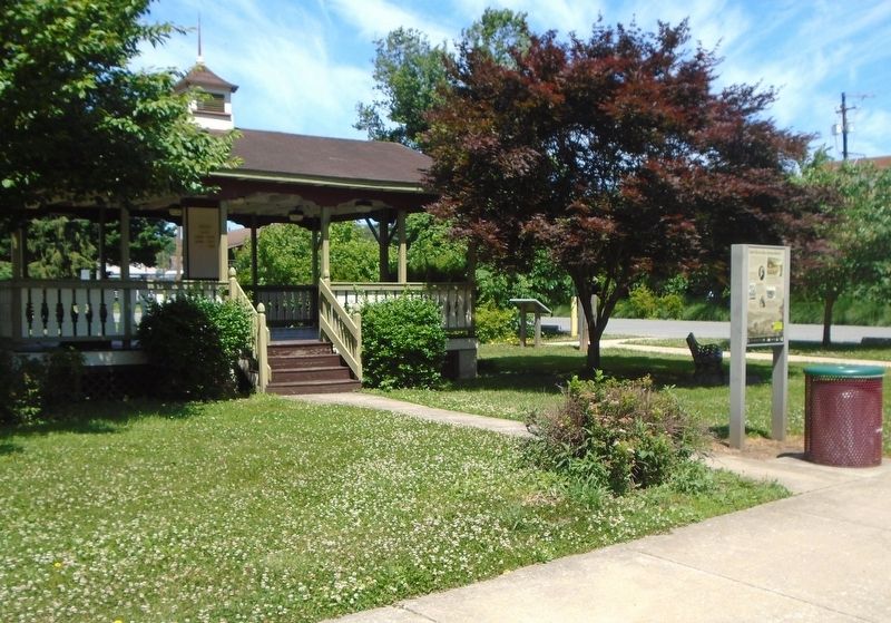
Location. 41° 12.087′ N, 77° 15.235′ W. Marker is in Jersey Shore, Pennsylvania, in Lycoming County. Marker is at the intersection of Main Street and Smith Street, on the right when traveling south on Main Street. Touch for map. Marker is in this post office area: Jersey Shore PA 17740, United States of America. Touch for directions.
Other nearby markers. At least 8 other markers are within walking distance of this marker. War Memorial (about 500 feet away, measured in a direct line); Spanish-American War Memorial (about 500 feet away); Major Keennan Post No. 349 G.A.R. Memorial (about 500 feet away); Veterans Memorial (about 500 feet away); World War Memorial (about 500 feet away); Fort Antes (approx. 0.2 miles away); Pine Creek Presbyterian Church (approx. 0.6 miles away); Jersey Shore Cemetery War Memorial (approx. ¾ mile away). Touch for a list and map of all markers in Jersey Shore.
Related markers. Click here for a list of markers that are related to this marker.
Also see . . .
1. Jersey Shore at Wikipedia. (Submitted on June 21, 2022, by William Fischer, Jr. of Scranton, Pennsylvania.)
2. Captain John Smith Chesapeake National Historic Trail. (Submitted on June 21, 2022, by William Fischer, Jr. of Scranton, Pennsylvania.)
3. Susquehanna Greenway. (Submitted on June 21, 2022, by William Fischer, Jr. of Scranton, Pennsylvania.)
Credits. This page was last revised on June 21, 2022. It was originally submitted on June 21, 2022, by William Fischer, Jr. of Scranton, Pennsylvania. This page has been viewed 155 times since then and 18 times this year. Photos: 1, 2. submitted on June 21, 2022, by William Fischer, Jr. of Scranton, Pennsylvania.

