Cherokee in Swain County, North Carolina — The American South (South Atlantic)
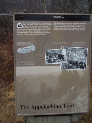
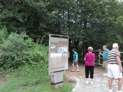
The Appalachian Trail
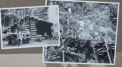
Hiking the trail is not easy and neither was building it. Here in the Smokies during the 1930s, hundreds of Civilian Conservation Corps (CCC) workers cut rock, felled trees, and built shelters—shaping the path that extends like a narrow ribbon from Georgia to Maine.
Erected by National Park Service U.S. Department of the Interior.
Topics and series. This historical marker is listed in these topic lists: Landmarks • Notable Places. In addition, it is included in the Civilian Conservation Corps (CCC) series list.
Location. 35° 36.655′ N, 83° 25.494′ W. Marker is in Cherokee, North Carolina, in Swain County. Marker is on Route 441 near the Appalachian Trail. Touch for map. Marker is in this post office area: Cherokee NC 28719, United States of America. Touch for directions.
Other nearby markers. At least 8 other markers are within walking distance of this marker. Hands That Built (a few steps from this marker); The Great Smokies (a few steps from this marker); Land of Diversity (within shouting distance of this marker in Tennessee); Rockefeller Memorial (within shouting distance of this marker in Tennessee); People of the Mountains (within shouting distance of this marker); “To the free people of America” (within shouting distance of this marker); A Mountain Sanctuary (about 300 feet away, measured in a direct line); Great Smoky Mountains National Park (about 300 feet away). Touch for a list and map of all markers in Cherokee.
Also see . . . A Walk in the Woods: Rediscovering America on the Appalachian Trail. 1999 book by humorist Bill Bryson. (Submitted on June 28, 2009, by J. J. Prats of Powell, Ohio.)
Additional commentary.
1. The Appalachian National Scenic Trail
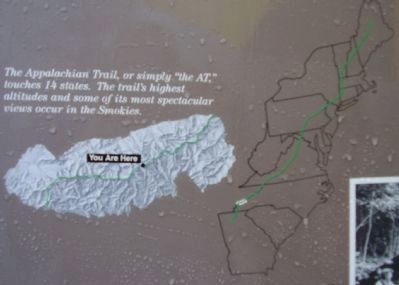
This trail, generally known as the Appalachian Trail or simply The A.T., is a marked hiking trail in the eastern United States, extending between Springer Mountain in Georgia and Katahdin in Maine.[2] It is approximately 2,175 miles (3,500 km)a[›] long. The path is maintained by thirty trail clubs and multiple partnerships.[3] The majority of the trail is in wilderness, although some portions do traverse towns and roads, and cross rivers.
The Appalachian Trail is famous for its many hikers, some of whom, called thru-hikers, attempt to hike it in its entirety in a single season. Earl Shaffer was the first to do so. Many books, memoirs, web sites and fan organizations are dedicated to this pursuit.
Along the way, the trail passes through the states of Georgia, North Carolina, Tennessee, Virginia, West Virginia, Maryland, Pennsylvania, New Jersey, New York, Connecticut, Massachusetts, Vermont, New Hampshire, and Maine. An extension, the International Appalachian Trail, continues north into Canada and to the end of the range, where it enters the North Atlantic Ocean.
— Submitted June 19, 2009, by Stanley and Terrie Howard of Greer, South Carolina.

Photographed By Stanley and Terrie Howard, March 14, 2009
4. The Appalachian Trail Marker
CCC crews built shelters along the Appalachian Trail. Many of them are still used.
The Appalachian Trail was one of the major undertakings of the Depression-era Civilian Conservation Corps (CCC). CCC workers cut the trail into Mount Cammerer's rock face.
Credits. This page was last revised on June 16, 2016. It was originally submitted on June 19, 2009, by Stanley and Terrie Howard of Greer, South Carolina. This page has been viewed 1,836 times since then and 81 times this year. Photos: 1. submitted on June 19, 2009, by Stanley and Terrie Howard of Greer, South Carolina. 2. submitted on August 29, 2012, by Bill Coughlin of Woodland Park, New Jersey. 3, 4. submitted on June 19, 2009, by Stanley and Terrie Howard of Greer, South Carolina. • J. J. Prats was the editor who published this page.


